Safety Score: 4,0 of 5.0 based on data from 9 authorites. Meaning please reconsider your need to travel to Switzerland.
Travel warnings are updated daily. Source: Travel Warning Switzerland. Last Update: 2024-04-24 08:14:40
Touring Stegen
Stegen in Bezirk Winterthur (Canton of Zurich) with it's 21 residents is a town located in Switzerland about 77 mi (or 124 km) north-east of Bern, the country's capital place.
Time in Stegen is now 02:19 AM (Thursday). The local timezone is named Europe / Zurich with an UTC offset of 2 hours. We know of 9 airports nearby Stegen, of which 3 are larger airports. The closest airport in Switzerland is Zürich Airport in a distance of 15 mi (or 24 km), West. Besides the airports, there are other travel options available (check left side).
There are several Unesco world heritage sites nearby. The closest heritage site is Monastic Island of Reichenau in Germany at a distance of 15 mi (or 25 km). The closest in Switzerland is Abbey of St Gall in a distance of 26 mi (or 25 km), North-East. We collected 10 points of interest near this location. Need some hints on where to stay? We compiled a list of available hotels close to the map centre further down the page.
Being here already, you might want to pay a visit to some of the following locations: Frauenfeld, Winterthur, Ohningen, Munchwilen and Pfaffikon. To further explore this place, just scroll down and browse the available info.
Local weather forecast
Todays Local Weather Conditions & Forecast: 9°C / 48 °F
| Morning Temperature | 3°C / 37 °F |
| Evening Temperature | 10°C / 50 °F |
| Night Temperature | 2°C / 36 °F |
| Chance of rainfall | 1% |
| Air Humidity | 49% |
| Air Pressure | 1009 hPa |
| Wind Speed | Gentle Breeze with 6 km/h (4 mph) from East |
| Cloud Conditions | Overcast clouds, covering 93% of sky |
| General Conditions | Light snow |
Friday, 26th of April 2024
14°C (57 °F)
8°C (46 °F)
Light rain, gentle breeze, overcast clouds.
Saturday, 27th of April 2024
15°C (60 °F)
8°C (47 °F)
Few clouds, light breeze.
Sunday, 28th of April 2024
17°C (63 °F)
12°C (54 °F)
Light rain, light breeze, broken clouds.
Hotels and Places to Stay
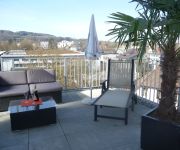
Hotel Frauenfeld
Motel Falken
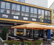
Blumenstein
Kartause Ittingen
HOTEL DOMICIL SWISS Q
Hotel Greuterhof
Videos from this area
These are videos related to the place based on their proximity to this place.
Sido - Schlechtes Vorbild live @ Open Air Frauenfeld 2009
Sido mit schlechtem Vorbild beim Open Air Frauenfeld am 10. Juli 2009.
Zuckerfabrik Frauenfeld Nord I
Das Wetter war halb bedeckt. Habe daran gedacht dass ich viel Farben für die Zuckerfabrik in der damaligen Firma STREIT AG in Frauenfeld Junkholzstrasse / Gerlikonerstrasse entwickeln durfte....
Turbonegro - Fuck The World (F.T.W.) live @ Open Air Frauenfeld 2009
TRBNGR are fuckin the world at the Open Air in Frauenfeld 10. July 2009.
Turbonegro - The Age of Pamparius live @ Open Air Frauenfeld 2009
TRBNGR mit der ersten Zugabe beim Frauenfeld Open Air am 10. Juli 2009. Apocalypse Dudes got nothing to lose. Ächt subbr gsy.
Quadcopterflug über Elgg ZH - Entfernung bis 1800 Meter !!
Quadcopterflug über Elgg ZH am 16.07.2013 inkl. Durchfahrt eines ICN sowie Güterzuges. Entfernung gemäss Google Maps bis zu 1,8km (1800 Meter). Ausrüstung: Bumblebee Quadcopter Kamera:...
Videos provided by Youtube are under the copyright of their owners.
Attractions and noteworthy things
Distances are based on the centre of the city/town and sightseeing location. This list contains brief abstracts about monuments, holiday activities, national parcs, museums, organisations and more from the area as well as interesting facts about the region itself. Where available, you'll find the corresponding homepage. Otherwise the related wikipedia article.
Frauenfeld District
Frauenfeld District is one of the five districts of the canton of Thurgau, Switzerland. It has a population of 62,950 (as of 31 December 2012). Its capital, and the capital of Thurgau, is the city of Frauenfeld. The district contains the following municipalities:
Blumenau (Winterthur)
Blumenau is a quarter in the district 5 of Winterthur. It was formerly a part of Veltheim municipality, which was incorporated into Winterthur in 1922. {{#invoke:Coordinates|coord}}{{#coordinates:47|29|43|N|8|48|29|E|region:CH |primary |name= }} 19px This Canton of Zurich location article is a stub. You can help Wikipedia by expanding it. vte Template:Portal:Switzerland/Stub
Elgg railway station
Elgg is a railway station in the Swiss canton of Zurich and municipality of Elgg. The station is located on the Winterthur–Wil line and is served by trains on the Zurich S-Bahn line S35.
Schottikon railway station
Schottikon is a railway station in the Swiss canton of Zurich and municipality of Elsau. The station is located on the Winterthur–Wil line and is served by trains on the Zurich S-Bahn line S35.


!['Monster [XXL KMG] Maier - Frühlingsfest 2010 Frauenfeld' preview picture of video 'Monster [XXL KMG] Maier - Frühlingsfest 2010 Frauenfeld'](https://img.youtube.com/vi/kXzZgvb1x7o/mqdefault.jpg)
!['Monster [XXL KMG] Maier - Frühlingsfest 2010 Frauenfeld' preview picture of video 'Monster [XXL KMG] Maier - Frühlingsfest 2010 Frauenfeld'](https://img.youtube.com/vi/G0dyRTXLYtA/mqdefault.jpg)


