Safety Score: 4,0 of 5.0 based on data from 9 authorites. Meaning please reconsider your need to travel to Switzerland.
Travel warnings are updated daily. Source: Travel Warning Switzerland. Last Update: 2024-04-24 08:14:40
Delve into Monts de Bière Derrière
The district Monts de Bière Derrière of in Jura-Nord vaudois District (Canton of Vaud) is a district located in Switzerland about 62 mi south-west of Bern, the country's capital town.
In need of a room? We compiled a list of available hotels close to the map centre further down the page.
Since you are here already, you might want to pay a visit to some of the following locations: Saint-George, Berolle, Gimel, Biere and Saubraz. To further explore this place, just scroll down and browse the available info.
Local weather forecast
Todays Local Weather Conditions & Forecast: 8°C / 47 °F
| Morning Temperature | 0°C / 33 °F |
| Evening Temperature | 7°C / 45 °F |
| Night Temperature | 3°C / 37 °F |
| Chance of rainfall | 0% |
| Air Humidity | 55% |
| Air Pressure | 1012 hPa |
| Wind Speed | Gentle Breeze with 5 km/h (3 mph) from East |
| Cloud Conditions | Overcast clouds, covering 86% of sky |
| General Conditions | Rain and snow |
Thursday, 25th of April 2024
9°C (49 °F)
4°C (39 °F)
Few clouds, gentle breeze.
Friday, 26th of April 2024
12°C (54 °F)
7°C (44 °F)
Light rain, gentle breeze, overcast clouds.
Saturday, 27th of April 2024
14°C (57 °F)
10°C (50 °F)
Overcast clouds, light breeze.
Hotels and Places to Stay
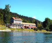
Bellevue Le Rocheray
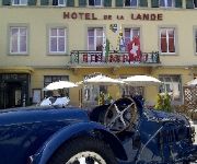
de la Lande
Videos from this area
These are videos related to the place based on their proximity to this place.
Vallée de Joux - Sommer 2013
Vallée de Joux - Sommer 2013 Camping à la Ferme Les Bioux Parc Régional du Jura Vaudois Suisse Schweiz Switzerland Svizzera Fotos: Georg Kissling Public Version 00:00 Camping à la ferme...
Visite à la glacière de Saint-George
Alors qu'un chemin carrossable permet de venir à proximité, nous décidons de laisser notre véhicule sur le parking du point de vue sur le bassin lémanique situé juste en dessous du col...
2009 06 21 La nouvelle gare du Brassus
Départ d'un train, pour Vallorbe, de la nouvelle gare du Brassus dans le canton de Vaud en Suisse.
How to make Skateboard - Swiss Skateboard Manufacturer
Swiss Hand Made Skateboard with Canadian Hard Maple Wood. LGS - Strongest Skateboards !
Présentation de l'institut Océan beauté - 1341 Vallée de Joux
Présentation de l'institut de beauté Océan beauté à 1341 L'Orient - Vallée de Joux.
Videos provided by Youtube are under the copyright of their owners.
Attractions and noteworthy things
Distances are based on the centre of the city/town and sightseeing location. This list contains brief abstracts about monuments, holiday activities, national parcs, museums, organisations and more from the area as well as interesting facts about the region itself. Where available, you'll find the corresponding homepage. Otherwise the related wikipedia article.
Institut Le Rosey
Institut Le Rosey, commonly referred to as Le Rosey or simply Rosey, is a school near Rolle, Switzerland. It is the most expensive school in the world, ahead of the world-renowned Collège Alpin International Beau Soleil. The school was founded by Paul-Émile Carnal in 1880 on the site of the 14th-century Château du Rosey near the town of Rolle in the Canton of Vaud. Rosey is one of the oldest boarding schools in Switzerland and is a prestigious educational institution.
Doubs (river)
The Doubs is a 453 km long river in eastern France and western Switzerland, left tributary of the Saône. Its source is near Mouthe in the western Jura mountains. First it flows northeast, more or less along the French-Swiss border (forming the border for approx. 40 km). Near Montbéliard it turns southwest, until it flows into the river Saône in Verdun-sur-le-Doubs, approx. 20 km northeast of Chalon-sur-Saône.
La Vallée District
La Vallée is a former district of the canton of Vaud, Switzerland, consisting of three municipalities in the Vallée de Joux. The seat of the district was the village of Le Sentier. La Vallée has been merged into Jura-North Vaudois District. The following municipalities are located within the district: L'Abbaye Le Chenit Le Lieu The following villages are in the district: Le Brassus Le Sentier Le Solliat Derrière-la-Côte L'Orient L'Abbaye Les Bioux Le Pont Le Lieu Les Charbonnières Le Sechey
La Coudre, Vaud
La Coudre is a village in the canton of Vaud, Switzerland. It is part of the municipality of L'Isle. The international school, St George's School in Switzerland, has a campus here.
Aubonne District
Aubonne District was a former district of the canton of Vaud in Switzerland. The seat of the district was the town of Aubonne until January 1, 2008. The municipalities are now part of the district of Morges, except Longirod, Marchissy and Saint-George which are now part of the district of Nyon.
Le Sentier
Le Sentier is a village in the Vallée de Joux in the Canton of Vaud, Switzerland. Part of the municipality Le Chenit, the village has 3,000 inhabitants. Numerous Swiss watchmakers are based in Le Sentier: Jaeger-LeCoultre, Gérald Genta, Patek Philippe, Vacheron Constantin.
Rolle District
Rolle District was a district of the canton of Vaud in Switzerland. The seat of the district was the city of Rolle until January 1, 2008. It is now part of Nyon District, except the town of Allaman which is now part of the Morges District.
L'Orient, Switzerland
L'Orient is a village in the Vallée de Joux, Vaud, Switzerland. It is part of the municipality of Le Chenit.
Le Séchey
Le Séchey is a part of Le Lieu, a municipality in the La Vallée district in the canton of Vaud, Switzerland.
Nyon District
Nyon District is a district in the canton of Vaud, Switzerland. The seat of the district is the city of Nyon.
Les Charbonnières
Les Charbonnières is a part of Le Lieu, a commune located in the La Vallée district of the canton of Vaud, Switzerland.
Lac de Joux
Lac de Joux is a lake in the Vallée de Joux in the Canton of Vaud, Switzerland. With a surface area of 9.5 km², it is the largest lake in Switzerland lying above 1,000 metres. Lac de Joux is located in the Jura Mountains.
HBG (time signal)
HBG was a low frequency time signal transmitter for the Swiss time reference system. It transmitted on 75 kHz with 20 kW power, and is located in Prangins, Switzerland. Due to the cost of urgently needed renovation for the aging antennas, and the ease with which all existing users could switch to the DCF77 time signal, the Swiss Federal Government decided to shut down HBG at the end of 2011. HBG transmission ceased at 2012-01-01 07:00:13.2 UTC.
Lac Brenet
Lac Brenet is a lake in the Vallée de Joux, canton of Vaud, Switzerland. It is located north of the Lac de Joux, only 200 meters away. Its elevation of 1002 meters is 2 meters below that of Lac de Joux. The lake used to drain naturally underground and the water resurfaced at the source of the Orbe River. Today the lake is used as a reservoir of the hydroelectric plant at Vallorbe. It is not to be confused with Lac des Brenets.
Vallée de Joux
The Vallée de Joux is a valley of the Jura Mountains mainly in the Swiss Canton of Vaud. The valley also continues into France at its higher, south-western, end. Located 30 miles (50 km) north of Geneva and north-west of Lausanne, its mean elevation is over 3300 feet (1000 metres). There are three Swiss lakes in the Vallée de Joux : the lac de Joux (around 6 miles long), the lac Brenet and the lac Ter.
Le Brassus
Le Brassus is a village in the Vallée de Joux in the Canton of Vaud, Switzerland. It is part of the municipality Le Chenit.
Lac Ter
Lac Ter is a small lake at Le Lieu, in the Vallée de Joux of the canton of Vaud, Switzerland.
La Côte Airport
The La Côte Airport is a private airport in Prangins, Switzerland. It hosted a fly-in in 2009
Allaman Castle
Allaman Castle has its origins in the 11/12th Century but the main components were built by the Count of Vaud in 1253. It is listed in the Swiss Inventory of Cultural Property of National and Regional Significance.
Rolle Castle
Rolle Castle is a castle in the municipality of Rolle of the Canton of Vaud in Switzerland. It is a Swiss heritage site of national significance.
Aubonne Castle
Aubonne Castle is a castle in the municipality of Aubonne of the Canton of Vaud in Switzerland. It is a Swiss heritage site of national significance.
Dully Castle
Dully Castle is a castle in the municipality of Dully of the Canton of Vaud in Switzerland. It is a Swiss heritage site of national significance.
Vincy Castle
Vincy Castle is a castle in the municipality of Gilly of the Canton of Vaud in Switzerland. It is a Swiss heritage site of national significance.
L'Isle Castle
L'Isle Castle is a castle in the municipality of L'Isle of the Canton of Vaud in Switzerland. It is a Swiss heritage site of national significance.
Luins Castle
Luins Castle is a castle in the municipality of Luins of the Canton of Vaud in Switzerland. It is a Swiss heritage site of national significance.


