Safety Score: 4,0 of 5.0 based on data from 9 authorites. Meaning please reconsider your need to travel to Switzerland.
Travel warnings are updated daily. Source: Travel Warning Switzerland. Last Update: 2024-04-24 08:14:40
Explore Unterrafrüti
The district Unterrafrüti of in Canton of Bern is located in Switzerland about 18 mi east of Bern, the country's capital.
If you need a place to sleep, we compiled a list of available hotels close to the map centre further down the page.
Depending on your travel schedule, you might want to pay a visit to some of the following locations: Langnau, Schuepfheim, Willisau, Taegertschi and Wangen an der Aare. To further explore this place, just scroll down and browse the available info.
Local weather forecast
Todays Local Weather Conditions & Forecast: 2°C / 36 °F
| Morning Temperature | -2°C / 28 °F |
| Evening Temperature | 5°C / 40 °F |
| Night Temperature | -2°C / 28 °F |
| Chance of rainfall | 2% |
| Air Humidity | 87% |
| Air Pressure | 1010 hPa |
| Wind Speed | Light breeze with 3 km/h (2 mph) from North-West |
| Cloud Conditions | Overcast clouds, covering 100% of sky |
| General Conditions | Snow |
Friday, 26th of April 2024
9°C (48 °F)
1°C (34 °F)
Light rain, light breeze, overcast clouds.
Saturday, 27th of April 2024
13°C (56 °F)
5°C (41 °F)
Broken clouds, light breeze.
Sunday, 28th of April 2024
14°C (57 °F)
6°C (43 °F)
Light rain, light breeze, overcast clouds.
Hotels and Places to Stay
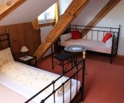
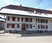
Bären Gasthof
Emmental
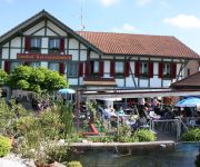
Hotel-Landgasthof Adler
Koi-Gartenteich
Videos from this area
These are videos related to the place based on their proximity to this place.
Freudigenegg Winterwanderung Wasen im Emmental - Lucky Video
Eine Winterwanderung in Wasen im Emmental. Vom Löchli auf die Freudigenegg. Weiter zum Windrad auf dem Schaber. Schonegg / Dräjerhüsli, Chaschishus, Grossenbach zurück nach Wasen im ...
Radtour Herzroute (1) Zug - Thun / Route 99
Vier (von sieben) Etappen der Herzroute / Route du Cœur von Zug nach Thun. rund 250km und 4000 Höhenmeter. Hervorragend beschildert mit der Routennummer 99. Ein ständiges hügelauf- und...
Tour de Suisse 2008 Etappe 1, Spitzentrio (Durchfahrt in Langnau)
2. Durchfahrt des Spitzentrios in Langnau.
neo1 Tigers-Talk 6 | 12. Dezember 2014
Im aktuellen Tigers-Talk sprechen wir über das noch bevorstehende Cupspiel SCL Tigers gegen den SC Bern vom 15. Dezember 2015. Dazu haben wir die Vertreterin der SCB-Fans Emmental, ...
plug in - 19.10.14
plug in - der Jugendgottesdienst in Langnau i.E. vom 19.10.2014 https://www.facebook.com/pages/Plug-in/419485788076663.
Videos provided by Youtube are under the copyright of their owners.
Attractions and noteworthy things
Distances are based on the centre of the city/town and sightseeing location. This list contains brief abstracts about monuments, holiday activities, national parcs, museums, organisations and more from the area as well as interesting facts about the region itself. Where available, you'll find the corresponding homepage. Otherwise the related wikipedia article.
Emmental
For the cheese made in the region, see Emmental (cheese). The Emmental is a region in west central Switzerland, forming part of the canton of Bern. It is a hilly landscape comprising the basins of the Emme and Ilfis rivers. The region is mostly devoted to farming, particularly dairy farming. Its notable cities are Burgdorf and Langnau.
Chuderhüsi Tower
Chuderhüsi Tower (or "Aussichtsturm Gauchern") is a 42 metre observation tower built of wood at Röthenbach im Emmental, Switzerland. The tower was built in 1998, burnt down in 2001 and was rebuilt in 2002.
Trachselwald District
Trachselwald District was a district in the canton of Bern, Switzerland. Its governor's seat was in Trachselwald Castle in Trachselwald. It consisted of 10 municipalities within an area of 191 km².
Signau District
Signau District was a district in Switzerland in the canton of Bern with its seat Signau. It included nine municipalities in an area of 320 km²:
Trachselwald Castle
Trachselwald Castle is a castle in the municipality of Trachselwald in the canton of Bern, Switzerland. It is a Swiss heritage site of national significance.
Ilfis Stadium
Ilfis Stadium is an indoor sporting arena built in 1975, located in Langnau i.E. , Switzerland. The capacity of the arena is 6,500. It is the home arena of the SCL Tigers ice hockey team.
Willisau District
Willisau District is one of the five districts, of the German-speaking Canton of Lucerne, Switzerland. Its capital is the town of Willisau. It has a population of 49,880 (as of 31 December 2011). Willisau District consists of the following municipalities: ^a 1992/97 survey gives a total area of 337.45 km without including certain large lakes, while the 2000 survey includes lakes but due to other changes is slightly lower.
Napfgebiet
The Napfgebiet is a hilly region in Switzerland lying between Bern and Lucerne. The region's highest elevation is the Napf at 1408 meters. It is counted both geographically and geologically as part of the Swiss plateau. The region is bounded by the Emmental to the south-west and the Entlebuch to the east. It is divided between the cantons of Bern and Lucerne and by the Brünig-Napf-Reuss line.
Entlebuch Biosphere
The Entlebuch Biosphere is a natural reserve at the foot of the Alps which includes the 395 km² large valley of the Little Emme River between Bern and Lucerne in the Swiss Canton of Lucerne. Since 2001, the region became after the Swiss National Park, the second UNESCO Biosphere Reserve in Switzerland.
Emmental-Oberaargau
Beginning 2010, Emmental-Oberaargau is one of five administrative divisions (regions) of the canton of Berne. It comprises the two former districts of Emmental and Oberaargau. It has a population of 168'000 (2005 estimate) in 97 municipalities, comprising 1051.4 km².
Emmental (administrative district)
Emmental District in the Canton of Bern was created on 1 January 2010. It is part of the Emmental-Oberaargau administrative region. It contains 42 municipalities with an area of 690.45 km and a population (as of December 2008) of 93,082.
Lützelflüh-Goldbach
Lützelflüh-Goldbach is a Swiss twin suburb located about 36 km driving distance from Bern and 9 km from Burgdorf, Switzerland.
Kastelen Tower Ruins
Kastelen Tower is a ruined castle in the municipality of Alberswil of the Canton of Lucerne in Switzerland. It is a Swiss heritage site of national significance.
Bailiff's Castle (Willisau)
The Bailiff's Castle is a castle in the municipality of Willisau of the Canton of Lucerne in Switzerland. It is a Swiss heritage site of national significance.
Wartenstein Castle (Bern)
Wartenstein Castle is a castle, now in ruins, located in the municipality of Lauperswil in the Canton of Bern of Switzerland.


