Safety Score: 3,0 of 5.0 based on data from 9 authorites. Meaning we advice caution when travelling to Spain.
Travel warnings are updated daily. Source: Travel Warning Spain. Last Update: 2024-04-25 08:17:04
Discover Atajate
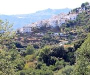
Atajate in Malaga (Andalusia) with it's 170 citizens is a place in Spain about 274 mi (or 441 km) south of Madrid, the country's capital city.
Current time in Atajate is now 07:39 PM (Thursday). The local timezone is named Europe / Madrid with an UTC offset of 2 hours. We know of 8 airports near Atajate, of which one is a larger airport. The closest is airport we know is Gibraltar Airport in Gibraltar in a distance of 34 mi (or 55 km). The closest airport in Spain is Málaga Airport in a distance of 41 mi (or 55 km), South. Besides the airports, there are other travel options available (check left side).
There are several Unesco world heritage sites nearby. The closest heritage site in Spain is Doñana National Park in a distance of 30 mi (or 49 km), North-West. We encountered 2 points of interest in the vicinity of this place. If you need a hotel, we compiled a list of available hotels close to the map centre further down the page.
While being here, you might want to pay a visit to some of the following locations: Jimera de Libar, Alpandeire, Benalauria, Farajan and Algatocin. To further explore this place, just scroll down and browse the available info.
Local weather forecast
Todays Local Weather Conditions & Forecast: 20°C / 67 °F
| Morning Temperature | 12°C / 54 °F |
| Evening Temperature | 16°C / 61 °F |
| Night Temperature | 11°C / 52 °F |
| Chance of rainfall | 0% |
| Air Humidity | 42% |
| Air Pressure | 1011 hPa |
| Wind Speed | Moderate breeze with 9 km/h (6 mph) from East |
| Cloud Conditions | Scattered clouds, covering 30% of sky |
| General Conditions | Scattered clouds |
Friday, 26th of April 2024
16°C (61 °F)
9°C (48 °F)
Scattered clouds, gentle breeze.
Saturday, 27th of April 2024
11°C (52 °F)
8°C (47 °F)
Light rain, moderate breeze, overcast clouds.
Sunday, 28th of April 2024
16°C (61 °F)
8°C (46 °F)
Light rain, gentle breeze, clear sky.
Hotels and Places to Stay
Molino del Santo
Hotel Bandolero
Posada Mirador de Jubrique
Videos from this area
These are videos related to the place based on their proximity to this place.
Barranco Arroyo Majales 1rapel
Primer rapel realizado en el barranco de Arroyo Majales. Se puede encontrar más información en www.buquin.zobyhost.com.
Goka 1100i a toda pastilla.
Serranía de Ronda. Rio Genal, Farajan. Una carretera de muuuchas curvas. La pronunciada cuesta en todo su recorrido impide alcanzar mucho mas velocidad... Podemos ver y escuchar el excelente.
Valle Rio Genal Finca Senegil
Filmamos las armoniosas y reconfortantes imágenes de uno de los más ríos más bellos y virgenes de Andalucia, EL GENAL, a su paso por la finca Senegil. http://www.fincasenegil.com/
Fiesta de la Harina 2015 - JimeRa de Libar
Flour fight in the streets of the pueblo blanco in February 2015.
Jimera de Libar Feria 2014 - Concurso de Peñas
Concurso de Peñas con rebujito y música a cargo de la Orquesta “LA GALA” en la Plaza Virgen de la Salud.
Wildfire Jimera de Libar - Cortes de la Frontera
Wildfire in the Serrania de Ronda between Jimera de Libar - Cortes de la Frontera. Copyright Karl Smallman, provision360.com.
Videos provided by Youtube are under the copyright of their owners.
Attractions and noteworthy things
Distances are based on the centre of the city/town and sightseeing location. This list contains brief abstracts about monuments, holiday activities, national parcs, museums, organisations and more from the area as well as interesting facts about the region itself. Where available, you'll find the corresponding homepage. Otherwise the related wikipedia article.
Atajate
Atajate is a municipality in the province of Málaga in the autonomous community of Andalucia in southern Spain. It is located east of the province in the Genal Valley and is one of the towns that make up the region of the Serrania de Ronda. It is the least populated town in the province of Málaga.
Jimera de Líbar
Jimera de Líbar is a town and municipality in the province of Málaga, part of the autonomous community of Andalusia in southern Spain. The municipality is situated approximately 26 kilometres from Ronda and sits at an altitude of 540 metres. It is located in the west of the province. It belongs to the comarca of Serranía de Ronda. It has a population of approximately 450 residents. The natives are called Jimeranos.


