Safety Score: 3,0 of 5.0 based on data from 9 authorites. Meaning we advice caution when travelling to Slovakia.
Travel warnings are updated daily. Source: Travel Warning Slovakia. Last Update: 2024-04-18 08:12:24
Discover Malé Vranie
Malé Vranie in Trnava is a place in Slovakia about 29 mi (or 47 km) south-east of Bratislava, the country's capital city.
Current time in Malé Vranie is now 05:43 AM (Friday). The local timezone is named Europe / Bratislava with an UTC offset of 2 hours. We know of 11 airports near Malé Vranie, of which 5 are larger airports. The closest is airport we know is Győr-Pér International Airport in Hungary in a distance of 20 mi (or 32 km). The closest airport in Slovakia is M. R. Štefánik Airport in a distance of 27 mi (or 32 km), South-East. Besides the airports, there are other travel options available (check left side).
There are several Unesco world heritage sites nearby. The closest heritage site is Millenary Benedictine Abbey of Pannonhalma and its Natural Environment in Hungary at a distance of 23 mi (or 37 km). The closest in Slovakia is Historic Town of Banská Štiavnica and the Technical Monuments in its Vicinity in a distance of 75 mi (or 37 km), South-East. If you need a hotel, we compiled a list of available hotels close to the map centre further down the page.
While being here, you might want to pay a visit to some of the following locations: Gyor, Mosonmagyarovar, Tet, Pannonhalma and Csorna. To further explore this place, just scroll down and browse the available info.
Local weather forecast
Todays Local Weather Conditions & Forecast: 10°C / 51 °F
| Morning Temperature | 2°C / 35 °F |
| Evening Temperature | 9°C / 48 °F |
| Night Temperature | 8°C / 46 °F |
| Chance of rainfall | 0% |
| Air Humidity | 59% |
| Air Pressure | 1015 hPa |
| Wind Speed | Moderate breeze with 11 km/h (7 mph) from East |
| Cloud Conditions | Broken clouds, covering 77% of sky |
| General Conditions | Light rain |
Saturday, 20th of April 2024
9°C (49 °F)
4°C (39 °F)
Light rain, moderate breeze, overcast clouds.
Sunday, 21st of April 2024
7°C (45 °F)
4°C (39 °F)
Light rain, fresh breeze, overcast clouds.
Monday, 22nd of April 2024
6°C (43 °F)
6°C (43 °F)
Moderate rain, moderate breeze, overcast clouds.
Hotels and Places to Stay
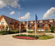
Orchidea Hotel****Lipót
Videos from this area
These are videos related to the place based on their proximity to this place.
Revita TV Rioter Paintball Club Győr Hungary better
Revita Tv Nyári Dolce Vita nevű adásában bolt látható ez az interjú/videó. A pálya a Dunaszeg melletti Dunaszentpál edelyében található a duna mellett.
Danube River, 1822 river kilometer, Hungary
Öreg-Duna meder 1822 folyamkilométer környéke, Magyarország 2012.03.07.
Kacsák a padon, árvízkor
A videó az idei (2009-es) Dunai árvízkor készült. A padok, amiken tanyáztak, körülbelül 40-50 centi mélyen voltak a vízben. Helyszín; Dunaszentpál.
Lipóti horgászverseny 2012
I created this video with the YouTube Video Editor (http://www.youtube.com/editor)
Timelapse | Ásványráró 2014.07.26.
Ásványráró, Duna part. Timelapse videó a grillezésről. Camera: SJ400.
XX. Bigatábor - Egy korszak vége
Augusztus 13. napján kezdetét veszi a XX. Bigatábor. A videó olyam, amilyen de sajnos nem volt több felvétel, benne van nagyjából mind.
Bős Gabčíkovo
Szia! E-mail(Minecraft map,rajz,üzenet küldésre): darnay.minecraft@gmail.com PayPal: da7adrian@gmail.com Facebook profile: https://www.facebook.com/adrian.darnay Facebook oldal: ...
Kill my phone
Szia! E-mail(Minecraft map,rajz,üzenet küldésre): darnay.minecraft@gmail.com PayPal: da7adrian@gmail.com Facebook profile: https://www.facebook.com/adrian.darnay Facebook oldal: ...
Férfi vs RedBull ¤Vlog¤
Újság cikk: http://adf.ly/ul2UJ Szia! E-mail(Minecraft map,rajz,üzenet küldésre): darnay.minecraft@gmail.com PayPal: da7adrian@gmail.com Facebook profile: https://www.facebook.com/adrian.darna...
Videos provided by Youtube are under the copyright of their owners.
Attractions and noteworthy things
Distances are based on the centre of the city/town and sightseeing location. This list contains brief abstracts about monuments, holiday activities, national parcs, museums, organisations and more from the area as well as interesting facts about the region itself. Where available, you'll find the corresponding homepage. Otherwise the related wikipedia article.
Gabčíkovo–Nagymaros Dams
The Gabčíkovo–Nagymaros Dams is a large barrage project on the Danube. It was initiated by the Budapest Treaty of 16 September 1977 between the Czechoslovak Socialist Republic and the People's Republic of Hungary. The project aimed at preventing catastrophic floods, improving river navigability and producing clean electricity.


