Safety Score: 3,0 of 5.0 based on data from 9 authorites. Meaning we advice caution when travelling to Slovakia.
Travel warnings are updated daily. Source: Travel Warning Slovakia. Last Update: 2024-04-20 08:25:34
Touring Motyčky
Motyčky in Banska Bystrica is a town located in Slovakia about 106 mi (or 171 km) north-east of Bratislava, the country's capital place.
Time in Motyčky is now 11:37 AM (Saturday). The local timezone is named Europe / Bratislava with an UTC offset of 2 hours. We know of 10 airports nearby Motyčky, of which 3 are larger airports. The closest airport in Slovakia is Sliač Airport in a distance of 15 mi (or 25 km), South. Besides the airports, there are other travel options available (check left side).
There are several Unesco world heritage sites nearby. The closest heritage site in Slovakia is Vlkolínec in a distance of 13 mi (or 21 km), North. Need some hints on where to stay? We compiled a list of available hotels close to the map centre further down the page.
Being here already, you might want to pay a visit to some of the following locations: Banska Bystrica, Ruzomberok, Zvolen, Turcianske Teplice and Martin. To further explore this place, just scroll down and browse the available info.
Local weather forecast
Todays Local Weather Conditions & Forecast: 6°C / 43 °F
| Morning Temperature | 3°C / 37 °F |
| Evening Temperature | 7°C / 45 °F |
| Night Temperature | 2°C / 36 °F |
| Chance of rainfall | 0% |
| Air Humidity | 83% |
| Air Pressure | 1012 hPa |
| Wind Speed | Light breeze with 5 km/h (3 mph) from North |
| Cloud Conditions | Overcast clouds, covering 100% of sky |
| General Conditions | Rain and snow |
Sunday, 21st of April 2024
8°C (47 °F)
1°C (33 °F)
Overcast clouds, gentle breeze.
Monday, 22nd of April 2024
9°C (48 °F)
3°C (37 °F)
Rain and snow, light breeze, overcast clouds.
Tuesday, 23rd of April 2024
6°C (42 °F)
5°C (41 °F)
Rain and snow, light breeze, overcast clouds.
Hotels and Places to Stay
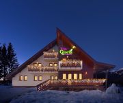
Villa Gloria
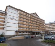
Šport Hotel*** Donovaly
Villa Gardenia
UNIPHARMA APARTMENTS
Videos from this area
These are videos related to the place based on their proximity to this place.
Liptovské Revúce a Ploská 2011
Kladenie vencov v Liptovských Revúcach a Pamätníku SNP na Ploskej. Rekonštrukcia bojov partizánov s nemeckou jednotkou KVH Ostrô.
Словакия
Путешественнику прекрасная Словакия может открыться с разных сторон. Сегодня невероятно популярны горнол...
Rozprávková vtáčia záhradka Mira Sanigu
V malebnom Revúckom údolí pod skalným oltárom Čierneho kameňa Miro Saniga v záhradke rodičovského domu vytvoril „rozprávkovú vtáčiu záhradku alebo „vtáčí raj. V modernej...
Boľševník obrovský
Boľševník obrovský bol do Európy zavlečený z Kaukazu a priľahlých oblastí ako okrasná rastlina.
Donovaly (1st February 2015)
Without sound. Traffic jams caused by snowy/icy road. Last 1.5 km from Donovaly's part Hanesy took 19 minutes (stuck behind snowploughs). Dopravne zapchy sposobene zasnezenou/zladovatenou...
Videos provided by Youtube are under the copyright of their owners.
Attractions and noteworthy things
Distances are based on the centre of the city/town and sightseeing location. This list contains brief abstracts about monuments, holiday activities, national parcs, museums, organisations and more from the area as well as interesting facts about the region itself. Where available, you'll find the corresponding homepage. Otherwise the related wikipedia article.
Staré Hory Mountains
The Staré Hory Mountains is a small mountain range in Central Slovakia, near the town of Banská Bystrica. It is a part of the Low Tatra, which is part of the Fatra-Tatra Area and the Inner Western Carpathians. The mountain range is named after the village of Staré Hory (literally Old Mountains). It borders the Veľká Fatra Mts. in the north west and north, Low Tatra in the east, Zvolen Basin in the south and the Kremnica Mountains in the west.


