Safety Score: 3,5 of 5.0 based on data from 9 authorites. Meaning please reconsider your need to travel to Sierra Leone.
Travel warnings are updated daily. Source: Travel Warning Sierra Leone. Last Update: 2024-04-23 08:18:23
Touring Wilberforce
Wilberforce in Western Area is a town located in Sierra Leone a little north-east of Freetown, the country's capital place.
Time in Wilberforce is now 03:19 PM (Tuesday). The local timezone is named Africa / Freetown with an UTC offset of zero hours. We know of 8 airports nearby Wilberforce. The closest airport in Sierra Leone is Lungi International Airport in a distance of 11 mi (or 18 km), North-East. Besides the airports, there are other travel options available (check left side).
Need some hints on where to stay? We compiled a list of available hotels close to the map centre further down the page.
Being here already, you might want to pay a visit to some of the following locations: Freetown, Forecariah, Conakry, Coyah and Makeni. To further explore this place, just scroll down and browse the available info.
Local weather forecast
Todays Local Weather Conditions & Forecast: 29°C / 85 °F
| Morning Temperature | 25°C / 78 °F |
| Evening Temperature | 27°C / 81 °F |
| Night Temperature | 26°C / 79 °F |
| Chance of rainfall | 0% |
| Air Humidity | 60% |
| Air Pressure | 1011 hPa |
| Wind Speed | Gentle Breeze with 8 km/h (5 mph) from East |
| Cloud Conditions | Broken clouds, covering 68% of sky |
| General Conditions | Light rain |
Wednesday, 24th of April 2024
30°C (85 °F)
26°C (79 °F)
Moderate rain, gentle breeze, overcast clouds.
Thursday, 25th of April 2024
30°C (85 °F)
26°C (80 °F)
Light rain, gentle breeze, broken clouds.
Friday, 26th of April 2024
29°C (84 °F)
26°C (80 °F)
Scattered clouds, gentle breeze.
Hotels and Places to Stay
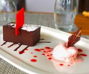
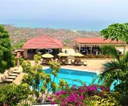
RADISSON BLU MAMMY YOKO
The Country Lodge Complex
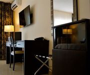
Home Suites
New Brookfields
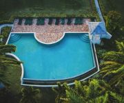
Nonsuch Bay Resort All Inclusive
Videos from this area
These are videos related to the place based on their proximity to this place.
The Ferry to Freetown - Sierra Leone
A clip of the ferry across the Sierra Leone River from Lungi to Freetown as it arrives in Freetown, Sierra Leone. This ferry is the main transportation link between the city and the airport...
White Powder In Freetown ;-) FPV Fun Warthox FQuad
White Powder In Freetown ;-) FPV Fun Warthox FQuad.
Tours-TV.com: Freetown
The capital of Sierra Leone - Freetown attracts tourists with numerous sights, beautiful beaches and city markets. Sierra Leone. (弗里敦, フリータウン, فريتاون). See on map...
Mass Casualty Training Course in Freetown, Sierra Leone
In August 2009, SOS helped organize a mass casualty training exercise in the Sierra Leone capital, Freetown. The event was held over two days, included didactic lectures and a full disaster...
Travel Tips: Dangerous Market After Dark
Here I show you how to navigate one of the many night market's in africa, keep your wallet in your front pocket and lets go!
Cap Anamur-Straßenkinderprojekt Pikin Paddy in Sierra Leone
Sierra Leone | Das Pikin Paddy ist ein Straßenkinder-Projekt von Cap Anamur und bedeutet „Freund der Kinder“. Wir sind ansässig in der Susan Bay, dem größten Brennpunkt in der Hauptstadt...
U ebul pay God
An anthem by a local composer, 'Mr. Aubrey Nat Jones', being sung by Zion Methodist Church Choir, Wilberforce Street, Freetown, Sierra Leone.
President Koroma motivates the shy Loko Tribe
This video is a 15 minutes pep talk given by the President of Sierra Leone to the Loko ethnic group in his country. The Lokos are usually shy and are well known to be a grouping whose members...
Videos provided by Youtube are under the copyright of their owners.
Attractions and noteworthy things
Distances are based on the centre of the city/town and sightseeing location. This list contains brief abstracts about monuments, holiday activities, national parcs, museums, organisations and more from the area as well as interesting facts about the region itself. Where available, you'll find the corresponding homepage. Otherwise the related wikipedia article.
Sierra Leone
Sierra Leone, officially the Republic of Sierra Leone, is a country in West Africa that is bordered by Guinea to the northeast, Liberia to the southeast, and the Atlantic Ocean to the southwest. Sierra Leone is a Constitutional Republic with a directly elected president and a Unicameral Legislature. The country has a tropical climate, with a diverse environment ranging from savannah to rainforests. The country covers a total area of 71,740 km and with an estimated population of 6 million.
Freetown
Freetown is the capital and largest city of Sierra Leone. It is a major port city in the Atlantic Ocean and is located in the Western Area of Sierra Leone. Freetown is Sierra Leone's major urban, economic, financial, cultural, educational and political center. The city proper had a population of 772,873 at the 2004 census, As of 2010, the population of Freetown is estimated at 1.2 million.
National Stadium (Sierra Leone)
Brookfields National Stadium is a multi-use national stadium of Sierra Leone, located in the capital city of Freetown. It is used mostly for football matches and it also has athletics facilities. It is the largest stadium in Sierra Leone and has a 45,000 capacity. The stadium serves as the exclusive home of the Sierra Leone national football team, as well as a venue for social, cultural, and religious events.
Wilberforce, Sierra Leone
Wilberforce is an area in Freetown, Sierra Leone. It is the highest point in the city and is also home to several foreign embassies, including China, Gambia, Germany, Liberia, Lebanon, Libya, Syria, and Austria http://www. slhc-uk. org. uk/diplomatic. htm. It is also home to a military barracks http://www. un. org/Depts/dpko/missions/unamsil/release. html.
Aberdeen, Sierra Leone
Aberdeen is a coastal neighborhood in Sierra Leone's capital of Freetown. It is home to numerous up-scale restaurants, hotels, Lumley beach and other tourist facilities.
Murray Town
Murray Town is an upscale neighborhood in Sierra Leone's capital of Freetown. It is home to a camp for the War Wounded and Amputeed population and the Amputees and War Wounded Association. It is also home to the Sierra Leone Grammar School. Murray Town contains many colonial style board houses dating back to the turn of the 20th century. {{#invoke:Coordinates|coord}}{{#coordinates:8|30|N|13|16|W|region:SL_type:city|| |primary |name= }}
Connaught Hospital
Connaught Hospital is a hospital located in Sierra Leone. Connaught Hospital was opened in 1912 by the Duke of Connaught, Prince Arthur. President Kabbah re-opened the hospital on May 5, 2006, alongside the Princess Christian Maternity Hospital (PCMH).
Sierra Leone Grammar School
The Sierra Leone Grammar School was founded on 25 March 1845 in Freetown, Sierra Leone by the Church Mission Society (CMS), and at first was called the CMS Grammar School. It was the first secondary educational institution for West Africans with a European curriculum. Many of the administrators and professionals of British West Africa were educated at the school.


