Safety Score: 3,6 of 5.0 based on data from 9 authorites. Meaning please reconsider your need to travel to Senegal.
Travel warnings are updated daily. Source: Travel Warning Senegal. Last Update: 2024-04-24 08:14:40
Touring Sor
Sor in Saint-Louis is a town located in Senegal about 111 mi (or 179 km) north-east of Dakar, the country's capital place.
Time in Sor is now 01:10 AM (Thursday). The local timezone is named Africa / Dakar with an UTC offset of zero hours. We know of 8 airports nearby Sor, of which one is a larger airport. The closest airport in Senegal is Saint Louis Airport in a distance of 3 mi (or 5 km), North-East. Besides the airports, there are other travel options available (check left side).
There are several Unesco world heritage sites nearby. The closest heritage site in Senegal is Djoudj National Bird Sanctuary in a distance of 55 mi (or 89 km), North-East. Need some hints on where to stay? We compiled a list of available hotels close to the map centre further down the page.
Being here already, you might want to pay a visit to some of the following locations: Saint-Louis, Louga, Rosso, Thies and Diourbel. To further explore this place, just scroll down and browse the available info.
Local weather forecast
Todays Local Weather Conditions & Forecast: 25°C / 77 °F
| Morning Temperature | 21°C / 69 °F |
| Evening Temperature | 23°C / 73 °F |
| Night Temperature | 22°C / 71 °F |
| Chance of rainfall | 0% |
| Air Humidity | 61% |
| Air Pressure | 1010 hPa |
| Wind Speed | Moderate breeze with 13 km/h (8 mph) from South-East |
| Cloud Conditions | Clear sky, covering 0% of sky |
| General Conditions | Sky is clear |
Friday, 26th of April 2024
27°C (81 °F)
22°C (71 °F)
Sky is clear, fresh breeze, clear sky.
Saturday, 27th of April 2024
25°C (77 °F)
21°C (70 °F)
Sky is clear, fresh breeze, clear sky.
Sunday, 28th of April 2024
24°C (75 °F)
21°C (69 °F)
Broken clouds, fresh breeze.
Hotels and Places to Stay
Resid'Hotel Diamarek
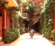
La maison Rose
Mermoz Saint Louis
Videos from this area
These are videos related to the place based on their proximity to this place.
Excursions à Saint Louis du Sénégal
Saint Louis - 2 jours Départ de Saly. Déjeuner à Saint Louis et visite de la ville dans l'après midi, diner et coucher à l'Hotel. Le lendemain direction la langue de Barbarie et visite...
Comment le pont Faidherbe de Ndar/Saint-Louis a été remplacé
Le pont Faidherbe de Saint-Louis a ete totalement changé mais a l'identitique. Le Film !
2009 Sénégal Nord, Saint Louis, Sur Le Fleuve
La Ville de Saint-Louis au Nord du Sénégal, à l'embouchure du Fleuve. Quelques vues sur le Fleuve et le Fameux Pont. WIKIPEDIA : Saint-Louis, Ndar en langue wolof, est l'une des plus grandes...
LE GOUVERNEUR DEFEND LA SIGNATURE DE NDIAEL
La convention de partenariat entre Senhuile et les deux collectifs des chefs de village sous l'emprise du projet est enfin signée pour le grand bonheur du DG de l'entreprise de l'agro-business....
FINAL ODCAV: MEDINE SOULEVE LE TROPHEE DES CADETS
La finale de l'ODCAV de Saint-Louis est remportée en séniors par le Stade de Pikine. Celle des cadets par l'ASC Médine qui reçoit ici son trophée.
Lompoul desert Koulang's photos around Lompoul, Senegal (senegal desert lompoul)
Preview of Koulang's blog at TravelPod. Read the full blog here: http://www.travelpod.com/travel-blog-entries/koulang/1/1239342060/tpod.html This blog preview was made by TravelPod using...
Séjour de coopération agricole au Sénégal
UPA DI vous convie à la troisième édition du séjour de coopération, qui se tiendra au Sénégal, du14 au 28 janvier 2012. Les participants auront l'occasion de découvrir le monde rural...
DONS: LA FONDATION SERVIR LE SÉNÉGAL AU SECOURS DES POPULATIONS DE SOR
Le ministre Mansour FAYE et la Fondation Servir Le Sénégal sont venus porter secours au Poste de santé de Sor qui manquait presque de tout. Faute de rentrées financières conséquentes....
ALIOUNE DIOP, DG ONAS, PLEBICITE PAR LES POPULATIONS
Elles ont tenu à le féliciter pour le brillant travail abattu à la tète de l'ONAS en un seulement. Il revient sur les motifs de satisfaction qui lui ont valu d'ètre distingué par les...
Videos provided by Youtube are under the copyright of their owners.
Attractions and noteworthy things
Distances are based on the centre of the city/town and sightseeing location. This list contains brief abstracts about monuments, holiday activities, national parcs, museums, organisations and more from the area as well as interesting facts about the region itself. Where available, you'll find the corresponding homepage. Otherwise the related wikipedia article.
Saint-Louis, Senegal
Saint-Louis, or Ndar as it is called in Wolof, is the capital of Senegal's Saint-Louis Region. Located in the northwest of Senegal, near the mouth of the Senegal River, and 320 km north of Senegal's capital city Dakar, it has a population officially estimated at 176,000 in 2005. Saint-Louis was the capital of the French colony of Senegal from 1673 until 1902. From 1902 until its independence from France the capital was Dakar.
Saint-Louis Airport
Saint-Louis Airport (French: Aéroport de Saint-Louis) is an airport serving Saint-Louis, the capital of the Saint-Louis Region in Senegal. Saint-Louis is located near the Senegal River, and served as the Senegal's capital until independence in 1960. It is 320 km north of Senegal's current capital in Dakar.
Faidherbe Bridge
Faidherbe Bridge is a road bridge over the Sénégal River which links the island of the city of Saint-Louis in Senegal to the African mainland. The metal bridge is 507.35 metres long and 10.5 metres wide, weighing 1,500 tonnes . It has eight spans, of which the longest five are 78.26 metres . Until the 19th century, access to the island was made through boats.


