Safety Score: 2,8 of 5.0 based on data from 9 authorites. Meaning we advice caution when travelling to Poland.
Travel warnings are updated daily. Source: Travel Warning Poland. Last Update: 2024-04-19 08:03:45
Explore Skarżyce
Skarżyce in Powiat świdnicki (Województwo Dolnośląskie) is located in Poland about 216 mi (or 347 km) south-west of Warsaw, the country's capital.
Local time in Skarżyce is now 10:32 PM (Friday). The local timezone is named Europe / Warsaw with an UTC offset of 2 hours. We know of 9 airports in the wider vicinity of Skarżyce, of which one is a larger airport. The closest airport in Poland is Copernicus Wrocław Airport in a distance of 23 mi (or 36 km), North-East. Besides the airports, there are other travel options available (check left side).
There are several Unesco world heritage sites nearby. The closest heritage site in Poland is Churches of Peace in Jawor and Świdnica in a distance of 12 mi (or 19 km), North-West. If you need a place to sleep, we compiled a list of available hotels close to the map centre further down the page.
Depending on your travel schedule, you might want to pay a visit to some of the following locations: Udanin, Swiebodzice, Swidnica, Walbrzych and Jawor. To further explore this place, just scroll down and browse the available info.
Local weather forecast
Todays Local Weather Conditions & Forecast: 9°C / 48 °F
| Morning Temperature | 3°C / 37 °F |
| Evening Temperature | 8°C / 46 °F |
| Night Temperature | 4°C / 40 °F |
| Chance of rainfall | 0% |
| Air Humidity | 58% |
| Air Pressure | 1008 hPa |
| Wind Speed | Fresh Breeze with 14 km/h (8 mph) from North-East |
| Cloud Conditions | Overcast clouds, covering 100% of sky |
| General Conditions | Light rain |
Saturday, 20th of April 2024
5°C (42 °F)
2°C (35 °F)
Rain and snow, gentle breeze, overcast clouds.
Sunday, 21st of April 2024
2°C (35 °F)
-1°C (30 °F)
Light snow, gentle breeze, overcast clouds.
Monday, 22nd of April 2024
4°C (39 °F)
-0°C (32 °F)
Overcast clouds, gentle breeze.
Hotels and Places to Stay
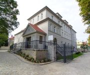
Villa la Pierre
Videos from this area
These are videos related to the place based on their proximity to this place.
Happysad Strzegom 21.06.2014r. Rynek - Dni Ziemi Strzegomskiej 2014
Udało nam się nakręcić kilka kawałków Happysadu na koncercie w Strzegomiu, postaram się wrzucić na kanał wszystkie które mam :) Było świetnie, kogo nie było, ten niech żałuje! :D.
Zespół Szkół Strzegom Wintergruesse fuer Lyzeum Lagadas
Zespół Szkół - Strzegom, Projekt 2012/2013 " Auf der Reise nach Solidaritaet - W poszukiwaniu solidarności"
Jaworzyna Śląska Z Lotu Ptaka, Drona, Część II FromSky.swidnica.pl
Film przedstawia Jaworzynę Śląską, miasto położone w województwie dolnośląskim, powiecie świdnickim, będące niegdyś głównym węzłem kolejowym w rejonie. Film nagrany za pomocą...
Videos provided by Youtube are under the copyright of their owners.
Attractions and noteworthy things
Distances are based on the centre of the city/town and sightseeing location. This list contains brief abstracts about monuments, holiday activities, national parcs, museums, organisations and more from the area as well as interesting facts about the region itself. Where available, you'll find the corresponding homepage. Otherwise the related wikipedia article.
Czechy, Lower Silesian Voivodeship
Czechy is a village in the urban-rural Gmina Jaworzyna Śląska, within Świdnica County, Lower Silesian Voivodeship, in south-western Poland. Prior to 1945 it was in Germany. It lies approximately 4 kilometres north-west of Jaworzyna Śląska, 11 kilometres north of Świdnica, and 49 kilometres south-west of the regional capital Wrocław.
Pastuchów
Pastuchów is a village in the urban-rural Gmina Jaworzyna Śląska, within Świdnica County, Lower Silesian Voivodeship, in south-western Poland. Prior to 1945 it was in Germany. It lies approximately 4 kilometres north of Jaworzyna Śląska, 12 kilometres north of Świdnica, and 46 kilometres south-west of the regional capital Wrocław.
Jaroszów, Lower Silesian Voivodeship
Jaroszów is a village in the administrative district of Gmina Strzegom, within Świdnica County, Lower Silesian Voivodeship, in south-western Poland. Prior to 1945 it was in Germany. It lies approximately 6 kilometres north-east of Strzegom, 16 kilometres north of Świdnica, and 47 kilometres west of the regional capital Wrocław. The village has a population of 2,150.
Morawa, Lower Silesian Voivodeship
Morawa is a village in the administrative district of Gmina Strzegom, within Świdnica County, Lower Silesian Voivodeship, in south-western Poland. Prior to 1945 it was in Germany. It lies approximately 4 kilometres east of Strzegom, 14 kilometres north of Świdnica, and 49 kilometres west of the regional capital Wrocław.
Skarżyce, Lower Silesian Voivodeship
Skarżyce is a village in the administrative district of Gmina Strzegom, within Świdnica County, Lower Silesian Voivodeship, in south-western Poland. Prior to 1945 it was in Germany. It lies approximately 6 kilometres east of Strzegom, 14 km north of Świdnica, and 48 km west of the regional capital Wrocław.
Mikoszowa
Mikoszowa is a village in the administrative district of Gmina Żarów, within Świdnica County, Lower Silesian Voivodeship, in south-western Poland. Prior to 1945 it was in Germany. It lies approximately 5 kilometres north-west of Żarów, 14 km north of Świdnica, and 45 km south-west of the regional capital Wrocław.
Przyłęgów
Przyłęgów is a village in the administrative district of Gmina Żarów, within Świdnica County, Lower Silesian Voivodeship, in south-western Poland. Prior to 1945 it was in Germany. It lies approximately 3 kilometres north-west of Żarów, 12 kilometres north of Świdnica, and 46 kilometres south-west of the regional capital Wrocław.
Pełcznica (river)
Pełcznica is a river of Poland.


