
Address & Contact
Contact Information:
Wikipedia page
Telefonnummer: +63 36 621 2249
Street address:
Roxas Airport
Arnaldo Boulevard
Roxas City
5800 Capiz
Philippinen
GPS Coordinates:
Longitude: 122,752°
Latitude: 11,598°
Summary
Roxas Airport is a medium sized airport in Philippines, serving the region of Roxas City, Barangay Gabuan. The longest runway is 6.201 feet or 1.890 meters long.
Facts:
Local name: Paliparan ng Roxas, Hulugpaan sang Roxas, Roxas City Airport size: medium airport Serving area: Roxas City, Barangay Gabuan Longest runway: 6201 (ft)
Codes:
IATA: RXS,
ICAO: RPVR
Flight information:
Departure times (FlightStats)
Flight times (FlightRadar24)
Location on map
Show bigger map on Openstreetmap
About the airport
Roxas Airport, with the IATA code RXS and the ICAO code RPVR, is a domestic airport located in Roxas City, Capiz, Philippines. Situated on the island of Panay, it serves as the primary gateway for travelers visiting the province of Capiz and its surrounding areas. The airport is named after Manuel Roxas, the first president of the Philippines.
Roxas Airport offers convenient connections to major cities in the Philippines, including Manila and Cebu. It is a relatively small airport with a single terminal, ensuring easy navigation for passengers. The facilities include a few shops, cafes, and a waiting area. The airport provides essential services such as baggage handling, customs, and immigration.
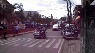
Transportation options from Roxas Airport to the city center are readily available, including taxis and tricycles. The airport is located approximately 3 kilometers away from Roxas City, making it a short journey for travelers.
Overall, Roxas Airport provides a convenient and hassle-free travel experience for visitors to Capiz and the surrounding areas, ensuring a smooth start to your trip in the Philippines.
Videos from the area of the airport

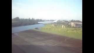
PAL Landing On Roxas City Airport, Philippines
The flight took about 50 minutes, from Manila to Roxas City. So there was hardly anything you can do other than read or sleep. In my case, it's pretty obvious what I busied myself with taking...

Philippine Airlines Aircraft Safety Instruction on Video
This is the video presentation of PAL's Aircraft Safety Instruction prior to plane take-off. Nicely done and presented with a touch of humor for passengers entertainment. I quite enjoyed it...
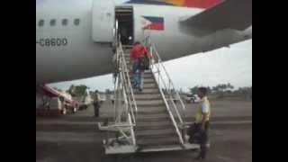
Boarding PAL - Going Back Home To Manila
Just a short video as we boarded the Philippine Airlines for our flight back to Manila. Too bad I didn't get a window sit. Oh well it's life haha. :) Roxas City, Philippines Sept. 1, 2012...
綺麗なフィリピン ロハス
私のイメージはフィリピンはゴミの国でした。
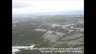
Roxas Airport Landing
It was my first time landing at Roxas Airport in Capiz.
Videos provided by Youtube are under the copyright of their owners. 
 Kalibo International Airport
Medium airport - 26 mi (42 km)
Iloilo International AirportMedium airport - 56 mi (90 km)
Bacolod-Silay City International AirportMedium airport - 59 mi (96 km)
Godofredo P. Ramos AirportMedium airport - 59 mi (95 km)
Romblon AirportMedium airport - 67 mi (108 km)
Evelio Javier AirportMedium airport - 80 mi (129 km)
Moises R. Espinosa AirportMedium airport - 80 mi (129 km)
Mactan Cebu International AirportLarge airport - 122 mi (197 km)
Ninoy Aquino International AirportLarge airport - 232 mi (375 km)
Diosdado Macapagal International AirportLarge airport - 288 mi (465 km)
Bigger and popular cities in the wider vicinity are these:
- Altavas
- Balasan
- Balete
- Batad
- Batan
- Bingawan
- Dao
- Dumalag
- Estancia
- Ivisan
- Jamindan
- Lemery
- Libacao
- Madalag
- Makato
- Malinao
- Mambusao
- New Washington
- Numancia
- Panay
- Panitan
- Passi
- Pilar
- Pontevedra
- President Roxas
- Roxas City
- San Dionisio
- San Rafael
- Sara
- Sigma
These are some smaller cities that might be interesting. They are all rather close.