Safety Score: 3,0 of 5.0 based on data from 9 authorites. Meaning we advice caution when travelling to Panama.
Travel warnings are updated daily. Source: Travel Warning Panama. Last Update: 2024-04-16 08:26:06
Discover San Felipe
The district San Felipe of Panamá in Provincia de Panamá is a district in Panama and is a district of the nations capital.
Looking for a place to stay? we compiled a list of available hotels close to the map centre further down the page.
When in this area, you might want to pay a visit to some of the following locations: Veracruz, San Miguelito, Arraijan, Vista Alegre and Alcalde Diaz. To further explore this place, just scroll down and browse the available info.
Local weather forecast
Todays Local Weather Conditions & Forecast: 31°C / 88 °F
| Morning Temperature | 24°C / 75 °F |
| Evening Temperature | 29°C / 85 °F |
| Night Temperature | 25°C / 77 °F |
| Chance of rainfall | 0% |
| Air Humidity | 58% |
| Air Pressure | 1009 hPa |
| Wind Speed | Gentle Breeze with 7 km/h (5 mph) from South |
| Cloud Conditions | Broken clouds, covering 71% of sky |
| General Conditions | Broken clouds |
Wednesday, 17th of April 2024
32°C (89 °F)
25°C (77 °F)
Broken clouds, gentle breeze.
Thursday, 18th of April 2024
32°C (89 °F)
25°C (77 °F)
Light rain, gentle breeze, overcast clouds.
Friday, 19th of April 2024
30°C (87 °F)
26°C (79 °F)
Light rain, light breeze, broken clouds.
Hotels and Places to Stay
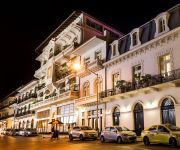
American Trade Hotel
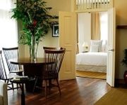
LAS CLEMENTINAS
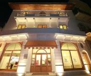
Villa Palma Boutique Hotel
Ojos Del Rio
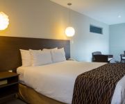
Panama Canal Country Inn and Suites by Radisson
HOTEL CENTROAMERICANO
Canal Inn B&B Panama
The Panams Hotel Boutique
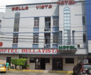
Hotel Bellavista
COSTA INN
Videos from this area
These are videos related to the place based on their proximity to this place.
Fishmarket and more in Panama City /10.2011/ HD
Some scenes from the fishmarket in Panama City. Watch my other HD Videos from Panama City. Filmed with a Canon Rebel t2i. I only can upload here 720p movies, the Internet is so slow.
An Unexpected Visit to Panama City, Panama
I bought a ticket to Medellín, but the layover was 14 hours! That was not expected! It was my mistake when I bought the ticket.
The Hospitality Tour: Skyline de Panama City
Florie traveled from Mexico to Argentina assisting hotels with a responsible state of mind to enhance their marketing while collecting their best sustainable practices. Follow her adventure...
Panama City /OLD TOWN/ Part1 /10.2011/ HD
Some scenes from Panama City. Watch Part 2 for the new part of the city. Canon Rebel t2i. I only can upload here 720p movies, the Internet is so slow.
Panama City, Panama Skyline from Casco Viejo
Panama City, Panama skyline. Includes the H2O, Destiny, Miramar, Vista Marina, MEGAPOLIS, Trump, & Pacific Bay buildings among others along Balboa Ave and in Patilla and Punta Pacifica. ...
Autoridades del Miviot visitarán San Felipe para evaluar posibles respuestas habitacionales
Tras una reunión con dirigentes que residen del corregimiento de San Felipe en ciudad capital y funcionario del Ministerio de Vivienda y Ordenamiento Territorial, (Miviot) se estableció realizar...
Panama City, Panama - Church of San José HD (2014)
Casco Viejo (Spanish for Old Quarter), also known as Casco Antiguo or San Felipe, is the historic district of Panama City. Completed and settled in 1673, it ...
Panama City, Panama - Plaza de la Independencia HD (2014)
Casco Viejo (Spanish for Old Quarter), also known as Casco Antiguo or San Felipe, is the historic district of Panama City. Completed and settled in 1673, it was built following the near-total...
Panama Hat
How to fold and unfold a Panama Hat, as explained by the very nice people from El Farol (Artesanías and Souvenirs) - Calle 1a San Felipe of Casco Antiguo Panamá ...
R. STRAUSS - ALSO SPRACH ZARATHUSTRA - Panamá Oeste Brass Ensemble
Teatro Anita Villalaz, Plaza Francia, Casco Antiguo, San Felipe, Panamá. Collage Asociación Nacional de Conciertos 2014 Panamá Oeste Ensemble Brass: Conductor Invitado: Jorge A. Oliva...
Videos provided by Youtube are under the copyright of their owners.
Attractions and noteworthy things
Distances are based on the centre of the city/town and sightseeing location. This list contains brief abstracts about monuments, holiday activities, national parcs, museums, organisations and more from the area as well as interesting facts about the region itself. Where available, you'll find the corresponding homepage. Otherwise the related wikipedia article.
Panama City
Panama City (Spanish: Panamá) is the capital and largest city of the Republic of Panama. It has a population of 880,691, with a total metro population of 1,272,672, and it is located at the Pacific entrance of the Panama Canal, in the province of Panama. The city is the political and administrative center of the country as well as a hub for international banking and commerce. It is considered a Beta - World City and one of three Central American cities listed in this category.
Balboa, Panama
Balboa is a district of Panama City, located at the Pacific entrance to the Panama Canal.
Bridge of the Americas
The Bridge of the Americas (Spanish: Puente de las Américas; originally known as the Thatcher Ferry Bridge) is a road bridge in Panama, which spans the Pacific entrance to the Panama Canal. Completed in 1962, at a cost of US$20 million, it was the only non-swinging bridge (there are two other bridges, one at the Miraflores locks and one at the Gatun locks) connecting the north and south American land masses until the opening of the Centennial Bridge in 2004.
Miramar Towers
The Miramar Towers are located in Avenida Balboa and Calle Federico Boyd, Panama City. The hotel and residential tower complex are currently the tallest buildings in Panama at 168 m (551 ft), with 55 floors. They will be enjoying this status for not too much longer, since new proposed and under construction projects are under way currently in Panama City, including structures ranging from 70 to 95 floors in height.
Panama Canal Authority
The Panama Canal Authority (Spanish: Autoridad del Canal de Panamá) is the agency of the government of Panama responsible for the operation and management of the Panama Canal. The ACP took over the administration of the Panama Canal from the Panama Canal Commission, the joint US–Panama agency that managed the Canal, on December 31, 1999, when the canal was handed over from the United States to Panama as the Torrijos-Carter Treaties stated.
Martyrs' Day (Panama)
Martyrs' Day is a Panamanian holiday which commemorates the January 9, 1964 riots over sovereignty of the Panama Canal Zone. The riot started after a Panamanian flag was torn during conflict between Panamanian students and Canal Zone Police officers, over the right of the Panamanian flag to be flown alongside the U.S. flag. U.S. Army units became involved in suppressing the violence after Canal Zone police were overwhelmed, and after three days of fighting, about 21 Panamanians and four U.S.
Fort Amador
Fort Amador and Fort Grant were former United States Army bases protecting the Pacific (southern) end of the Panama Canal at Panama Bay. Amador was the primary on-land site, lying below the Bridge of the Americas. Grant consisted of a series of islands lying just offshore, some connected to Amador via a causeway. Fort Sherman was the corresponding base on the Atlantic (northern) side.
Ancon Hill
Ancon Hill is a steep 654-foot hill which overlooks Panama City, Panama adjacent to the township of Ancón. It was under U.S. jurisdiction as part of the Panama Canal Zone for much of the 20th century and therefore was never developed like most of the surrounding urbanized parts of the city. As a result, it became a kind of an "island" of jungle in an urban area, where wildlife still survives cut off from other jungle areas.
Hospital Nacional
Hospital Nacional (English: National Hospital) is a private hospital in Panama city. It is located on Avenida Cuba and 38 street in Bella Vista.
Hospital Santo Tomas
Hospital Santo Tomás (HST) (English: Saint Thomas Hospital), is the largest Public hospital that the Panamanian Health Ministry has. Its long history goes as far as 1703. {{#invoke:Coordinates|coord}}{{#coordinates:8|58|14.89|N|79|31|56.73|W| |primary |name= }}
Instituto Oncologico Nacional
The National Oncologic Institute or ION is a specialized hospital for cancer treatment, located in Panama City, Panama. Between August 2000 and March 2001, patients receiving radiation treatment for prostate cancer and cancer of the cervix received lethal doses of radiation, resulting in 17 fatalities.
Figali Convention Center
Figali Convention Center is an indoor sports arena, in Fort Amador, Panama City, Panama. The capacity of the arena is 10,275. Built in 2003, as the main venue for the Miss Universe 2003 Pageant, which took place in Panama that year. Since then, it has been used mainly for many concerts and sports events, such as boxing and ice skating. It has a high-class structure and architecture, making it one of the best, if not the best, Convention Centers in Central America.
Estadio Municipal de Balboa
Estadio Municipal de Balboa is a multi-purpose stadium in Balboa, Panama. It is currently used mostly for football matches and is the home stadium of Municipal Chorrillo. The stadium holds 2,000 people. The stadium was originally part of the Balboa High School campus, and was used mostly to play football and baseball. Currently the field is administered by the Panama Canal Authority.
Diablo, Panama
Diablo was one of many townships in the Panama Canal Zone. It was established in 1905 by William Luke Jenkins. It was located directly across from the entrance to Albrook AFB, on a low hill overlooking the canal just past Balboa Harbor. The Diablo clubhouse was a center for social activity, and included a restaurant and a number of other services.
Albrook Air Force Station
Albrook Air Force Station is a former United States Air Force facility in Panama. It was closed on 30 September 1997 as a result of the Torrijos-Carter Treaties which specified that United States military facilities in the former Panama Canal Zone be closed and the facilities be turned over to the Panamanian government. It was located on the east side of the Panama Canal just south of Fort Clayton and north of the township of Balboa, Panama.
Balboa Heights, Panama
Balboa Heights was more or less part of the Panama Canal township of Balboa, existing on the edge of it towards Ancón, with some of it on the lower slopes of Ancon Hill. It wasn't really a proper township in terms of having anything other than residential neighborhoods, but it got its own map page in the Canal Zone telephone book.
University of Panama
The University of Panama was founded on October 7, 1935, with a student body of 175 in the fields of Education, Commerce, Natural Sciences, Pharmacy, Pre-Engineering and Law. As of 2008, it maintains a student body of 74,059 distributed in 228 buildings around the country. The University of Panama was founded under the administration of the President of the Republic, Dr. Harmodio Arias Madrid. Its founder and first President was the distinguished citizen Dr. Octavio Méndez Pereira.
Palacio de las Garzas
The Palacio de las Garzas (Herons' Palace) is the governmental office and residence of the President of Panama. It receives its name because of herons roamming freely in the courtyard. The herons were first brought to the building in 1922 by former president Belisario Porras, at the suggestion of friend and famed Panamanian poet Ricardo Miro.
Balboa High School (Panama)
Balboa High School was a public high school in the former Canal Zone on the isthmus of Panama. {{#invoke:Coordinates|coord}}{{#coordinates:8|57|32.35|N|79|33|26.47|W| |primary |name= }}
Isthmus Department
The Isthmus Department or Department of Panama (Spanish: Departamento de Panama) was one of the departments of Gran Colombia and later of the Republic of Colombia. It was created in 1824 and covered the territory of what is now the country of Panama and some territories north. After the Thousand Days War and the influence of the United States to build the Panama Canal the former Department of Gran Colombia separated from Colombia and became the Republic of Panama.
Estadio Javier Cruz
Estadio Javier Cruz 'Artes y Oficios' is a multi-purpose stadium. It located at the corner of Ricardo J. Alfaro Avenue and Vía Simón Bolivar in Panama City, Republic of Panama; close to Colegio de Artes Y Oficios Melchor Lasso de La Vega, from which it has received part of his name. It is currently used mostly for football matches and is the home stadium of Chorrillo F.C. and Plaza Amador from the Liga Panameña de Futbol. The stadium holds 2,500 spectators.
Casco Viejo, Panama
Casco Viejo (Spanish for Old Town), also known as Casco Antiguo or San Felipe, is the historic district of Panama City. Completed and settled in 1673, it was built following the near-total destruction of the original Panamá city, Panamá Viejo in 1671, when the latter was attacked by pirates. It was designated a World Heritage Site in 1997.
Panama Metro
The Panamá Metro is a transport project in Panama City, in Panama, planned to open in January 2014.
Panama State
Panamá State was one of the states of Colombia. Created 27 February 1855 under the name Estado Federal de Panamá (Federal State of Panamá). Later was recognized as Estado de la Federación in the constitution of the Granadine Confederation of 1858, and in the constitution of 1863 renamed as Estado Soberano (Sovereign State of Panamá) in the national and state constitutions of 1863.
Panama Canal Museum
The Panama Canal Museum (Spanish: Museo del Canal Interoceánico de Panamá) is a non-profit and public museum located in Panama City, Panama. Established in 1997, the museum is devoted to the history of the construction of the Panama Canal in its various stages, including the first French construction attempt, the later construction by the United States, and the eventual transfer to Panamanian control.


