Safety Score: 2,8 of 5.0 based on data from 9 authorites. Meaning we advice caution when travelling to Norway.
Travel warnings are updated daily. Source: Travel Warning Norway. Last Update: 2024-04-24 08:14:40
Discover Bekkelaget
The district Bekkelaget of Oslo in Oslo (Oslo County) is a subburb in Norway and is a district of the nations capital.
If you need a hotel, we compiled a list of available hotels close to the map centre further down the page.
While being here, you might want to pay a visit to some of the following locations: Kolbotn, Nesoddtangen, Ski, Kjenn and Rotnes. To further explore this place, just scroll down and browse the available info.
Local weather forecast
Todays Local Weather Conditions & Forecast: 7°C / 44 °F
| Morning Temperature | 3°C / 37 °F |
| Evening Temperature | 8°C / 46 °F |
| Night Temperature | 3°C / 37 °F |
| Chance of rainfall | 4% |
| Air Humidity | 75% |
| Air Pressure | 1006 hPa |
| Wind Speed | Calm with 2 km/h (2 mph) from South |
| Cloud Conditions | Overcast clouds, covering 99% of sky |
| General Conditions | Rain and snow |
Friday, 26th of April 2024
5°C (40 °F)
3°C (37 °F)
Overcast clouds, light breeze.
Saturday, 27th of April 2024
8°C (46 °F)
3°C (38 °F)
Light rain, light breeze, broken clouds.
Sunday, 28th of April 2024
8°C (46 °F)
8°C (47 °F)
Light rain, light breeze, overcast clouds.
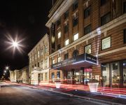
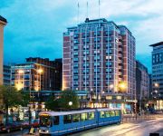
Hotels and Places to Stay
First Hotel Grims Grenka
Thon Hotel Terminus
Bjørvika Apartments
Clarion Hotel The Hub
SCANDIC BYPORTEN
Oslo central station apartments
Comfort Grand Central
Best Western Kampen
THON HOTEL OPERA
Clarion Collection Bastion
Videos from this area
These are videos related to the place based on their proximity to this place.
Gamle Oslo sanert
Bilder fra 1972 av Rådhusplassen i Oslo, Vippetangen og fra saneringen rundt Østbanen og området rundt for å gi plass til bl.a. ny sentralstasjon, Oslo City, Postgirobygget m.v..
FREEDOM THEATRE: WHAT KIND OF FREEDOM?
This was Session 6 on Day 2 of the conference 'All that is banned is desired' which was held in Oslo, Norway, in October 2012. Speaker: Jonatan Stanczak, Co-Founder and Administrative Manager,...
Juletre pyntet med fuglemat
Juletre i hagen omgjort til fineste fuglerestaurant. Se http://moseplassen.com/kategori/dyr/ for mer fuglegalskap! og http://moseplassen.com/2011/12/lekker-hjemmelaget-fuglemat/ for forklaring...
Test Drive Unlimited 2 | Motorcycle Lap [Video Replay]
Test Drive Unlimited 2 Motorcycle lap in Hawaii :) Like and subscribe for more videos in the future.
Brannvesen i 1941 Fiat og Magirius
Kastellet Brannvesen i Oslo, ble under krigen forsterket med frivillige. Det ble kalt det Sivile Luftvern, og var forløperen til Sivilforsvaret. Filmen viser øvelser og en utrykkning.
Go pro hero 3 silver - A Normal Sunday
Ingierstrand bad og harald huysman gokart. 10m hopp. Go pro hero 3 Silver.
Oslo - Stadtrundfahrt mit Opernsaengerin
Am 19.8.2012 unternahmen wir eine denkwuerdige Stadtrundfahrt durch das sonnige Oslo. Eine ehem. Opernsaengerin zeigte uns, untermalt von kurzen Arien, das schoene sonnige Oslo. Der Ausflug.
Videos provided by Youtube are under the copyright of their owners.
Attractions and noteworthy things
Distances are based on the centre of the city/town and sightseeing location. This list contains brief abstracts about monuments, holiday activities, national parcs, museums, organisations and more from the area as well as interesting facts about the region itself. Where available, you'll find the corresponding homepage. Otherwise the related wikipedia article.
Bekkelaget
Bekkelaget is an area in the borough Nordstrand in Oslo, Norway. Until 2004 it was, together with adjacent Ekeberg, a part of the borough Ekeberg-Bekkelaget. Bekkelaget is known nationwide for the sports club Bækkelagets SK.
Ekeberg
Ekeberg is a neighborhood in the city of Oslo, Norway. The Norway Cup soccer tournament takes place at Ekebergsletta every summer. "Sletta" means "the plain". The painting "The Scream" by Edvard Munch is painted from Utsikten ("the view"), a part of Ekeberg. In the area are a number of old Iron Age grave mounds and Bronze Age ritual sites. This establish the area of Ekeberg as one of the oldest inhabited places around Oslo. During the Middle Ages, the farm of Ekeberg belonged to Hovedøya Abbey.
Norway Cup
Norway Cup is an international youth football tournament which has been hold annually since 1972, except in 1976, in Oslo, Norway. It is the world's second-largest football tournament, after Gothia Cup, and sees a typical 1400 to 1600 participating teams per year. Norway cup consists of tournaments for ages 10 through 19 for both genders, with 43,141 teams having participated between 1972 and 2009. The tournament takes place at Ekebergsletta.
Ekebergsletta
Ekebergsletta is a field in Ekeberg, Oslo, Norway. For most people, Ekebergsletta is known as the place where the Norway Cup started in 1972 and which is still one of many places around Oslo where the game is held. Roald Amundsen landed his Airship Norge here for a few hours in 1926 on his way to towards the north pole. The foundation of the mast used by the airship can still be found.
Sjursøya
Sjursøya is a peninsula located in Oslo, Norway. The peninsula is entirely used by the Port of Oslo as a container and petroleum port, and serves as the primary oil port for Eastern Norway. A train accident occurred at Sjursøya on 24 March 2010, when a runaway set of 16 empty carriages belonging to CargoNet crashed into a terminal building at high speed. This incident caused 3 deaths and 4 injured persons.
Kastellet (station)
Kastellet is a light rail station on the Oslo Tramway. Located at Kastellet in Nordstrand, the station is situated between Sørli and Bråten. It was opened in 11 June 1917.
Sørli (station)
Sørli is a light rail station on the Oslo Tramway. Located at Sørli in Nordstrand, the station is situated between Holtet and Kastellet. It was opened in 11 June 1917. The station is served by lines 18 and 19.
Holtet (station)
Holtet is a light rail station on the Ekeberg line of the Oslo Tramway. It is located at Holtet in Ekeberg, in the borough of Nordstrand, in Oslo, Norway. It was opened in 11 June 1917 and has a balloon loop. The station is served by lines 18 and 19. Rush-hour services with line 18 terminate at Holtet.
Sportsplassen (station)
Sportsplassen is a light rail station on the Ekeberg Line of the Oslo Tramway. It is located near Sportsplassen in Ekeberg, in the borough of Nordstrand, in Oslo, Norway. The station opened on 11 June 1917 as part of the Ekeberg Line to Sæter. The station is served by lines 18 and 19, using both SL79 and SL95 trams.
Jomfrubråten (station)
Jomfrubråten is a light rail station on the Ekeberg Line of the Oslo Tramway. It is located near Jomfrubråten in Ekeberg, in the borough of Nordstrand, in Oslo, Norway. The station opened on 11 June 1917 as part of the Ekeberg Line to Sæter. The station is served by lines 18 and 19, using both SL79 and SL95 trams. From 30 September 1931 to 29 October 1967, the Simensbråten Line split from the Ekeberg Line after Jomfrubråten. The next station along the Simensbråten Line was Ekebergparken.
Sjømannsskolen (station)
Sjømannsskolen is a light rail station on the Ekeberg Line of the Oslo Tramway. It is located near Sjømannsskolen (the Seamen School) in Ekeberg, in the borough of Nordstrand, in Oslo, Norway. The station opened on 11 June 1917 as part of the Ekeberg Line to Sæter. The station is served by lines 18 and 19, using both SL79 and SL95 trams.
Oslo Hospital (station)
Oslo Hospital is a light rail station on the Ekeberg Line of the Oslo Tramway. It is located near Oslo Hospital in Ekeberg, in the borough of Gamlebyen, in Oslo, Norway. The station opened on 2 December 1878 as the terminus of the second segment of the Gamleby Line built by Kristiania Sporveisselskab. It was renamed following the change of name of the city from Kristiania to Oslo in 1925.
St Halvards plass (station)
St Halvards plass is a tram station on the Gamleby Line of the Oslo Tramway. It is located at the square St Halvards plass, on the intersection of Oslo gate and Bispegata in Gamlebyen, Oslo, Norway. The station opened on 6 October 1875 as part of the Gamleby Line extension to Oslo Hospital by Kristiania Sporveisselskab. The station is served by lines 18 and 19, using both SL79 and SL95 trams.
Grønlia
Grønlia is a neighborhood in the borough Gamle Oslo in Oslo, Norway. It is located below Ekebergåsen, along the Oslofjord, south of Sørenga and north of Kongshavn. The area is dominated by the Port of Oslo and railway tracks. As part of the Fjord City urban renewal program, the area will become a residential area.
St Mary's Church, Oslo
St Mary's Church (Norwegian: Mariakirken i Oslo) was a medieval church in Oslo, Norway. It was the royal chapel and had an important political role, as its provost from 1314 also was Chancellor of Norway. St Mary's Church had been built in stages with final additions made in the 1300s. The church was set on fire by Swedish forces in connection with an attack in 1523. After the Reformation, it was so dilapidated that it could not be repaired and was demolished in 1542.
Sørenga
Sørenga is a neighborhood in Gamlebyen in Oslo, Norway. It is located east of Bjørvika, west of Vannspeilet, south of the street Bispegata and Oslo torg, and west and north of the Alna River. South of the area the Sørengautstikkeren runs out into the Oslo Fjord.
Sjursøya train accident
The Sjursøya train accident was a railway accident that occurred on 24 March 2010 at around 13:15 local time, when a set of 16 freight cars began to roll uncontrollably during shunting on Alnabru, north in Oslo. The train dispatcher central chose to lead the runaway train in the direction of Sjursøya, along the Loenga–Alnabru Line, where it derailed and rolled through a Statoil building in the terminal area at Sjursøya, a peninsula which is part of the Oslo ports facilities.
Ekeberghallen
Ekeberghallen is an indoor sports arena located at Ekebergsletta in Nordstrand, Oslo, Norway. It was opened in 1973, and expanded in 1981 when adjacent office localities named Osloidrettens Hus were opened as well. It is mainly used by Bækkelagets SK and other sports clubs in the city, for indoor sports such as basketball, handball, volleyball, badminton, indoor athletics and futsal. Formerly it was used for rock concerts. It has also been used as a professional boxing venue.
Ormøya
Ormøya (previously called Ormsund) is an inhabited island in the inner part of Oslofjord, in the municipality of Oslo. It is located north of the island Malmøya and west of the mainland at Bekkelaget / Nordstrand. A bridge over the strait Ormsundet connects the island to the mainland. The island covers an area of 0.18 square kilometres Ormøy Church, designed by architect Bernhard Steckmest, was built in the 1890s.
Ulvøya (Oslo)
Ulvøya is an inhabited island in the inner part of Oslofjord, in the municipality of Oslo. It is located east of the island Malmøya and west of the mainland at Nordstrand. A bridge over the strait Ulvøysundet connects the island to the mainland. The island covers an area of 0.3 square kilometres
Gamlebyen Church
Gamlebyen Church is a private church, belonging to Oslo University Hospital and is also called Oslo Hospital's Church, located in the old town of Oslo, Norway. It is leased to the Diocese of Oslo of the Church of Norway and serves as the parish church for the Gamlebyen parish in Oslo. Up to 1925 it had the name Oslo Church, but when the city changed its name from Kristiania to Oslo, the church got the present name.
St. Hallvard's Cathedral
St. Hallvard's Cathedral, also known as St. Halvard's church, St. Hallvard's Cathedral, St Hallvard Church, the former Oslo Cathedral and Oslo Cathedral Church was the earliest cathedral in Oslo, Norway, now ruins. The cathedral was built at the height of the Old Town market square Oslo during the early 12th century, and was used as a church until about 1655.
St. Clement's Church, Oslo
St. Clement's Church or Klemet's Church was one of the Roman Catholic parish churches of the old Oslo in Norway. The church was consecrated St. Clement, who was martyred because he was drowned with an anchor tied around his neck. He was thus the patron saint of, among other things seafarers. It was located between the former Clemensallmenningen and Østre strede, south of the Episcopal castle and Halvard's Church.
Middelalderparken
Middelalderparken is Norwegian for the Medieval Park in the borough of Gamle Oslo in Oslo, Norway. The park was built in 2000 in Sørenga in The medieval town of Oslo in The Old Town, Oslo (Gamlebyen). That is about ten minutes walk from the Oslo Central Station. The park is located within the so-called Medieval Park area, which also included the Memorial Park and Ladegården on the north side of Bispegata.
Old Town, Oslo
The Old Town of Oslo is a neighborhood in the inner city of Oslo, Norway, belonging to the borough of Gamle Oslo and is the oldest urban areas within the current capital. Oslo's old town was established with the urban structure around year 1000 and was the capital of Norway's dominion in 1314. Old Town core area (i.e. the southern and the central part of Old Town) has several ruins of stone and brick lying ahead in the day, and large amounts of protected cultural underground.


!['Test Drive Unlimited 2 | Motorcycle Lap [Video Replay]' preview picture of video 'Test Drive Unlimited 2 | Motorcycle Lap [Video Replay]'](https://img.youtube.com/vi/BB9RIEaZBrc/mqdefault.jpg)


