
Address & Contact
Contact Information:
Wikipedia page
Telefonnummer: +47 67 03 33 00
Street address:
Brønnøysund Airport
Hovøyveien 11
8900 Brønnøysund
Norwegen
GPS Coordinates:
Longitude: 12,217°
Latitude: 65,461°
Summary
Brønnøysund Airport is a large airport in Norway, serving the region of Brønnøy, Bronnoysund. The longest runway is 3.937 feet or 1.200 meters long.
Facts:
Local name: Bronnoy Airport size: medium airport Serving area: Brønnøy, Bronnoysund Longest runway: 3937 (ft)
Codes:
IATA: BNN,
ICAO: ENBN
Flight information:
Departure times (FlightStats)
Flight times (FlightRadar24)
Location on map
Show bigger map on Openstreetmap
About the airport
Brønnøysund Airport (IATA: BNN, ICAO: ENBN) is a small regional airport located in Brønnøysund, a picturesque town in the Nordland county of Norway. Situated on the southern coast, this airport serves as a convenient gateway to the stunning landscapes and attractions of the Helgeland region.
Despite its modest size, Brønnøysund Airport offers essential facilities and services for travelers. The terminal building provides comfortable waiting areas, a café, and a small shop. The airport is well-connected with regular flights to and from Oslo, the capital city of Norway, making it easily accessible for both domestic and international travelers.
Upon arrival, visitors can explore the charming town of Brønnøysund, known for its idyllic coastal scenery and the famous Torghatten mountain with its distinctive hole. The airport is also a convenient starting point for exploring the nearby Vega Archipelago, a UNESCO World Heritage site renowned for its unique cultural and natural heritage.
With its convenient location and essential amenities, Brønnøysund Airport is an excellent choice for travelers seeking to experience the natural beauty and cultural richness of Norway's Helgeland region.
Hotels and places to stay

THON HOTEL BRONNOYSUND

THON HOTEL TORGHATTEN

Galeasen Hotell
Videos from the area of the airport


Brønnøysund
bygg og anleggsteknikk vg 1 06-07 Byggteknikk vg 2 07- 08 på Brønnøysund vgs.

TIP 1A funny clips and more
fun.
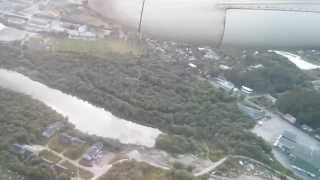
Wideroe Dash 8-100 LN-WII taking off at Brönnöysund bound for Bodö
Wideroe Dash 8-100 LN-WII taking off at Brönnöysund Airport bound for Bodö.
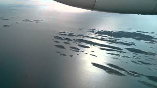
Wideroe Dash 8-100 LN-WII landing at Brönnöysund Airport
Wideroe Dash 8-100 LN-WII landing at Brönnöysund Airport arriving from Trondheim.

Betel Brønnøysund
Betel pinsemenighet holder friluftsmøte ved paviljongen i Brønnøysund sentrum.
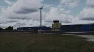
AON ENBN Brønnøysund Airport
Videos provided by Youtube are under the copyright of their owners. 
 Sandnessjøen Airport, Stokka
Medium airport - 35 mi (57 km)
Mosjøen Airport, KjærstadMedium airport - 36 mi (59 km)
Rørvik Airport, RyumMedium airport - 53 mi (86 km)
Namsos Høknesøra AirportSmall airport - 71 mi (114 km)
Mo i Rana Airport, RøssvollMedium airport - 86 mi (138 km)
Bodø AirportLarge airport - 138 mi (223 km)
Røst AirportSmall airport - 143 mi (230 km)
Trondheim Airport, VærnesLarge airport - 144 mi (232 km)
Bigger and popular cities in the wider vicinity are these:
- Bronnoysund
- Gladstad
- Grong
- Hoylandet
- Husoya
- Joa
- Kolvereid
- Lauvsnes
- Leknes
- Leland
- Luroy
- Mosjoen
- Namdalseid
- Namsos
- Namsskogan
- Nesna
- Ranemsletta
- Rorvik
- Royrvik
- Sandnessjoen
- Sandvika
- Silvalen
- Snaase
- Solfjellsjoen
- Steinkjer
- Terrak
- Trofors
- Vagaholmen
- Vevelstad
- Vik
These are some smaller cities that might be interesting. They are all rather close.