Safety Score: 3,0 of 5.0 based on data from 9 authorites. Meaning we advice caution when travelling to New Zealand.
Travel warnings are updated daily. Source: Travel Warning New Zealand. Last Update: 2024-04-24 08:14:40
Explore Tiromoana
Tiromoana in Buller District (West Coast) is located in New Zealand about 183 mi (or 294 km) west of Wellington, the country's capital.
Local time in Tiromoana is now 05:54 PM (Thursday). The local timezone is named Pacific / Auckland with an UTC offset of 12 hours. We know of 8 airports in the wider vicinity of Tiromoana, of which one is a larger airport. The closest airport in New Zealand is Westport Airport in a distance of 23 mi (or 37 km), North-East. Besides the airports, there are other travel options available (check left side).
If you need a place to sleep, we compiled a list of available hotels close to the map centre further down the page.
Depending on your travel schedule, you might want to pay a visit to some of the following locations: Greymouth, Richmond, Christchurch, Nelson and Blenheim. To further explore this place, just scroll down and browse the available info.
Local weather forecast
Todays Local Weather Conditions & Forecast: 14°C / 57 °F
| Morning Temperature | 13°C / 55 °F |
| Evening Temperature | 11°C / 52 °F |
| Night Temperature | 12°C / 54 °F |
| Chance of rainfall | 20% |
| Air Humidity | 95% |
| Air Pressure | 1005 hPa |
| Wind Speed | Fresh Breeze with 15 km/h (9 mph) from South |
| Cloud Conditions | Overcast clouds, covering 100% of sky |
| General Conditions | Heavy intensity rain |
Friday, 26th of April 2024
9°C (49 °F)
7°C (44 °F)
Moderate rain, fresh breeze, overcast clouds.
Saturday, 27th of April 2024
9°C (49 °F)
9°C (49 °F)
Light rain, light breeze, overcast clouds.
Sunday, 28th of April 2024
14°C (57 °F)
9°C (48 °F)
Overcast clouds, light breeze.
Hotels and Places to Stay
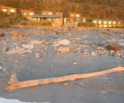
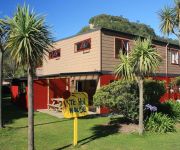
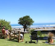
Punakaiki Resort
Te Hui House
Punakaiki Beach Hostel
Videos from this area
These are videos related to the place based on their proximity to this place.
Punakaiki Blowholes and Pancake Rocks, New Zealand
The mighty Blowholes spit out huge foutains in the air. A rough sea and interesting looking layered Pancake Rocks are also shown.
Punakaiki's Pancake Rocks - Roadside Stories
The famous Pancake Rocks at Punakaiki resemble a layered stack of pancakes, and caves beneath them open into blowholes which emit spectacular bursts of spray. The rocks are made of limestone...
Punakaiki, New Zealand
Punakaiki - blow holes and Pancake Rocks, New Zealand. Less dramatic - low tide and rainy.
Punakaiki Pancake Rocks & Blowholes
The Pancake Rocks are a heavily eroded limestone area where the sea bursts though a number of vertical blowholes during high tides. Together with the 'pancake'-layering of the limestone (created...
Punakaiki Blowholes and Pancake Rocks in Paparoa National Park
Beautiful Punakaiki Blowholes and Pancake Rocks at sunset on the beautiful South Island of New Zealand. See more content from around the world at www.tulsatrot.com.
NOT the Wet Coast Wynnejoy's photos around Punakaiki, New Zealand (high tide punakaiki nz)
Preview of Wynnejoy's blog at travelpod. Read the full blog here: http://www.travelpod.com/travel-blog-entries/wynnejoy/1/1264102745/tpod.html This blog prev...
Pancake Rocks, Punakaiki, West Coast New-Zealand
A Dolomite Point, un processus d'erosion lie au climat a donne a la pierre calcaire la forme de piles de crepes. A maree haute, la mer s'engouffre sous les rochers et jaillit violemment des...
Jour 8 : Nelson-Punakaiki Jucco's photos around Punakaiki, New Zealand (punakaiki new zealand)
Preview of Jucco's blog at TravelPod. Read the full blog here: http://www.travelpod.com/travel-blog-entries/jucco/1/1205173680/tpod.html This blog preview was made by TravelPod using the...
greetings from punakaiki from the almost three of us
we are in the middle of nowhere on the west coast and stopped for a hot soy drink with honey in the rain and found this strange big truck parked by the road where they want us to send a video...
Videos provided by Youtube are under the copyright of their owners.
Attractions and noteworthy things
Distances are based on the centre of the city/town and sightseeing location. This list contains brief abstracts about monuments, holiday activities, national parcs, museums, organisations and more from the area as well as interesting facts about the region itself. Where available, you'll find the corresponding homepage. Otherwise the related wikipedia article.
Fox River (Buller)
The Fox River is a river in the Buller District of New Zealand. It arises in the Paparoa Range near Mount Dewar and flows north-west through the Paparoa National Park to the Tasman Sea at Woodpecker Bay The river passes through a spectacular gorge. The northern branch of the river has limestone caves containing stalactite and stalagmite formations. The river was named after William Fox, a gold prospector. A hiking track leads from State Highway 6 near the mouth of the river up to the caves.


