Safety Score: 3,0 of 5.0 based on data from 9 authorites. Meaning we advice caution when travelling to New Zealand.
Travel warnings are updated daily. Source: Travel Warning New Zealand. Last Update: 2024-04-25 08:17:04
Discover Solway
The district Solway of Masterton in Masterton (Wellington) is a subburb in New Zealand about 49 mi north-east of Wellington, the country's capital city.
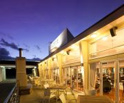
If you need a hotel, we compiled a list of available hotels close to the map centre further down the page.
While being here, you might want to pay a visit to some of the following locations: Palmerston North, Wellington, Blenheim, Napier and Nelson. To further explore this place, just scroll down and browse the available info.
Local weather forecast
Todays Local Weather Conditions & Forecast: 16°C / 61 °F
| Morning Temperature | 10°C / 50 °F |
| Evening Temperature | 15°C / 59 °F |
| Night Temperature | 16°C / 60 °F |
| Chance of rainfall | 0% |
| Air Humidity | 63% |
| Air Pressure | 1007 hPa |
| Wind Speed | Moderate breeze with 10 km/h (7 mph) from South-East |
| Cloud Conditions | Overcast clouds, covering 100% of sky |
| General Conditions | Overcast clouds |
Friday, 26th of April 2024
16°C (61 °F)
6°C (43 °F)
Light rain, moderate breeze, scattered clouds.
Saturday, 27th of April 2024
15°C (59 °F)
5°C (42 °F)
Sky is clear, calm, clear sky.
Sunday, 28th of April 2024
17°C (62 °F)
7°C (45 °F)
Sky is clear, gentle breeze, clear sky.
Hotels and Places to Stay
Gateway Motor Inn Boutique Hotel
COPTHORNE RESORT SOLWAY PARK-MASTERTON
ASURE MASTERTON MOTOR LODGE
Videos from this area
These are videos related to the place based on their proximity to this place.
Masterton Motorplex Drag Racing
Just a mash up of runs in LOW D from the weekend in no particular order.
'Leaving For The Front' WW1 Re-enactment, 13-Aug-14, Masterton, New Zealand
(part 7 of 9) To commemorate 100 years since the first Wairarapa contingent left for World War 1, local people re-enact their departure, marching from Masterton Town Hall to Masterton Railway Station.
A4 Skyhawks doing their thing at Masterton Airshow in 2001
This is shot on VHS tape so the quality isn't that good but the flying makes up for it, I hope!
'Leaving For The Front' WW1 Re-enactment, 13-Aug-14, Masterton, New Zealand
(part 5 of 9) To commemorate 100 years since the first Wairarapa contingent left for World War 1, local people re-enact their departure, marching from Masterton Town Hall to Masterton Railway Station.
Masterton Shunt - Solway snow - Featherston & South
A little overnight excursion I took myself on, a few years back.
NZ Performance Pro Import RX8 at Masterton drags Jan 8th & 9th 2011
Paul Dowdall's RX8 debut at Masterton Motorplex. Video shot and provided by Peter Isaacs.
NZAWA Annual Rally in Masterton June 2012
New Zealand Association of Women in Aviation annual rally held in Masterton 1-4 June 2012.
xr6 turbo ute beats a jaguar(madd jagg) at masterton drags
Sunday now! the second day of racing and the ute got a time of 14.4 seconds against this jaguar that had red lighted but still a sweet result.
Videos provided by Youtube are under the copyright of their owners.
Attractions and noteworthy things
Distances are based on the centre of the city/town and sightseeing location. This list contains brief abstracts about monuments, holiday activities, national parcs, museums, organisations and more from the area as well as interesting facts about the region itself. Where available, you'll find the corresponding homepage. Otherwise the related wikipedia article.
Masterton
Masterton is a large town and local government district in the Wellington Region of New Zealand. It is the largest town in the Wairarapa, a region separated from Wellington by the Rimutaka ranges. It is 100 kilometres north-east of Wellington, 28 kilometres south of Eketahuna, on the Ruamahanga River. Masterton is a thriving community with an urban population of 20,300, and district population of 23,500 (June 2012 estimates).
Roman Catholic Diocese of Palmerston North
The Latin Rite Catholic Diocese of Palmerston North is a suffragan Diocese of the Roman Catholic Archdiocese of Wellington. It was formed on 6 March 1980 when the Archdiocese was divided. The Diocese has an area of area 36,200 km² and had, in 2011, 59,099 Catholics, 58 Priests, 141 Religious and a total population of 470,000 people.
Tauweru River
The Tauweru River, sometimes called the Taueru River, is a river in the Wairarapa region of New Zealand's North Island. It drains from the pastoral eastern highlands of the Wairarapa and joins the Ruamahanga River just north of the Gladstone Road bridge into Gladstone, southeast of Carterton. The river's name is Māori for "hanging in clusters" and named after it is the town of Tauweru, located along the middle reaches of the river east of Masterton.
Te Whiti, New Zealand
Te Whiti, formerly Te Whiti o Tu in the nineteenth century, is a rural community in the Wairarapa region of New Zealand's North Island. Its status has been under dispute and threatened in the twentieth century, and Land Information New Zealand acknowledges Te Whiti solely as a homestead.
Carterton Railway Station
Carterton Railway Station, in the Wairarapa district of New Zealand, is a single platform railway station in the town of Carterton. It is located at the corner of Broadway, Davy and Wheatstone Streets, near the main shopping precinct on State Highway 2 (SH 2). It is on the Wairarapa Line, three stops and 17 minutes' journey time to Masterton, eight stops and 1 hour 19 minutes journey time to Wellington, on Wairarapa Connection trains.
Masterton Railway Station
Masterton railway station is a single-platform, urban railway station serving the town of Masterton in New Zealand's Wairarapa district. The station lies on the Wairarapa Line, and is located at the end of Perry Street. It is one hour, thirty-seven minutes journey time to Wellington. Trains for the Wairarapa Connection service terminate at this station. Masterton is one of three stations in the town of Masterton, the others being Renall Street and Solway.
Renall Street Railway Station
Renall Street railway station is an urban single-platform railway station on Renall Street in the Wairarapa town of Masterton in New Zealand’s North Island. Renall Street is one of three railway stations in Masterton, the others being Masterton and Solway. As part of the Wairarapa station upgrade programme to prepare stations for the new SW-class passenger carriages, this station was closed from 14 May 2007 until early July 2007.
Solway Railway Station
Solway railway station is an urban single-platform railway station in the Wairarapa town of Masterton in New Zealand’s North Island. It is on Ngaumutawa Road, between Hillcrest Street and Judds Road. It is one of three railway stations in Masterton, the others being Masterton and Renall Street. As part of the Wairarapa station upgrade programme to prepare stations for the SW-class passenger carriages, this station was upgraded between 14 May 2007 and late August 2007.
Hood Aerodrome
Hood Aerodrome is an aerodrome, located in southern urban area of Masterton, New Zealand. The aerodrome was named after George Hood, a pioneer Masterton aviator who died trying to make the first Trans-Tasman crossing in 1928. The aerodrome is used extensively for general aviation flights, and is also used for commercial flights.
Waingawa Railway Station
Waingawa railway station is a station on the Wairarapa Line in the Wairarapa district of New Zealand’s North Island. It is located about 1 kilometre south of the Waingawa River and is situated in a heavy industrial area. It served passenger trains until 1992 and now only handles freight (private sidings and special consignments).
Solway College
Located in Masterton, New Zealand, Solway College is one of New Zealand's oldest girls' boarding schools, being founded in 1916. It is an integrated school for girls from Year 7 to Year 13 (Forms 1 to 7), offering a variety of boarding options and a limited number of day girl places.
Makoura College
Makoura College (spelled Makora College prior to 1990) is a state co-educational secondary school located in Masterton, New Zealand
Rathkeale College
Rathkeale College is a state-integrated Anglican boys secondary school on the outskirts of Masterton, New Zealand.
Wairarapa College
Wairarapa College is a state coeducational secondary school located in Masterton, New Zealand. The college first opened in 1938, following the merger of Wairarapa High School with the Masterton Technical School. Serving Years 9 to 13, the college has 943 students as of November 2012, including 175 resident in the school's on-site boarding hostel, College House.
Chanel College, Masterton
Chanel College, Masterton is a Catholic secondary school situated in Masterton, New Zealand. The school is named after St Peter Chanel, who was a French Marist priest killed on the Pacific island of Futuna in 1841. The school was established in 1978. It resulted from the amalgmation of two schools, St Joseph’s College for Boys (founded in 1945) operated by the Marist Brothers and St Bride’s College for Girls which had been established in 1898 by the Brigidine Sisters.
Fernridge, New Zealand
Fernridge is a small rural settlement located 4 km northwest of Masterton, New Zealand. The area has a mixture of farms, horticultural smallholdings and lifestyle blocks.
Kopuaranga River
The Kopuaranga River is a river of the Wairarapa, in New Zealand's North Island. It flows generally south from rough hill country southwest of Eketahuna, reaching its outflow into the Ruamahanga River five kilometres north of Masterton.
Waingawa River
The Waingawa River is a river of the Wellington and Manawatu-Wanganui Regions of New Zealand's North Island. A major tributary of the Ruamahanga River, it flows generally southeast from its origins close to The Mitre, the highest peak of the Tararua Range. The Waingawa flows through the western suburbs of the city of Masterton and reaches the Ruamahanga 10 kilometres southeast of Carterton.
Lansdowne, Wellington
Lansdowne is a suburb in the northern area of Masterton, New Zealand.
Clareville Railway Station
|} Clareville railway station was a flag station serving the small settlement of Clareville, north of Carterton in the Wairarapa region of New Zealand's North Island. It survived for nine decades from when it opened in 1880 until closure to all traffic in 1970.
Middleton Railway Station
Middleton railway station was a short-lived rural flag station in the Wairarapa region of New Zealand’s North Island. It was located on the Wairarapa Line between the stations of Clareville (to the south) and Waingawa (to the north) near what was known as West Taratahi Road (now Wiltons Road). It opened in 1880 but was closed just over a decade later in 1891.
Solway, New Zealand
Solway is a suburb in the southern part of Masterton, a large town in the Wairarapa Valley. Solway is the second largest suburb in the town after Lansdowne.
Queen Elizabeth Park, Masterton
Queen Elizabeth Park is a cricket ground in Masterton, Wellington, New Zealand. The first recorded match held on the ground came in 1907 when Wairarapa played the touring Marylebone Cricket Club. The ground later held its first first-class match during the 1966/67 Plunket Shield when Central Districts played Auckland. Between the 1966/67 and 2002/03 seasons, twelve first-class matches were held there, the last of which saw Central Districts play Wellington in the 2002/03 State Championship.
2012 Carterton hot air balloon crash
On 7 January 2012, a scenic hot air balloon flight from Carterton, New Zealand, collided with a high voltage power line while attempting to land, causing it to catch fire, disintegrate and crash just north of the town, killing all eleven people (ten passengers and the pilot) on board.
Opaki Railway Station
Opaki railway station served the small rural village of Opaki, 6 km north of Masterton, in the Wairarapa region of New Zealand’s North Island. It was located on the Wairarapa Line between the stations of Masterton (to the south) and Kopuaranga (to the north) with vehicular access from Wingate Road.


