Safety Score: 3,0 of 5.0 based on data from 9 authorites. Meaning we advice caution when travelling to New Zealand.
Travel warnings are updated daily. Source: Travel Warning New Zealand. Last Update: 2024-04-19 08:03:45
Delve into Harbour View
The district Harbour View of Lower Hutt in Lower Hutt City (Wellington) is a subburb in New Zealand a little north-east of Wellington, the country's capital town.
If you need a hotel, we compiled a list of available hotels close to the map centre further down the page.
While being here, you might want to pay a visit to some of the following locations: Wellington, Blenheim, Palmerston North, Nelson and Richmond. To further explore this place, just scroll down and browse the available info.
Local weather forecast
Todays Local Weather Conditions & Forecast: 15°C / 59 °F
| Morning Temperature | 12°C / 54 °F |
| Evening Temperature | 14°C / 56 °F |
| Night Temperature | 11°C / 53 °F |
| Chance of rainfall | 0% |
| Air Humidity | 68% |
| Air Pressure | 1012 hPa |
| Wind Speed | Fresh Breeze with 14 km/h (9 mph) from South-East |
| Cloud Conditions | Scattered clouds, covering 39% of sky |
| General Conditions | Scattered clouds |
Saturday, 20th of April 2024
17°C (62 °F)
9°C (49 °F)
Overcast clouds, light breeze.
Sunday, 21st of April 2024
17°C (63 °F)
10°C (49 °F)
Sky is clear, light breeze, clear sky.
Monday, 22nd of April 2024
17°C (62 °F)
10°C (51 °F)
Sky is clear, gentle breeze, few clouds.
Hotels and Places to Stay
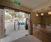
Boulcott Lodge
Fernhill Motor Lodge
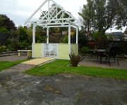
Kenlea Cottage
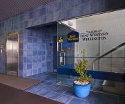
BEST WESTERN WELLINGTON
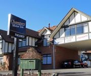
Champers Motor Inn
Abbeycourt Motel
Motel 22
Quality Inn Angus
Green Gables Motel
ASURE 83 By the Sea Motor Lodge
Videos from this area
These are videos related to the place based on their proximity to this place.
Melling, Lower Hutt: 1987 Mazda BFMR v 1994 Subaru WRX STi
1987 Mazda BFMR v 1994 Subaru STi WRX SH2, Melling, Lower Hutt, Wellington, New Zealand.
The old Naenae Railway Station, with Ganz-Mavag EMU, Lower Hutt, NZ
A Ganz-Mavag EMU passing southwards through the old Naenae railway station, Lower Hutt, New Zealand, on 6 May 2012. The station closed for demolition shortly after this video was taken.
SOLD - 12 Corrondella Grove, Belmont, Lower Hutt
Peacefull City-Fringe Living - 4 bedroom, Land: 2749 sqm Bathrooms: 2 bathrooms (ensuite) Bedrooms: 4, plus Study Parking: Double garage, plus Loft, plus offstreet. For Sale by Negotiation....
26-28 Judd Crescent, Naenae Lower Hutt
http://www.jitgovind.com/listing/26-28-judd-crescent-naenae-lower-hutt/ Sitting Tenants -- Landlords Dream.
Melling, Lower Hutt: 1987 Mazda BFMR v 1994 Subaru WRX STi
1987 Mazda BFMR v 1994 Subaru STi WRX SH2, Melling, Lower Hutt, Wellington, New Zealand.
57 Nelson St Petone Lower Hutt Wellington
http://www.jitgovind.com/listing/57-nelson-st-petone-lower-hutt-wellington/\ SOMEBODY HELP ME! I am in desperate need of a makeover! My location is absolutely prime, a short walk to the stylish...
Ride to Lower Hutt River Bank market Timelapse
Riding to the Lower Hutt River Bank Market - 16 minutes compressed to two minutes - shot with Ipod taped to Handlebars.
Small Business Insurance Lower Hutt Wellington Call 04-570 2234
http://www.plus4.co.nz/insurance-lower-hutt-chris-mackay/, We are Small Business Insurance in Lower Hutt Wellington. Call Us Today at 04-570 2234 or Visit: Plus4 Insurance Chris MacKay Level...
Melling to Wellington NZ by train
A view from the rear of a Ganz-Mavag Electric Multiple Unit travelling from Melling (Lower Hutt) to Wellington on 18 April 2012 during the morning peak-time.
Videos provided by Youtube are under the copyright of their owners.
Attractions and noteworthy things
Distances are based on the centre of the city/town and sightseeing location. This list contains brief abstracts about monuments, holiday activities, national parcs, museums, organisations and more from the area as well as interesting facts about the region itself. Where available, you'll find the corresponding homepage. Otherwise the related wikipedia article.
Petone
Petone is a major suburb of the city of Lower Hutt in New Zealand. It is located at the southern end of the narrow triangular plain of the Hutt River, on the northern shore of Wellington Harbour. The name, from the Māori Pito-one, means "end of the sand beach".
Melling, New Zealand
Melling is a suburb of Lower Hutt, to the north of Wellington in the North Island of New Zealand. It is on the west bank of the Hutt River, on State Highway 2, the Wellington-Hutt main road, and directly across the river from the centre of Lower Hutt. It is also the name of the three-lane bridge connecting the Hutt City central business district with State Highway 2, a route subject to extensive congestion at peak times.
St. Bernard's College, Lower Hutt
St Bernard's College (often abbreviated to SBC) is a Catholic Year 7 to 13 (Form 1 to 7) secondary School for Boys, located on Waterloo Rd, Lower Hutt, Wellington, New Zealand. The Marist Brothers, in response to Archbishop McKeefry's call, opened St Bernard's School in 1946. The spirit of the Marist Brothers is still an integral part of the culture of the College.
Hutt Valley High School
Hutt Valley High School (also known as HVHS, Hutt High) is a state co-educational secondary school located in Lower Hutt, New Zealand. It is a uniformed school, with the uniform coming under review roughly every 5 years by the order of the Board of Trustee’s. The current principal is Ross Sinclair. Hutt Valley High School has continued to expand and now has a diverse school population from over 60 different national and cultural backgrounds.
Alicetown
Alicetown is a central suburb of Lower Hutt located at the bottom of the North Island of New Zealand. The suburb is situated north of the major suburb of Petone and west of the Lower Hutt CBD. Its boundaries are the Ewen Bridge that crosses the Hutt River, New Zealand to the east, the Western Hutt Rd/Melling Railway track to the west and Wakefield St/Hutt Railway track to the south. Beginning as a farming settlement, Alicetown was settled from the early 1900s by Petone factory workers.
Hutt Intermediate School
Hutt Intermediate School (HIS) is an intermediate school located in Lower Hutt, New Zealand. The school was founded in 1948, and currently has a total number of 685 students and a teaching staff of 45. The principal, up until the end of 2006, was Neil Withington. He was the principal of Hutt Intermediate School for six years, and has left to take up a position at Victoria University of Wellington. Mike Gillatt has taken up the position since.
Belmont, Wellington
For the suburb of North Shore City (Auckland), see Belmont, Auckland. BelmontBasic informationLocal authority Lower Hutt CityPopulation 2,568 FacilitiesSurroundsNortheast KelsonEast AvalonSoutheast NaenaeSouth BoulcottSouthwest Tirohangavte Belmont is a suburb of Lower Hutt, to the north of Wellington in the North Island of New Zealand. It is on the west bank of the Hutt River, on State Highway 2, the Wellington-Hutt main road, and across the river from the centre of Lower Hutt.
Raphael House Rudolf Steiner School
Raphael House Rudolf Steiner School is a coeducational, state integrated composite school in Belmont, Lower Hutt. It provides a Waldorf education for Years 1 to 13. Matriculation starts when children are 7 years of age.
Petone Railway Station
Petone railway station is a dual platform, suburban railway station serving Petone, a suburb of Lower Hutt in the Wellington region of New Zealand’s North Island. Facilities at this station include a bus terminal, carpark, ticket office, and cycle storage. Pedestrian access between the two side platforms is by way of either a subway to the south or a footbridge to the north (the footbridge also connects across State Highway 2 to Pito-one Road).
Westfield Queensgate
Westfield Queensgate (also known by its former name Queensgate Mall) is a large shopping centre in central Lower Hutt, New Zealand. The centre first opened in 1986, and underwent a large scale development that was completed in August 2006. The centre features: 2 floor Farmers department store Large The Warehouse store New Woolworths supermarket 9 screen SkyCity cinema Plus over 170 specialty stores.
Moera
Moera is a suburb of the city of Lower Hutt in New Zealand and urban district of the city of Wellington.
Sacred Heart College, Lower Hutt
Sacred Heart College, Lower Hutt is a Catholic secondary school situated in the Wellington Region of New Zealand. It was established in 1912 by the Sisters of Our Lady of the Missions and was the first secondary school to be opened in the Hutt Valley. It was originally sited in high street on the property known as Margaret street. In 1957 the school was shifted to the existing site on Laings road.
Tirohanga
Tirohanga is a suburb of Lower Hutt City situated at the bottom of the North Island of New Zealand. The suburb is located on the western side of the Hutt River and State Highway 2.
Harbour View, New Zealand
Harbour View is a suburb of Lower Hutt City situated at the bottom of the North Island of New Zealand. The suburb is located on the western side of the Hutt River and State Highway 2.
Normandale, New Zealand
Normandale is a suburb of Lower Hutt City situated at the bottom of the North Island of New Zealand. The suburb is located on the western side of the Hutt River and State Highway 2. Normandale became a part of Lower Hutt City on 6 October 1957, formerly it was part of Hutt County.
Maungaraki
Maungaraki is a suburb of Lower Hutt City situated at the bottom of the North Island of New Zealand. The suburb is located on the western hills of the Hutt Valley with access to the area via State Highway 2. Maungaraki translated from Māori means: "mountains to the north", this probably references the Māori pā to the south that once stood at Pito-one. Housing increased rapidly in the area during the 1960s, at the time it was the largest local government subdivision in New Zealand.
Ava, New Zealand
Ava is a suburb of Lower Hutt City situated at the bottom of the North Island of New Zealand. The suburb is located in the harbour ward of the city adjacent to Petone.
Korokoro, New Zealand
Korokoro is a suburb of Lower Hutt City situated at the bottom of the North Island of New Zealand. The suburb is located on the western hills of the Hutt Valley overlooking Petone and the Wellington harbour. Korokoro was established in the 1900s by the Liberal government, and was a relatively small settlement until the Lower Hutt City Council developed the area for private housing in the 1960s. Korokoro has a full primary school which about 140 pupils attend.
Belmont Regional Park
Belmont Regional Park is a Wellington Regional park located between Lower Hutt and Porirua, New Zealand. It is the largest of the Wellington Regional parks, stretching close to 15km from Wellington Harbour to Haywards and 10km to Porirua, containing farm land, native bush, and peaks up to 456m (Belmont Trig). There are several entrances from the Hutt Valley side and two on the Porirua side. Some tracks permit mountain biking and horse riding.
Ava Railway Station
Ava Railway Station is an intermediate station in Lower Hutt, New Zealand served by Tranz Metro's electric multiple unit trains on the Hutt Valley Line section of the Wairarapa Line. The island platform station between double tracks serves the suburb of Ava.
Woburn Railway Station
Woburn Railway Station is an intermediate station in Lower Hutt, New Zealand served by Tranz Metro's electric multiple unit trains on the Hutt Valley Line section of the Wairarapa Line. The island platform station between double tracks serves the suburb of Woburn.
Melling Railway Station
Melling Railway Station is the terminal station on the single track Melling Line in Lower Hutt, New Zealand. The island platform station serves the suburb of Melling. The station is served by Tranz Metro's electric multiple unit trains.
Western Hutt Railway Station
Western Hutt Railway Station, formerly Lower Hutt, is an intermediate station on the single-track Melling Line in Lower Hutt, New Zealand, It is served by Metlink electric multiple unit trains operated by Tranz Metro.
Petone Recreation Ground
Petrone Recreation Ground is a cricket ground in Lower Hutt, Wellington, New Zealand. The first recorded match held on the ground came in 1951 when Hutt Valley played Wanganui in the 1950/51 Hawke Cup. The ground later held its first first-class match during the 1991/92 Shell Trophy when Wellington played Otago, with the match ending in an 8 wicket victory for Otago.
Hutt Recreation Ground
Hutt Recreation Ground is a football, cricket and rugby union ground in Lower Hutt, Wellington, New Zealand. The first recorded cricket match held on the ground came in 1949 when Hutt Valley played Nelson in the 1948/49 Hawke Cup. A single List A match was played there in 1971 when Wellington played Central Districts in the 1971/72 New Zealand Motor Corporation Knock-Out, which Wellington won by 47 runs.


