Safety Score: 3,0 of 5.0 based on data from 9 authorites. Meaning we advice caution when travelling to New Zealand.
Travel warnings are updated daily. Source: Travel Warning New Zealand. Last Update: 2024-04-22 08:01:33
Delve into Brockville
The district Brockville of Dunedin in Dunedin City (Otago) is a district located in New Zealand about 383 mi south-west of Wellington, the country's capital town.
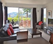
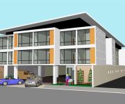
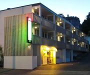
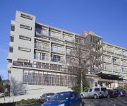
In need of a room? We compiled a list of available hotels close to the map centre further down the page.
Since you are here already, you might want to pay a visit to some of the following locations: Invercargill, Christchurch, Greymouth, and . To further explore this place, just scroll down and browse the available info.
Local weather forecast
Todays Local Weather Conditions & Forecast: 15°C / 59 °F
| Morning Temperature | 7°C / 45 °F |
| Evening Temperature | 13°C / 55 °F |
| Night Temperature | 11°C / 53 °F |
| Chance of rainfall | 0% |
| Air Humidity | 42% |
| Air Pressure | 1016 hPa |
| Wind Speed | Gentle Breeze with 7 km/h (4 mph) from East |
| Cloud Conditions | Broken clouds, covering 67% of sky |
| General Conditions | Broken clouds |
Wednesday, 24th of April 2024
16°C (60 °F)
12°C (54 °F)
Overcast clouds, gentle breeze.
Thursday, 25th of April 2024
16°C (61 °F)
10°C (50 °F)
Light rain, fresh breeze, few clouds.
Friday, 26th of April 2024
8°C (47 °F)
7°C (44 °F)
Light rain, fresh breeze, broken clouds.
Hotels and Places to Stay
Bluestone On George
Roslyn Apartments
SCENIC HOTEL SOUTHERN CROSS
QUEST DUNEDIN SERVICED APTS
George Street Motel Apartments (previously Farrys Motel)
Pacific Park Dunedin
KINGSGATE HOTEL DUNEDIN
Dunedin Palms Motel
Chapel Apartments
The Victoria Hotel Dunedin
Videos from this area
These are videos related to the place based on their proximity to this place.
Mountain Bike Dunedin (GoPro) New Zealand
GoPro video action featuring Buthunes Gully, Signal Hill, Otago Pennisula, Karetai Track, Buskin trail and Dunedin Dirt Girls. Filmed by Alex and Jen Bardsley.
Taking the Multicopter on Holiday
A few video clips from the Christmas holidays taken with a Y6 Multicopter and a Contour HD GPS camera. Dunedin harbour mouth "the teeth", Otago Peninsula, "The Pyramids", Lake Waihola, Chain...
Taking the Multicopter on Holiday, larger version
A few video clips from the Christmas holidays taken with a Y6 Multicopter and a Contour HD GPS camera. Dunedin harbour mouth "the teeth", Otago Peninsula, "The Pyramids", Lake Waihola, Chain...
Red Deer Hunt South Island New Zealand
Be Aware: This is a hunting video No gory bits though. A lot of look at the countryside on our journey in and out. I team up with Keith (and his hounds in case we require their help). On...
Foreign Food Test 1 - L&P, Twisties, Tim Tams
Kind of a cop out I know... More exciting foods next time :) Follow me on my travel bog: http://sheepytime.wordpress.com/
The Steepest Street in the world
A journey up the steepest street in the world. Dunedin, NewZealand.
The Lord of the Posters - part II (2/2)
The Lord of the Posters - part II The ISMSC is an annual conference on Supramolecular Chemistry. This year (January 2012) was organized in Dunedin - New Zealand. This was the perfect chance...
Dunedin Rental Properties 3 Mulberry Lane 3BR/1BA by Dunedin Property Management
Call +64 3 487 8351 or visit http://www.manaproperty.co.nz/listings to view our currently available rental properties. Visit http://www.manaproperty.co.nz/ today and learn more about our "Dunedin...
Bird Table Mark 2
Bird table mark II. Gaylene makes special bird porridge (oats, fat, seeds) that sit in the drained plastic pottles and nails hold apples or sometimes other fat lumps. Nice and high (3m)...
Videos provided by Youtube are under the copyright of their owners.
Attractions and noteworthy things
Distances are based on the centre of the city/town and sightseeing location. This list contains brief abstracts about monuments, holiday activities, national parcs, museums, organisations and more from the area as well as interesting facts about the region itself. Where available, you'll find the corresponding homepage. Otherwise the related wikipedia article.
Otago Boys' High School
Otago Boys' High School (OBHS) is one of New Zealand's oldest boys' secondary schools, located in Dunedin, Otago, New Zealand. It was founded on 3 August 1863 and moved to its present site in 1885. The main building was designed by Robert Lawson and is regarded as one of the finest Gothic revival structures in the country. Situated on high ground above central Dunedin it commands excellent views of the city and is a prominent landmark.
Anglican Diocese of Dunedin
The Diocese of Dunedin is one of the thirteen dioceses and hui amorangi of the Anglican Church in Aotearoa, New Zealand and Polynesia. The diocese covers the same area as the provinces of Otago and Southland in the South Island of New Zealand. Area 65,990 km², population 272,541 (2001). Anglicans are traditionally the third largest religious group in Otago and Southland after Presbyterians and Roman Catholics.
Kaikorai Presbyterian Church
Kaikorai Presbyterian Church is a Presbyterian congregation of the PCANZ Presbyterian Church of Aotearoa New Zealand located in Kaikorai, a suburb of Dunedin, New Zealand. Kaikorai Presbyterian Church has stood at the crossroads of Taieri Road and Nairn Street since 1868.
Kavanagh College
Kavanagh College is a Catholic Secondary school in Dunedin, New Zealand. The school in its present form dates from 1989 but its origins as a secondary school go back to 1871.
Columba College
Columba College is an integrated presbyterian school in Roslyn, Dunedin, New Zealand. The roll is made up of pupils of all ages. The majority of pupils are in the girls secondary, day and boarding school, but there is also a primary school consisting of boys and girls in years 1-6.
Wakari Hospital
Wakari Hospital is a psychiatric hospital located in Dunedin, New Zealand. It is situated in the suburb of Wakari, about three kilometres north-west of the city centre. The hospital is operated by the Southern District Health Board and is closely associated with Dunedin Public Hospital. It contains specialised psychiatric services but also cares for people with intellectual disability and people undergoing physical rehabilitation.
Beverly-Begg Observatory
The Beverly-Begg Observatory a New Zealand astronomical observatory, situated on Robin Hood Park in the Belleknowes part of Dunedin's town belt. It was established in 1922 by the Dunedin Astronomical Society and is the home of the group. The annex was added in the 1960s.
Moana Pool
Moana Pool is the largest swimming pool in the southern half of New Zealand's South Island. It is located at the corner of Littlebourne Road and Upper Stuart Street close to Otago Boys' High School, on the slopes of Roslyn, overlooking the centre of the city of Dunedin. The pool complex can be seen from much of the city, and commands extensive views over central and coastal Dunedin.
John McGlashan College
John McGlashan College is an integrated secondary, day and boarding school for boys, located in the suburb of Maori Hill in Dunedin, New Zealand. The school currently caters for approximately 520 students from years 7 to 13, including 150 boarders.
Flagstaff, Otago
Flagstaff, known in Māori as Te Whanaupaki, is a prominent hill overlooking the northwest of the city of Dunedin, in New Zealand's South Island. Together with Mount Cargill, which lies to its northeast, it dominates the skyline of the city. Flagstaff lies seven kilometres to the north of Dunedin's city centre. The hill was known by the Māori as Whakari, and an anglicised form of this name is still used for the Dunedin suburb of Wakari, which lies to the south of Flagstaff.
Kaikorai Valley College
Kaikorai Valley College is a co-educational secondary school in Dunedin, New Zealand. Kaikorai Valley College is a large Year 7 to 13 school situated in a park-like setting in south west Dunedin. This year Kaikorai Valley College has celebrated 53 years. Initially starting as Kaikorai Valley High School in 1958, the school combined with Kenmure Intermediate School in 1996 to become Kaikorai Valley College, and in 2008 celebrated its 50th jubilee.
Arthur Street Cemetery
Arthur Street cemetery was the first cemetery built in Dunedin, New Zealand. It is situated on the City Rise, on the corner of Arthur Street and Rattray Street, on the slopes overlooking the city's centre, which lies 500 metres to the east. The first burial at the site was of surveyor's labourer James Campbell, buried on October 29, 1846, over a year before the settlement of Dunedin was founded in 1848.
Wakari
Wakari is a residential suburb of the New Zealand city of Dunedin. It is located 2.5 kilometres to the northwest of the city centre, immediately to the west of the ridge which runs to the west of the city's centre. Wakari lies to the north of the upper reaches of the Kaikorai Valley, and is also north of the suburb of Kaikorai. The suburbs of Roslyn and Maori Hill are situated on the ridge immediately to the southeast and east of Wakari.
City Rise
City Rise is an inner suburb of the New Zealand city of Dunedin. One of the city's older suburbs, it is, as its name suggests, centred on the slopes which lie close to the city centre, particularly those closest to the city's original heart of The Exchange (for this reason, places are said to be on the City Rise rather that in City Rise). Extensive views across the central city can be gained from much of City Rise.
Mornington, Otago
Mornington is a suburb of the city of Dunedin, in the South Island of New Zealand. It is situated on hilly slopes 2 kilometres to the west of the city centre, the slopes forming part of a ridge which surrounds the heart of the city. At the time of the 2006 census, the permanent population was 3,393, a decrease of 15 since 2001. The use of the name Mornington for the area was first recorded in 1862.
Halfway Bush
Halfway Bush is a suburb of the New Zealand city of Dunedin. It is located 3 kilometres to the northwest of the city centre, close to the point at which Taieri Road becomes the winding rural Three Mile Hill Road. It was this road which gave the suburb its name, as this locality was halfway between the Taieri Plains and central Dunedin in the early days of European settlement, when Three Mile Hill was the main route from Dunedin to the Otago hinterland.
Maryhill, New Zealand
Maryhill is a residential suburb of the New Zealand city of Dunedin. It is located on a ridge to the southwest of the central city between the suburbs of Mornington, Kenmure, and Caversham. The smaller suburb of Balaclava lies immediately to its west. Maryhill takes its name from a district in the city of Glasgow in Scotland, where many of the early settlers of the suburb originated.
Roslyn, Otago
Roslyn is a major residential and retail suburb of the New Zealand city of Dunedin. It is located 150 metres above the city centre on the ridge which runs in a crescent around the central city's western edge. It is 2.5 kilometres to the northwest of the city centre, immediately above the Town Belt. Roslyn's 2001 population was 3,957. Roslyn is connected to the city's CBD via Stuart Street and City Road.
Brockville, New Zealand
Brockville is a residential suburb of the New Zealand city of Dunedin. It is located at the edge of the city's main urban area, 5.5 kilometres to the northwest of the city centre, but separated from it by both a ridge of hills and the Kaikorai Valley. The suburb's main street is Brockville Road, which leaves Kaikorai Valley Road close to the boundary between the suburbs of Kaikorai and Bradford, winding up the slopes which forms the northwestern boundary of Kaikorai Valley.
Burnside, Otago
Burnside is a mainly industrial suburb of the New Zealand city of Dunedin. It is located at the mouth of a long valley, the Kaikorai Valley, through which flows the Kaikorai Stream. This valley stretches to the northeast for 3.5 kilometres . Burnside is 5.5 kilometres to the southwest of the city centre, close to eastern end of the much larger suburb, Green Island. Other suburbs located nearby include Concord, immediately to the southeast and Kenmure further up Kaikorai Valley.
Kaikorai Valley
Kaikorai Valley is a long broad valley which runs through the west of the New Zealand city of Dunedin, 5 kilometres to the west of the city centre. It is the valley of a small stream, the Kaikorai Stream,which runs from northeast to southwest down the length of the valley.
1979 Abbotsford landslip
On 8 August 1979, a major landslip occurred in the Dunedin, New Zealand suburb of Abbotsford. It was the largest landslide in a built-up area in New Zealand's history, resulting in the destruction of 69 houses - around one sixth of the suburb - but no fatalities.
High Street School (Dunedin)
High Street School (Dunedin) is a primary school bounded by High, Alva, Montpellier Streets and Queens Drive in the central suburb of Mornington, in the southern city of Dunedin, New Zealand. It is one of approximately 45 primary schools in Dunedin.
Roslyn Overbridge
The Roslyn Overbridge (also known as Roslyn Bridge or Highgate Bridge) is a landmark in the New Zealand city of Dunedin. Located 2.5 kilometres northwest of the city's centre, it allows for the passage of the arterial Upper Stuart Street under Highgate, the main suburban road which runs along the ridge of hills which surrounds the city centre. The bridge, constructed in 1954 consists of a single arch, and lies at the heart of one of the city's more complex interchanges.
Green Island, New Zealand
Green Island is a suburb of Dunedin, New Zealand. It is not on the sea — formerly a borough, it took its name from the Green Island bush, uncleared native forest extending from the valley where the town is centred over the hills towards the coast. The offshore island's name was used to identify the bush.


