Safety Score: 3,0 of 5.0 based on data from 9 authorites. Meaning we advice caution when travelling to New Zealand.
Travel warnings are updated daily. Source: Travel Warning New Zealand. Last Update: 2024-04-23 08:18:23
Delve into Mechanics Bay
The district Mechanics Bay of Auckland in Auckland (Auckland) is a district located in New Zealand about 307 mi north of Wellington, the country's capital town.
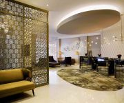
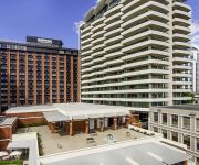
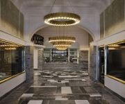
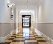
In need of a room? We compiled a list of available hotels close to the map centre further down the page.
Since you are here already, you might want to pay a visit to some of the following locations: Hamilton, Whangarei, Tauranga, Rotorua and Kaitaia. To further explore this place, just scroll down and browse the available info.
Local weather forecast
Todays Local Weather Conditions & Forecast: 18°C / 65 °F
| Morning Temperature | 12°C / 53 °F |
| Evening Temperature | 14°C / 58 °F |
| Night Temperature | 12°C / 54 °F |
| Chance of rainfall | 0% |
| Air Humidity | 50% |
| Air Pressure | 1022 hPa |
| Wind Speed | Gentle Breeze with 6 km/h (4 mph) from North-East |
| Cloud Conditions | Clear sky, covering 2% of sky |
| General Conditions | Sky is clear |
Thursday, 25th of April 2024
19°C (66 °F)
15°C (60 °F)
Overcast clouds, gentle breeze.
Friday, 26th of April 2024
15°C (59 °F)
14°C (58 °F)
Light rain, moderate breeze, overcast clouds.
Saturday, 27th of April 2024
16°C (61 °F)
13°C (56 °F)
Light rain, moderate breeze, broken clouds.
Hotels and Places to Stay
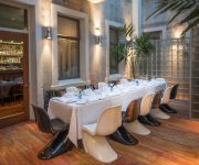
Hotel DeBrett
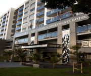
WALDORF STADIUM APARTMENT HOTEL
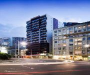
WALDORF CELESTION APARTMENT HTL
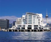
Hilton Auckland
Grand Mercure Auckland
Pullman Auckland
Auckland Harbour Oaks
Hotel Grand Windsor MGallery by Sofitel
QUEST ON QUEEN
QUEST PARNELL
Videos from this area
These are videos related to the place based on their proximity to this place.
Cafe Hanoi | Auckland
Cafe Hanoi's menu is inspired by the food stalls and hole-in-the-wall restaurants of Hanoi's Old Quarter. Dishes are characterized by a unique combination of ingredients and cooking techniques....
Auckland City View From The Harbour
Another wonderful view of Auckland City from CharterboatsNZs flagship classic cruiser MV Spartacus.
Auckland City Saturday Farmers’ Market at Britomart
Vegetables, food and other stuff from Farmers every Saturday on the Takutai Square.
Open Door: Volunteers - Part 2
More than one million New Zealanders are actively involved in volunteer work, both informally within their communities and formally through the almost 100,00...
Waldorf Stadium Apartment Hotel - Two Bedroom Junior Suite
Waldorf Apartments - Your place in the city.... Qualmark rated 4.5 star Apartments, Waldorf Stadium is the Waldorf Group's premiere apartment hotel in New Zealand. Situated in the heart of...
Waldorf Stadium Apartment Hotel - Two Bedroom Family Apartment
Waldorf Apartments - Your place in the city.... Qualmark rated 4.5 star Apartments, Waldorf Stadium is the Waldorf Group's premiere apartment hotel in New Zealand. Situated in the heart of...
Waldorf Stadium Apartment Hotel - Studio Apartment
Waldorf Apartments - Your place in the city.... Qualmark rated 4.5 star Apartments, Waldorf Stadium is the Waldorf Group's premiere apartment hotel in New Ze...
Britomart Street Ball
Britomart Streetball is 2 vs 2 football played in the Britomart carpark in Auckland City for kids aged 12-16. With a grandstand set up, Noah Hickey as MC, the REDBULL Hummer thumping out the...
Videos provided by Youtube are under the copyright of their owners.
Attractions and noteworthy things
Distances are based on the centre of the city/town and sightseeing location. This list contains brief abstracts about monuments, holiday activities, national parcs, museums, organisations and more from the area as well as interesting facts about the region itself. Where available, you'll find the corresponding homepage. Otherwise the related wikipedia article.
Britomart Transport Centre
Britomart Transport Centre is the CBD public transport hub of Auckland, New Zealand, and the northern terminus of the North Island Main Trunk line. It combines a bus interchange with a railway station in a former Edwardian post office, extended with expansive post-modernist architectural elements. It is located at the foot of Queen Street, the main commercial thoroughfare of Auckland CBD, with the main ferry terminal just across Quay Street.
Devonport Naval Base
Devonport Naval Base is the home of the Royal New Zealand Navy, located at Devonport, New Zealand on Auckland's North Shore. It is currently the only base of the navy that operates ships, and was a navy base from as far back as 1841. The base consists of HMNZS Philomel (the administration centre for the base), the Fleet Support Organisation, and the Fleet Personnel and Training Organisation.
Mechanics Bay
Mechanics Bay is the name of a former bay (now filled in) on the Waitemata Harbour in Auckland City, New Zealand. It is also the name used to describe the area of the former bay that is now mainly occupied by commercial and port facilities. Sometimes the bay formed between Tamaki Drive and the western reclamation edge of Fergusson container terminal is also referred to as Mechanics Bay.
Auckland Railway Station
Auckland Railway Station is the former main railway station of Auckland, New Zealand, and is located on the eastern edge of the Auckland CBD near Mechanics Bay. It was a city landmark from the time it was opened in 1930, and is a grand architectural statement in beaux-arts brick and mortar, having been called "one of the most self-consciously monumental public buildings erected in early twentieth-century New Zealand".
Vector Arena
Vector Arena is a 12,000-seat arena for sports and entertainment events in Auckland, New Zealand. Named for a sponsor, Vector Limited, the arena is located at Quay Park, Parnell, very close to the former Auckland Railway Station. Vector Arena cost around $80 million, and of this sum ratepayers contributed $68 million for the facility to be managed by QPAM, the NZ operator, in New Zealand first big public-private partnership. This runs for 40 years before ownership is transferred to the city.
Stanley Bay, New Zealand
Stanley Bay on the North Shore, New Zealand is a small suburb near Devonport. It is mostly residential; the surrounding towns and shops are only a walk away. The Devonport Naval Base lies to the east of the bay on the south side of the Stanley Bay peninsula and is connected to storage facilities on the north side at Ngataringa Bay by a tunnel. The population was 2,187 in the 2006 Census, an increase of 24 from 2001.
Vero Centre
The Vero Centre (constructed as the Royal & SunAlliance Centre) is a high rise office tower located in Auckland, New Zealand. Constructed in 2000, it was Auckland's first major tower built since the 1980s. The centre contains a health club and gymnasium, main entry public foyer, retail outlets in the 5 podium levels and 32 office levels. As of 2005, it is New Zealand’s tallest "and most technologically advanced" landmark office tower. It is also known for its 'halo' roof feature.
Princes Wharf
Princes Wharf is a former commercial wharf on the Auckland waterfront, in Auckland City, New Zealand, which has been redeveloped into a multi-story high-class mixed-use development and cruise ship terminal. While generally considered a success in redevelopment, as is the close-by Viaduct Basin, some critics have called its architecture 'urbanely sterile', while others have remarked on the restrictions private owners have placed on public access rights.
Commercial Bay
Commercial Bay was the bay on the southern side of the Waitemata Harbour, formerly defining the original extent of the Auckland waterfront, Auckland, New Zealand. It was framed by two substantial headlands, Smale's Point dividing it from Freemans Bay in the west and Point Britomart dividing it from Official Bay and Mechanics Bay in the east.
Ports of Auckland
Ports of Auckland Limited (POAL), the successor to the Auckland Harbour Board, is the Council-owned company administering Auckland's commercial freight and cruise ship harbour facilities. As the company operates all of the associated facilities in the Greater Auckland area (excluding the ferry terminals and local marinas for recreational yachting), this article is about both the current company and the ports of Auckland themselves.
Navy Hospital, Devonport
The Navy Hospital, historically the Royal New Zealand Navy Hospital (RNZNH) is the hospital of the New Zealand Navy. It is located in Devonport, on Devonport Naval Base in Auckland. The hospital specialises in surgery and hyperbaric treatment.
Downtown Shopping Centre
Downtown Shopping Centre, formerly Westfield Downtown, is a smaller shopping centre with 12,417 m² gross lettable area in the Auckland CBD, Auckland City, New Zealand. It is situated at 11–19 Customs Street West between Lower Albert Street and the Britomart Transport Centre. In late 2012, it was sold by Westfield to Precinct Properties Holdings New Zealand Limited formerly AMP NZ Office Limited (ANZO), and is currently being rebranded.
Old Government House, Auckland
Old Government House is the former residence of the Governor of New Zealand in Auckland, New Zealand. The present Government House in Auckland was previously a private residence. The building, the second Government House built in Auckland, was designed by William Mason, and was completed in 1856 as one of the measures taken by Auckland to retain its status as New Zealand's capital. However, the house was used only sporadically after the seat of government was moved to Wellington in 1865.
Auckland Marine Rescue Centre
The Auckland Marine Rescue Centre is the control centre for the Coastguard Northern Region and Surf Lifesaving Northern Region, New Zealand. It also houses other marine services such as the Harbourmaster and the Maritime Police. It is located in Mechanics Bay/Parnell, Auckland City, at the eastern end of the Ports of Auckland container terminal.
Auckland Ferry Terminal
The Auckland Ferry Terminal, sometimes called the Downtown Ferry Terminal, is the hub of the Auckland ferry network that connects Auckland City with North Shore City and some locations in Waitakere City and Manukau City. The ferry terminal is in the Auckland CBD on the Auckland waterfront. It is at the north end of Queen Street, opposite the Britomart Transport Centre, which is the hub for local buses and trains.
Dilworth Building
The Dilworth Building is a heritage mixed-use (residential apartments and shops on the ground floor) building at the corner of Customs Street and Queen Street in the Auckland CBD, New Zealand. The building by William Gummer & Reginald Ford was constructed between 1925 and 1927, and is listed as a "Historic Place - Category I" by the New Zealand Historic Places Trust.
Calliope Dock
The Calliope Dock is a historical stone drydock on the grounds of the Devonport Naval Base, in Devonport, Auckland, New Zealand. It was built in 1888 to service ships of the British Royal Navy, and is still in use today.
Auckland Council
The Auckland Council is the council for the Auckland Region in New Zealand. It began operating on 1 November 2010, combining the functions of the existing regional council and the region's seven previous city and district councils into one "super council" or "super city" governed by a mayor, 20 members of the governing body and 148 members of 21 local boards. It is the largest council in Australasia, with a $3 billion annual budget, $29 billion of assets, and approximately 8,000 staff.
Deloitte Centre
The Deloitte Centre is a high rise office tower located in Auckland, New Zealand. Built between 2006–2009, it contains 18 levels and office as well as 4 basement car parks and 3 levels of plant, and a special two storey high architectural feature on the top giving a total height of 100m. The building will have 5 stars in the 'Green Star' environmental rating.
Queens Wharf, Auckland
Queens Wharf is a concrete wharf in Auckland, New Zealand, that continues off Queen Street (the main street in central Auckland). It was previously owned and used by Ports of Auckland. In 2010 it was sold to the Auckland Regional Council and the New Zealand Government, and it was transformed to act as "Party Central" for the 2011 Rugby World Cup.
Grand Hotel (Auckland)
The Grand Hotel, at 9 Princes Street, was the leading hotel of Auckland, New Zealand, from 1889 until 1966. With its vaulted ceilings, ornate mantlepieces, red carpet and marble statuary, the Grand Hotel was a plush and social rendezvous from its opening.
Parnell Rose Gardens
The Dove Myer Robinson Park more commonly known as the Parnell Rose Gardens are rose gardens located in Parnell, New Zealand. Some of the plants in the area have been bred by internationally celebrated rose breeders and each year in November, the gardens are host to the Parnell Festival of Roses, which showcases New Zealand craft stalls, art exhibitions, music, strolling performers and thousands of roses. The park is named after the longest serving mayor of Auckland, who served for 18 years.
Old Synagogue (Auckland)
The Old Synagogue is a 19th century building at 19A Princes Street in central Auckland, New Zealand, that was formerly a synagogue. It is now called University House, and is part of the University of Auckland. A Jewish community had been present in Auckland since its founding in 1840. The synagogue building, which blends Moorish and classical elements, was designed and built by Edward Bartley in 1884–1885, and the synagogue opened on 9 November 1885.
Gus Fisher Gallery
The Gus Fisher Gallery is part of The University of Auckland’s National Institute of Creative Arts and Industries (NICAI), and is located in The Kenneth Myers Centre, an historic building restored in 2000 with the help of the gallery's patron, Gus Fisher (1920–2010).
Imperial Hotel, Auckland
The Imperial Hotel at the corner of Fort and Queen Street in Auckland, New Zealand; Now a part of the National Historic Places Trust, It is still operational, but now offers accommodation to backpackers. The building has served as a social centre for the city for more than 125 years, and remains a place where drinking and social interaction occur.


