Safety Score: 3,0 of 5.0 based on data from 9 authorites. Meaning we advice caution when travelling to New Zealand.
Travel warnings are updated daily. Source: Travel Warning New Zealand. Last Update: 2024-04-24 08:14:40
Delve into Arch Hill
The district Arch Hill of Auckland in Auckland (Auckland) is a subburb in New Zealand about 306 mi north of Wellington, the country's capital town.
If you need a hotel, we compiled a list of available hotels close to the map centre further down the page.
While being here, you might want to pay a visit to some of the following locations: Hamilton, Whangarei, Tauranga, Rotorua and Kaitaia. To further explore this place, just scroll down and browse the available info.
Local weather forecast
Todays Local Weather Conditions & Forecast: 18°C / 65 °F
| Morning Temperature | 12°C / 53 °F |
| Evening Temperature | 14°C / 58 °F |
| Night Temperature | 12°C / 54 °F |
| Chance of rainfall | 0% |
| Air Humidity | 50% |
| Air Pressure | 1022 hPa |
| Wind Speed | Gentle Breeze with 6 km/h (4 mph) from North-East |
| Cloud Conditions | Clear sky, covering 2% of sky |
| General Conditions | Sky is clear |
Thursday, 25th of April 2024
19°C (66 °F)
15°C (60 °F)
Overcast clouds, gentle breeze.
Friday, 26th of April 2024
15°C (59 °F)
14°C (58 °F)
Light rain, moderate breeze, overcast clouds.
Saturday, 27th of April 2024
16°C (61 °F)
13°C (56 °F)
Light rain, moderate breeze, broken clouds.
Hotels and Places to Stay
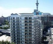
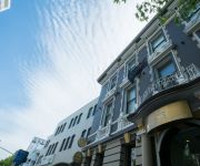
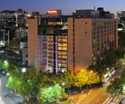
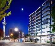
YHA Auckland City - Hostel / Backpacker
VR Queen Street - Hotel & Suites
Swiss-Belsuites Victoria Park
City Lodge Accommodation - Hostel
Waldorf St Martins Apartments Hotel
HOTEL BIANCO OFF QUEEN
Auckland City Hotel Hobson St
GRAND MILLENNIUM AUCKLAND
RENDEZVOUS HOTEL AUCKLAND
VR AUCKLAND CITY
Videos from this area
These are videos related to the place based on their proximity to this place.
Bianca Del Rio performs at Encore, Auckland New Zealand
Bianca Del Rio performing the final show in Auckland of her standup comedy Australia & New Zealand Tour.
Auckland New Zealand - Discover it now
Auckland New Zealand. Discover the diverse cosmopolitan city and its endless luxury holiday accommodation solutions. For more info visit: https://www.luxuryholidayhouses.com/
Auckland Restaurants & Food - www.TravelGuide.TV
http://travelguide.tv/auckland/restaurants.html Auckland Restaurants and Food - Find the best restaurants to eat at in Auckland New Zealand with this travel and tourism video from www.TravelGuid...
2nd Alarm Building Fire on McKelvie St, Ponsonby, 13 Dec 08
Second alarm fire at a commercial building in the central Auckland suburb of Ponsonby. Thats Parnell's new Mercedes Econic keeping an eye on things from above. Pretty impressive reach on that...
Pump 207 + Aerial 205 New Zealand Fire Service Auckland City Fire Station
The Scania Pump 207 and the Mack aerial 205 of the New Zealand Fire Service turning out of Auckland's Central fire station to different calls on different days. One call was at 1.45 PM and...
Fire Control Unit Responding, Auckland City, 12 Apr 2010
Auckland 2014 responding from the city central station. This will probably be my final video of this truck, as it is due to be replaced with a much larger 2010 DAF. New Zealand Fire Service...
New Auckland 207! Turnout from City Station, 6 Dec 2010
Auckland City took delivery of this 2010 Scania P310 a few weeks ago. The new red/yellow/blue NZFS livery is controversial, but the recent addition of the extra light and reflective stripe...
Pirate City Rollers
An example of the interaction between a quite good jammer and some good blocking work. The example is marred by the fact that the jam lasted for almost three minutes...
Auckland City Fire Station Turnout, Greys Ave, 17 Nov 09
Central Fire Station turnout from a different angle... Auckland City 207: 2004 Scania P94DB Pump Rescue / Tender http://www.111emergency.co.nz/A-C/CSG449.htm Auckland City 205: 1981...
Highway Patrol Struggling To Reach Crash Scene, Newton On-Ramp, 20 Apr 2010
New Zealand Police - Highway Patrol 2009 Holden Commodore SV6 Newton Road On-Ramp SH16 / North-Western Motorway Auckland New Zealand Disclaimer: This YouTube channel is in no way...
Videos provided by Youtube are under the copyright of their owners.
Attractions and noteworthy things
Distances are based on the centre of the city/town and sightseeing location. This list contains brief abstracts about monuments, holiday activities, national parcs, museums, organisations and more from the area as well as interesting facts about the region itself. Where available, you'll find the corresponding homepage. Otherwise the related wikipedia article.
Freemans Bay
Freemans Bay is the name of a former bay and now inner city suburb of Auckland, in the North Island of New Zealand. The historical bay was filled in to a large extent, and lost its shoreline to reclamation works. Historically a poor and often disreputable quarter, it is now a wealthy neighbourhood known for its mix of heritage homes and more recent single-dwelling houses, as well as for its two large parks.
Karangahape Road
Karangahape Road (commonly known as K' Road) is one of the main streets in the central business district (CBD) of Auckland, New Zealand. The massive expansion of motorways through the nearby inner city area - and subsequent flight of residents and retail into the suburbs - turned it from one of Auckland's premier shopping streets into a run-down red light district from the 1960s onwards.
Mount Eden Railway Station
Mt Eden Railway Station is a Western Line station of the local railway network in the Mount Eden suburb of Auckland, New Zealand. It has an island platform, and is reached via a footbridge from Mt Eden Rd or from the level crossing between Ngahura Street and Fenton Street.
Eden Terrace
Eden Terrace is an inner city suburb of Auckland, located 2 km south of the Auckland CBD, in the North Island of New Zealand. Eden Terrace is under the local governance of the Auckland Council. According to the 2006 census, Eden Terrace has a population of 1,965.
Newton, New Zealand
Newton is a small suburb of Auckland City, New Zealand, under the local governance of the Auckland Council. It had a population of 837 in the 2001 census. Since the construction of the Central Motorway Junction in 1965–75, Newton has been divided into two parts, and as a result, lost much of its size and coherence. The northern part is centred on Karangahape Road, and the southern part on Newton Road. Both Karangahape and Newton Roads intersect with Symonds Street to the east.
Arch Hill, New Zealand
Arch Hill is a small suburb of Auckland, New Zealand. Arch Hill is under the local governance of the Auckland Council. The area is called Arch Hill due to its "natural features".
Grafton, New Zealand
Grafton is a suburb of Auckland City, New Zealand. The suburb is named for the Duke of Grafton, a patron of the first Governor of New Zealand, William Hobson, and was once known as 'Grafton Heights', denoting its history as a well-off suburb in Auckland's earliest decades. According to the 2001 census, Grafton has a population of 2,052. The suburb is characterised by its many historic buildings, many of them essentially unchanged from the early decades of the 20th century.
Central Motorway Junction
The Central Motorway Junction or CMJ (best known as Spaghetti Junction and rarely as Central Motorway Intersection), is the intersection of New Zealand State Highways 1 and 16, just south of the central business district of Auckland, New Zealand. A multilevel structure (three traffic levels crossing above each other in several locations), it has been described as a "fiendishly complicated, multi-layered puzzle of concrete, steel and asphalt".
Myers Park, Auckland
Myers Park is a narrow park in central Auckland, New Zealand, running parallel to the upper part of Queen Street. It is characterised by steep, grassed slopes and canopied with a mixture of large exotic and native trees, including an alley of large palm trees. Benches and artwork (including a heritage marble copy of Michelangelo's sitting Moses statue) line the paths connecting to Queen Street, K Road, Grey's Avenue and Aotea Square.
Auckland Girls' Grammar School
Auckland Girls' Grammar School (AGGS) is a New Zealand secondary school for girls located in Newton, in the Auckland central business district. Established in 1888, it is one of the oldest secondary institutions in the country. The school received the Goodman Fielder awards for School and Secondary School of the year in 2000. The main block is listed as a Category II Historic Place.
Waihorotiu Stream
The Waihorutiu Stream (or sometimes Wai Horotiu Stream), also called the 'Queen Street River', is a former stream in the downtown region of Auckland City, New Zealand, which has long since been covered over and made to disappear by the increasing urbanisation of the area.
St Matthew's, Auckland
St Matthew's, or St Matthew-in-the-City, is an historic Anglican church located in the Central Business District of Auckland, renowned for its neo-Gothic style since its completion in 1905.
Western Park, Auckland
Western Park is a midsized public park located in the suburb of Freemans Bay, west of the CBD of Auckland, New Zealand. It is situated in two merging gullies which run downhill to the sea (now several kilometres away due to land reclamation) from what was once called Te Rimu Tahi ridge (the 'lone Rimu tree ridge' in Maori). Originally, the Tuna Mau stream used to run through the park's area.
Victoria Park Market
Victoria Park Market is a craft, souvenir and clothing market and retail complex in Auckland, New Zealand. It is housed in a former waste depot and incinerator complex. The Market is located in Freemans Bay and takes its name from nearby Victoria Park.
Langham Hotel, Auckland
The Langham Hotel is a five-star hotel in Auckland, New Zealand. Formerly named the Sheraton Auckland Hotel & Towers, it occupies the historic site of Partington's Windmill, a local landmark until its demolition in 1950.
Auckland Town Hall
The Auckland Town Hall is a historic building on Queen Street in downtown Auckland, New Zealand, known both for its original and ongoing use for administrative functions (such as Council meetings and hearings), as well as for its famed Great Hall and its separate Concert Chamber. The Town Hall and its surrounding context is highly protected as a 'Category A' heritage place in the city's district plan.
Pigeon Post House
The Pigeon Post House is located at 112 Newton Road, Newton, Auckland, New Zealand, on the corner of Newton Road and Upper Queen Street. From 1897 into the early 20th century the building was used as a pigeon-carrier postal service between Great Barrier Island and Auckland. It was New Zealand's first regular air-mail postal service. Today the building houses offices.
The Edge Performing Arts & Convention Centre
The Edge is New Zealand's largest performing arts and convention centre complex / organisation.
Aotea Centre
The Aotea Centre is a performing arts and events centre / theatre in the Auckland CBD, Auckland City, New Zealand. Located at the western edge of Aotea Square, off Queen Street, the centre provides cultural venue space in the heart of the city and is managed by 'The Edge' (which also operates the Auckland Town Hall and the Auckland Civic Theatre, both close by around the square).
Mercury Theatre, Auckland
The Mercury Theatre is a theatre in Auckland, New Zealand, located on Mercury Lane, off Karangahape Road. It was built in 1910 by the architect Edward Bartley and is the oldest surviving theatre in Auckland. Built in the English Baroque style, it was initially known as the Kings Theatre. On being converted into a cinema in 1926, a new entrance was built on Karangahape Road – this is now the Norman Ng Building. From 1968 to 1991 it was the premises of the Mercury Theatre Company.
1993 Auckland mid-air collision
The 1993 Auckland mid-air collision was an aircraft accident in New Zealand. It occurred on 26 November 1993, when two aircraft operated by Airwork, under contract to the New Zealand Police, collided and crashed in central Auckland. The mid-air collision of the Aérospatiale TwinStar helicopter and Piper Archer airplane resulted in the deaths of all four occupants – a civilian Airwork pilot on each aircraft and two New Zealand Police officers on the helicopter.
Ironbank (Auckland)
Ironbank is a 4,500-m, six-level mixed-used (retail and office) development on Karangahape Road, Auckland City, New Zealand. The building also provides a mechanical, automated car stacker for 96 cars, which the robotic system racks in a four-level storage wall. It also used a variety of environmentally friendly building facilities, such as reduced energy demands due to a design that can dispense with air conditioning.
Soho Square Ponsonby
Soho Square Ponsonby was a failed development in the suburb of Grey Lynn in Auckland, New Zealand. The $250 million project was announced in 2006 and was meant to be a major attraction in the area with apartments, office space and retail areas. Construction started on the site of an old yeast manufacturing plant, but progress was slow and the developers had gone into receivership by the end of 2009.
Auckland Baptist Tabernacle
The Auckland Baptist Tabernacle is a heritage-listed church located near the corner of Queen Street and Karangahape Road, at the edge of Auckland central business district in New Zealand.
Symonds Street Cemetery
Symonds Street Cemetery is a historic cemetery and park in central Auckland, New Zealand. It is in 5.8 hectares of deciduous forest on the western slope of Grafton Gully, by the corner of Symonds Street and Karangahape Road, and is crossed by the Grafton Bridge. The cemetery and the street are named for William Cornwallis Symonds, a British Army officer prominent in the early colonisation of New Zealand. It has a Historic Place - Category I listing with the New Zealand Historic Places Trust.


