Safety Score: 3,3 of 5.0 based on data from 9 authorites. Meaning please reconsider your need to travel to Netherlands.
Travel warnings are updated daily. Source: Travel Warning Netherlands. Last Update: 2024-04-23 08:18:23
Explore Schenkel
The district Schenkel of Capelle aan den IJssel in Gemeente Capelle aan den IJssel (South Holland) is located in Netherlands about 33 mi south-west of Amsterdam, the country's capital.
If you need a place to sleep, we compiled a list of available hotels close to the map centre further down the page.
Depending on your travel schedule, you might want to pay a visit to some of the following locations: The Hague, Haarlem, Amsterdam, Utrecht and Heemskerk. To further explore this place, just scroll down and browse the available info.
Local weather forecast
Todays Local Weather Conditions & Forecast: 10°C / 51 °F
| Morning Temperature | 1°C / 34 °F |
| Evening Temperature | 9°C / 48 °F |
| Night Temperature | 6°C / 43 °F |
| Chance of rainfall | 0% |
| Air Humidity | 44% |
| Air Pressure | 1020 hPa |
| Wind Speed | Moderate breeze with 9 km/h (6 mph) from East |
| Cloud Conditions | Broken clouds, covering 56% of sky |
| General Conditions | Light rain |
Wednesday, 24th of April 2024
10°C (49 °F)
6°C (44 °F)
Light rain, fresh breeze, overcast clouds.
Thursday, 25th of April 2024
10°C (49 °F)
8°C (46 °F)
Light rain, moderate breeze, overcast clouds.
Friday, 26th of April 2024
8°C (46 °F)
8°C (46 °F)
Moderate rain, light breeze, overcast clouds.
Hotels and Places to Stay
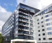
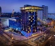
Mainport Hotel
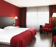
NH Capelle
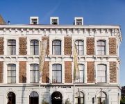
Suitehotel Pincoffs
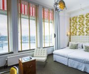
Hotel New York
Inntel Hotels Rotterdam Centre
nhow Rotterdam
The Art Hotel
citizenM Rotterdam
Hampshire Hotel Savoy Rotterdam
Maria Callas Yachthotel
Videos from this area
These are videos related to the place based on their proximity to this place.
Hoogwater Krimpen aan den IJssel sluiting Hollandse IJsselkering
http://112krimpen.nl/nieuws.php?nieuws_id=1289 Hoogwater Krimpen aan den IJssel sluiting Hollandse IJsselkering.
Politie onruimt gekraakte scheepswerf in Krimpen aan den IJssel
Met zeven wagens, een ME bus en een boot en met meer dan 30 agenten werden vandaag tussen 15:00 en 17:00 de loodsen en gebouwen van de voormalige scheepswerf Van Duyvendijk in ...
Otto beklimt de Algerabrug, Krimpen aan den IJssel
Walker Otto beklimt voor de 2e dag de Algerabrug, deze keer de toren aan de Krimpense kant. Het filmpje is nu dan ook gemaakt met een andere camera en van dichterbij omdat ik op m'n vrije dag...
Lifeliner 2 PH-ULP in de sneeuw Lupinestraat Capelle aan den IJssel
Lifeliner 2 PH-ULP Lupinestraat Capelle aan den IJssel.
24 Uur Spoed Slotenmaker Capelle aan den IJssel | Video huren? Email support@vindslotenmakers.nl
24 Uur Spoed Slotenmaker Capelle aan den IJssel | Deze video huren? Email naar support@vindslotenmakers.nl Uw bedrijfsinformatie wordt verwerkt in de titel, de beschrijving en in de ...
Traumaheli LifeLiner 2 PH - KHE Capelle aan den IJssel
Traumaheli LifeLiner 2 PH - KHE Capelle aan den IJssel HV.
Gereformeerde Kerk Vrijgemaakt Capelle aan den IJssel-ZuidWest (deel 2)
Gereformeerde Kerk Vrijgemaakt Capelle aan den IJssel-ZuidWest (deel 2)
Gereformeerde Kerk (Vrijgemaakt) Capelle aan den IJssel-ZuidWest (deel 1)
Gereformeerde Kerk (Vrijgemaakt) Capelle aan den IJssel-ZuidWest (deel 1)
20140112 Capelle aan den IJssel
Met Dave Kersten en Patjoelah Kuin naar Capelle aan den IJssel. Ondanks de 'strenge' winter toch even met de motor erop uit!
Videos provided by Youtube are under the copyright of their owners.
Attractions and noteworthy things
Distances are based on the centre of the city/town and sightseeing location. This list contains brief abstracts about monuments, holiday activities, national parcs, museums, organisations and more from the area as well as interesting facts about the region itself. Where available, you'll find the corresponding homepage. Otherwise the related wikipedia article.
Prins Alexander
Prins Alexander is a borough in the northeast of Rotterdam, Netherlands. Prins Alexander has 7 neighbourhoods: Het Lage Land Kralingseveer Nesselande Ommoord Oosterflank Prinsenland Zevenkamp
Ommoord
Ommoord is a neighbourhood in the borough Prins Alexander, part of the municipality of Rotterdam, South Holland, the Netherlands. Ommoord is surrounded by the neighbourhoods Zevenkamp, Het Lage Land and Terbregge. It has around 25.000 inhabitants across 12.500 households. The river Rotte flows through the north of Ommoord.
Zevenkamp
Zevenkamp is a neighborhood of Rotterdam, The Netherlands.
Van Brienenoordbrug
The Van Brienenoord Bridge is an arch bridge for car traffic over the river Nieuwe Maas, which is a major distributary of the river Rhine. The bridge is located at the east side of Rotterdam, Netherlands. The bridge exists of two almost identical arches laying parallel and next to each other, followed by three bascule bridges. With over 250,000 vehicles every day the Van Brienenoord Bridge, which is part of the A16 highway is the most busy road in the Netherlands.
IJsselmonde (village)
IJsselmonde is a former village in the Dutch province of South Holland. It was located to the east of the city of Rotterdam. The village ("IJssel mouth") derives its name from the river Hollandsche IJssel, which flows into the Nieuwe Maas opposite from the village. The village gives its name to the large island it's on, IJsselmonde. IJsselmonde was a separate municipality until 1941, when it merged with Rotterdam.
Stormpolder
Stormpolder is a polder and a hamlet in the Dutch province of South Holland. It is located about 7 km east of the center of Rotterdam, in the municipality of Krimpen aan den IJssel. It lies between the Nieuwe Maas and Hollandsche IJssel rivers. Stormpolder was a separate municipality between 1817 and 1855, when it became part of Krimpen aan den IJssel.
Romeynshof (Rotterdam Metro)
Romeynshof is a subway station on line A of the Rotterdam Metro system, and is situated in Rotterdam-Ommoord. It is located between Graskruid station, where lines A and B split, and Binnenhof station, the northern terminus of line A. Trains coming from Binnenhof will depart for Schiedam Centrum for most of the day. After 5 pm their destination will be Kralingse Zoom and at night Alexander.
Graskruid (Rotterdam Metro)
Graskruid is a subway station on lines A and B of the Rotterdam Metro and is situated in the northeastern part of Rotterdam. At Graskruid station, the track splits into the two station short Line A branch and the longer Line B branch. The station consists of an island platform between two running tracks. This station was opened on May 28, 1983 when the East-West Line (also formerly called Caland line) was extended from its previous terminus Capelsebrug.
Oosterflank (Rotterdam Metro)
Oosterflank is a subway station on Rotterdam Metro lines A and B, and is situated in the northeastern part of Rotterdam, in the borough Prins Alexander. The station is named after the neighbourhood Oosterflank, situated just east of the subway station. This station was opened on May 28, 1983 when the East-West Line (also formerly the Caland line) was extended from its previous terminus Capelsebrug. Note that this section uses overhead wires to provide traction power.
Capelsebrug (Rotterdam Metro)
Capelsebrug is a subway station on lines A, B, and C of the Rotterdam Metro. The station is situated in the eastern part of Rotterdam in the Netherlands, at the border with the municipality Capelle aan den IJssel. At Capelsebrug station, lines A and B turn north towards Schenkel station, while line C continues east towards Slotlaan station.. The westbound trains stop at either side of an island platform between two running tracks, while all eastbound trains share one platform.
De Terp (Rotterdam Metro)
De Terp is a subway station on Line C of the Rotterdam Metro and is situated in the town of Capelle aan den IJssel, just east of Rotterdam. It is the northern terminus of the line. The station was opened on May 26, 1994, as part of the extension of the East-West Line or Caland Line from Capelsebrug station. The station consists of an island platform between two tracks.
De Tochten (Rotterdam Metro)
De Tochten is a subway station on Line B of the Rotterdam Metro and is situated in Rotterdam-Zevenkamp. It is penultimate station of the line. The station was opened on April 19, 1984. It has served as terminus for a long time, until the opening of the one-station extension towards the new Nesselande station on August 29, 2005.
Kralingse Zoom
Kralingse Zoom is a subway station on lines A, B, and C of the Rotterdam Metro, in the Kralingen neighbourhood of eastern Rotterdam. The station is located just west of the A16 motorway on the east side of Kralingse Zoom, the road it is named after. At Kralingse Zoom station, transfer is available to several bus lines, as well as to the ParkShuttle, a people mover to a nearby business district.
Capelle Centrum (Rotterdam Metro)
Capelle Centrum is a subway station on Line C of the Rotterdam Metro and is situated in the town of Capelle aan den IJssel, just east of Rotterdam. It is the penultimate station of the line. The station was opened on May 26, 1994, as part of the extension of the East-West Line or Caland Line from Capelsebrug station towards De Terp station. The station consists of two tracks with a platform on both sides.
Slotlaan (Rotterdam Metro)
Slotlaan is a subway station on Line C of the Rotterdam Metro and is situated in the town of Capelle aan den IJssel, just east of Rotterdam. The station was opened on May 26, 1994, as part of the extension of the East-West Line or Caland Line from Capelsebrug station towards De Terp station. The station consists of two tracks with a platform on both sides.
Prinsenlaan (Rotterdam Metro)
Prinsenlaan is a subway station on Rotterdam Metro lines A and B, and is situated in the northeastern part of Rotterdam, in the borough Prins Alexander. The station is located between the neighbourhoods Het Lage Land and Oosterflank. This station was opened on May 28, 1983 when the East-West Line (also formerly the Caland line) was extended from its previous terminus Capelsebrug. Note that this section uses overhead wires to provide traction power.
Schenkel (Rotterdam Metro)
Schenkel is a subway station on Rotterdam Metro lines A and B, and is situated in the northeastern part of Rotterdam, in the borough Prins Alexander. The station is named after a neighbourhood in nearby Capelle aan den IJssel, situated to the southeast of the subway station. This station was opened on May 28, 1983 when the East-West Line (also formerly the Caland line) was extended from its previous terminus Capelsebrug. Note that this section uses overhead wires to provide traction power.
Hesseplaats (Rotterdam Metro)
Hesseplaats is a station on Line B of the Rotterdam Metro and is situated in the Ommoord district of Rotterdam.
Nieuw Verlaat (Rotterdam Metro)
Nieuw Verlaat is a station on Line B of the Rotterdam Metro and is situated in the Zevenkamp neighbourhood of Rotterdam.
Ambachtsland (Rotterdam Metro)
Ambachtsland is a station on Line B of the Rotterdam Metro and is situated in the Zevenkamp neighbourhood of Rotterdam.
Beverwaard
Beverwaard is a neighborhood of Rotterdam, Netherlands.
Kralingseveer
Kralingseveer is a neighborhood of Rotterdam, Netherlands.
Oosterflank
Oosterflank is a neighborhood of Rotterdam, Netherlands.
Oud-IJsselmonde
Oud-IJsselmonde is a neighborhood of Rotterdam, Netherlands.
Sagenbuurt
Sagenbuurt is a neighborhood of Rotterdam, Netherlands.


