Safety Score: 3,3 of 5.0 based on data from 9 authorites. Meaning please reconsider your need to travel to Netherlands.
Travel warnings are updated daily. Source: Travel Warning Netherlands. Last Update: 2024-04-18 08:12:24
Discover Tuindorp
The district Tuindorp of Utrecht in Gemeente Utrecht (Provincie Utrecht) is a subburb in Netherlands about 21 mi south-east of Amsterdam, the country's capital city.
If you need a hotel, we compiled a list of available hotels close to the map centre further down the page.
While being here, you might want to pay a visit to some of the following locations: Amsterdam, 's-Hertogenbosch, Lelystad, Haarlem and Heemskerk. To further explore this place, just scroll down and browse the available info.
Local weather forecast
Todays Local Weather Conditions & Forecast: 11°C / 52 °F
| Morning Temperature | 3°C / 37 °F |
| Evening Temperature | 10°C / 50 °F |
| Night Temperature | 7°C / 44 °F |
| Chance of rainfall | 2% |
| Air Humidity | 56% |
| Air Pressure | 1019 hPa |
| Wind Speed | Gentle Breeze with 9 km/h (5 mph) from South-East |
| Cloud Conditions | Broken clouds, covering 72% of sky |
| General Conditions | Moderate rain |
Friday, 19th of April 2024
8°C (46 °F)
6°C (44 °F)
Moderate rain, moderate breeze, overcast clouds.
Saturday, 20th of April 2024
9°C (48 °F)
5°C (40 °F)
Light rain, moderate breeze, broken clouds.
Sunday, 21st of April 2024
9°C (48 °F)
5°C (40 °F)
Light rain, moderate breeze, broken clouds.
Hotels and Places to Stay
Grand Hotel Karel V
Court Hotel
UtrechtCityApartments Plompetorengracht
Eye Hotel
Van der Valk Hotel Utrecht
Malie Hotel Utrecht
Mother Goose Hotel
NH Utrecht
Park Plaza Utrecht
Mitland
Videos from this area
These are videos related to the place based on their proximity to this place.
Trajectvideo Utrecht - Maliebaan Spoorwegmuseum [2011]
Trajectvideo vanuit de pendeltrein tussen station Utrecht Centraal en het spoorwegmuseum in Utrecht aan station Utrecht Maliebaan. Deze elk uur rijdende pendeltrein is de enige trein die regulier...
Science park marathon Utrecht 2015
Een beeldverslag bij Wendy's hele bijzondere 2e marathon door Utrecht, met loopmaatjes Ritchie, Marek en John.
Sunday Funday In Downtown Utrecht (2.23.14 - Day 1333)
Today I did some sightseeing in downtown Utrecht. There, I got recognized a couple of times, too! In the afternoon I met up with Assgier and another buddy of ours to have a sub and a brewsky....
kermis Griftpark Utrecht zondag 5 april 2015
Sfeerbeelden van de kermis op het Griftpark in Utrecht op zondag 5 april 2015.
Luckiest Man Alive met het Zuilens Fanfare Corps: Op Zuilen b.voc. Marloes Klaasen
Luckiest Man Alive brengt zijn werk "Op Zuilen" ten gehore met het koninklijk Zuilens Fanfare Corps o.l.v. Erik Rozendom. Met Marloes Klaasen b.vocal. ZIMIHC theater, Zuilen, zondagmiddag...
Bicycle Trip: Utrecht - Groenekan - Maartensdijk - Holl. Rading - Lage Vuursche - Baarn [UGMHRLVB]
Bicycle Trip: Utrecht - Groenekan - Maartensdijk - Hollandsche Rading - Lage Vuursche - Baarn [UGMHRLVB] This is the trip of Saturday June 22th 2013. The route on Google Maps is here: Google...
Bicycle Trip: Weerdsingel Oostzijde in Utrecht to Darwindreef in Utrecht [UGMHRLVB part 1]
Bicycle Trip: Weerdsingel Oostzijde in Utrecht to Darwindreef in Utrecht [UGMHRLVB part 1] This is part 1 (of 4) of the bicycle trip called "Utrecht - Groenekan - Maartensdijk - Hollandsche...
Utrecht Netherlands, City, Life and University
This Video was created during a vistit at our friends from the EGEA (European Geography Association) Utrecht. Thanks a lot for welcoming us and showing your nice city!
Valley of Dance trip (Bosma).kermis Griftpark Utrecht 2012
de trip Valley of Dance (Bosma) gefilmd vrijdag 15 juni 2012 op de kermis Griftpark in Utrecht.
Videos provided by Youtube are under the copyright of their owners.
Attractions and noteworthy things
Distances are based on the centre of the city/town and sightseeing location. This list contains brief abstracts about monuments, holiday activities, national parcs, museums, organisations and more from the area as well as interesting facts about the region itself. Where available, you'll find the corresponding homepage. Otherwise the related wikipedia article.
Dom Tower of Utrecht
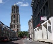
The Dom Tower of Utrecht is the tallest church tower in the Netherlands, at 112.5 metres (368 feet) in height, and the Gothic-style tower is the symbol of the city. The tower was part of the Cathedral of Saint Martin, Utrecht, also known as Dom Church, and was built between 1321 and 1382, to a design by John of Hainaut. The cathedral was never fully completed due to lack of money. Since the unfinished nave collapsed in 1674 the Dom tower became a free standing tower.
St. Martin's Cathedral, Utrecht
St. Martin's Cathedral, Utrecht, or Dom Church was the cathedral of the diocese of Utrecht during the Middle Ages. Once the Netherlands’ largest church, dedicated to Saint Martin of Tours, it is one of the country's two pre-Reformation cathedrals, along with the cathedral in Middleburg, Province of Zeeland. It has been a Protestant church since 1580. The building is the one church in the Netherlands that closely resembles the classic Gothic style as developed in France.
University of Humanistic Studies
The University of Humanistic Studies is a university in Utrecht, the Netherlands. It is the youngest university in the Netherlands and houses about 400 students. It is also the only university offering a degree programme in humanistic studies. The UvH was founded in 1989.
Roman Catholic Archdiocese of Utrecht
The Archdiocese of Utrecht is an archdiocese of the Catholic Church in the Netherlands. The archdiocese is the metropolitan for 6 suffragans, the dioceses of Breda, Groningen-Leeuwarden, Haarlem-Amsterdam, Roermond, Rotterdam, and 's-Hertogenbosch.
Vredenburg (castle)
Vredenburg or Vredeborch was a 16th-century castle built by Habsburg emperor Charles V in the city of Utrecht in the Netherlands. Some remains of the castle, which stood for only 50 years, are still visible on what is now Vredenburg square in Utrecht.
Sonnenborgh Observatory
Sonnenborgh - museum & observatory in Utrecht is a public astronomical observatory and museum open to the public. It is located in Utrecht, Netherlands. The university observatory was founded in 1853 and from 1854 until 1897 it was the first home of the Royal Dutch Meteorological Institute.
Railway Museum (Netherlands)
The Railway Museum in Utrecht is the Dutch national railway museum. It was established in 1927 and since 1954 has been housed in the "Maliebaan station", a former railway station.
Museum Speelklok
Museum Speelklok (previously known as Museum van Speelklok tot Pierement) is a museum in Utrecht, The Netherlands. It has a collection of automatically playing musical instruments, most of which still work and therefore still can play their music. Among the instruments on display are music boxes, musical clocks, pianolas, barrel organs (including the typically Dutch large street organs) and a turret clock with carillon. The word speelklok means musical clock.
St Catherine's Cathedral, Utrecht
St. Catherine's Cathedral, Utrecht, is a Roman Catholic church dedicated to Saint Catherine of Alexandria situated in Utrecht in the Netherlands. It was built as part of the Carmelite friary founded in 1456. After 1529, work on the building was continued by the Knights Hospitallers. The large church was completed only in the middle of the 16th century. From 1580 to 1815 it was the home of a Protestant community.
St. Eloy's Hospice
St. Eloy's Hospice is a guildhall in Utrecht in the Netherlands. Between the Dom tower and the Mariaplaats in Utrecht in The Netherlands there is a unique house that bears the name: St. Eloyen Gasthuis (St. Eloy's Hospice). The house has been occupied by the Smedengilde since 1440. According to documents preserved the guild has existed since 1304, but older. The house can be visited free of charge on the second Saturday of September. The fraternity is private nowadays.
Abstede
Abstede is a neighbourhood of the Dutch city of Utrecht. According to the 19th century historian A.J. van der Aa, Abstede (formerly also called Abtstede or Abstade) derives its name from an abbey of Cistercian nuns. The abbey was closed in 1227, when the nuns were moved against their will by Wilbrand van Oldenburg, bishop of Utrecht, to the St. Servaas Monastery, in the city, that he himself founded. Until the end of the eighteenth century, Abstede was a separate jurisdiction, like a village.
Catharijne
Catharijne is a former municipality on the west side of the Dutch city of Utrecht. It was a separate municipality between 1818 and 1823, when it merged with the city of Utrecht. It was named for the St. Catharina monastery in Utrecht, which was demolished in 1528 to make way for the castle Vredenburg. One of the city gates was named after this monastery; the municipality of Catharijne was on the outside of this gate.
Lauwerecht
Lauwerecht is a former municipality in the Dutch province of Utrecht. It was located northwest of the city of Utrecht and existed from 1818 to 1823. It is now part of Utrecht.
Oudegracht
The Oudegracht, or "old canal", runs through the center of Utrecht, the Netherlands. It starts in the southeast of the city. Here the Kromme Rijn (the original main bed of the Rhine river) and the Vaartse Rijn (a medieval canal reconnecting Utrecht to the newer main stream of the Rhine, the Lek) arrive to meet the original moat of the fortified town, and the Oudegracht goes from there into the center of town.
Christelijk Gymnasium Utrecht
The Christelijk Gymnasium Utrecht is a Dutch grammar school in Utrecht, in the Netherlands. It was founded in 1897. The Koni or West is building of the school, located on the Koningsbergerstraat in Lombok, which explains its nickname Koni. The school is located in the building of a former secondary school, the De Bruijne Lyceum. The Diac or Oost is the former building. It is located in the city centre, on the Oudegracht and near the Ledig Erf and the Twijnstraat.
Centraal Museum
The Centraal Museum is a museum in Utrecht, The Netherlands. The museum was founded in 1838. Initially, the collection - exhibited on the top floor of the Utrecht townhall - was limited to art related to the city of Utrecht. In 1921 the collection merged with various private collections in the new 'centralised museum' (hence the name 'Centraal museum', centraal being the Dutch word for central) located in the former medieval monastery at the Nicolaaskerkhof.
Pieterskerk, Utrecht
The Pieterskerk is one of the oldest Roman Catholic churches in the Dutch city of Utrecht, dedicated to Peter the Apostle. Its construction began in 1039 and it was inaugurated on 1 May 1048 by Bernold, Bishop of Utrecht (although the lost west towers were probably only finished about a century after the inauguration). The church was the eastern end of Utrecht's "Kerkenkruis", of which the Domkerk was the centre.
Museum Catharijneconvent
The Museum Catharijneconvent is a national museum of religious art in Utrecht. It is located in the former Catharijneconvent, having been sited there since 1979. Its collections include those of the museum of religious art of the Catholic Archbishopric of Utrecht, located in the convent until 1979. In 2006 the Convent closed for restoration. It is part of the Utrecht Museum Night.
St. Salvator's Church
The Sint-Salvator church (also called the Old-Munster church) was one of the five collegiate chapters in the Dutch city of Utrecht. The others were the Dom Church, the St. Peter's Church, the St. John's church and the St. Mary's church. The St. Salvator church was situated on the present-day Dom square right next to the Dom Church. The St. Salvator church was demolished following the Protestant Reformation, as a result of the outlawing of Catholicism in the Dutch Republic in 1587.
Vaartse Rijn
The Vaartse Rijn is a canal connecting the city of Utrecht with Nieuwegein and the Lek river in the Dutch province of Utrecht. The Vaartse Rijn was formerly a major shipping route between Utrecht and the Rhine basin.
Museum Maluku
Museum Maluku, also known by the abbreviation MuMa, is a museum dedicated to the Moluccas and the Moluccan community living in the Netherlands. Museum Maluku is located in the city of Utrecht. The original mission of the museum was to preserve and promote Moluccan cultural heritage in the Netherlands. However, the mission of the museum has now expanded to include exhibitions on Moluccans throughout the world, including Indonesia.
Muziekcentrum Vredenburg
Muziekcentrum Vredenburg was a music venue in Utrecht, Netherlands with a capacity of 5,000 people. The venue has hosted concerts by many famous artists, spanning many different genres. The old building is broken down, currently the city of Utrecht is building a new bigger venue on the same location. This will probably be opened in 2014 and called Muziekpaleis. Big concerts now temporarily take place in the Red Box, a location outside the city centre.
Jacobikerk
The Jacobikerk is a landmark Protestant church in Utrecht (city), Netherlands. The building is located on the St Jacobsstraat, named for its patron saint St. James the Greater. The church is one of the medieval parish churches of Utrecht, along with the Buurkerk, the Nicolaïkerk and the Geertekerk. Today it is known as the starting place for Dutch pilgrims on their way to Santiago de Compostella along the Way of St. James. The Dutch Confraternity of St.
St. Gertrude's Cathedral
St. Gertrude's Cathedral in Utrecht, the Netherlands, is the seat of the Archbishop of Utrecht and the mother church of the Old Catholic Church of the Netherlands (and of the wider Old Catholic Communion). It is located at Willemsplantsoen, at the edge of the city centre. The current church building was constructed between 1912 and 1914, and was designed by E.G. Wentinck in Neo-Romanesque style, echoing St. Mary's Church, which formerly stood on the Mariaplaats, very close by.
The Letters of Utrecht
The Letters of Utrecht (Dutch: De Letters van Utrecht) form an endless poem in the stones of a street in the center of the Dutch city of Utrecht. Every Saturday at 13:00, the next letter is hewn into the next cobblestone. It takes several years to publish an average sentence. Every few years another member of Utrechts' guild of poets extends the poem. The poem was started on June 2, 2012 and Utrecht's mayor, Aleid Wolfsen, contributed the first letter hewn at the opening.







!['Trajectvideo Utrecht - Maliebaan Spoorwegmuseum [2011]' preview picture of video 'Trajectvideo Utrecht - Maliebaan Spoorwegmuseum [2011]'](https://img.youtube.com/vi/raXt5cFYC8c/mqdefault.jpg)


!['Bicycle Trip: Utrecht - Groenekan - Maartensdijk - Holl. Rading - Lage Vuursche - Baarn [UGMHRLVB]' preview picture of video 'Bicycle Trip: Utrecht - Groenekan - Maartensdijk - Holl. Rading - Lage Vuursche - Baarn [UGMHRLVB]'](https://img.youtube.com/vi/uwBDuD5aGiU/mqdefault.jpg)
!['Bicycle Trip: Weerdsingel Oostzijde in Utrecht to Darwindreef in Utrecht [UGMHRLVB part 1]' preview picture of video 'Bicycle Trip: Weerdsingel Oostzijde in Utrecht to Darwindreef in Utrecht [UGMHRLVB part 1]'](https://img.youtube.com/vi/OT3gG4ie5h8/mqdefault.jpg)


