Safety Score: 3,3 of 5.0 based on data from 9 authorites. Meaning please reconsider your need to travel to Netherlands.
Travel warnings are updated daily. Source: Travel Warning Netherlands. Last Update: 2024-04-20 08:25:34
Delve into Verrenbest
The district Verrenbest of Best in Gemeente Best (North Brabant) is a subburb in Netherlands about 63 mi south of Amsterdam, the country's capital town.
If you need a hotel, we compiled a list of available hotels close to the map centre further down the page.
While being here, you might want to pay a visit to some of the following locations: 's-Hertogenbosch, Heeze, Turnhout, Laakdal and Utrecht. To further explore this place, just scroll down and browse the available info.
Local weather forecast
Todays Local Weather Conditions & Forecast: 10°C / 49 °F
| Morning Temperature | 5°C / 41 °F |
| Evening Temperature | 9°C / 49 °F |
| Night Temperature | 6°C / 43 °F |
| Chance of rainfall | 5% |
| Air Humidity | 58% |
| Air Pressure | 1022 hPa |
| Wind Speed | Fresh Breeze with 13 km/h (8 mph) from South-East |
| Cloud Conditions | Overcast clouds, covering 90% of sky |
| General Conditions | Moderate rain |
Sunday, 21st of April 2024
10°C (49 °F)
5°C (41 °F)
Light rain, moderate breeze, scattered clouds.
Monday, 22nd of April 2024
9°C (48 °F)
4°C (40 °F)
Overcast clouds, gentle breeze.
Tuesday, 23rd of April 2024
11°C (51 °F)
8°C (46 °F)
Broken clouds, light breeze.
Hotels and Places to Stay
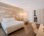
NH Collection Eindhoven Centre
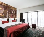
Inntel Hotels Art Eindhoven
Crown Hotel Eindhoven
Novotel Eindhoven
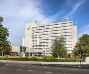
Holiday Inn EINDHOVEN
Boutique Hotel Lumiere
Queen Eindhoven
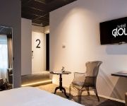
Glow
Crown Inn
NH Best
Videos from this area
These are videos related to the place based on their proximity to this place.
Videobericht Jean-Paul: hardlopers in actie voor KWF Kankerbestrijding
Bekijk de videoboodschap van Jean-Paul! Jean-Paul liep de New York City Marathon. En hij had een reden... Heeft u zelf iets wat u goed kunt, graag doet, of zou willen doen? Zet dan ook...
Muzikale ganzenparade op kermis in Best
De bezoekers van de kermis in Best werden op de tweede dag van het evenement muziek vermaakt door een ganzenparade.
Haunted Mansion (Hinzen) off-onride kermis Best 2012.
de Haunted Mansion (Hinzen) off-onride gefilmd zaterdag 30 juni 2012 op de kermis in Best.
Carl Craig presents 69 Live @ Extrema Outdoor XO Live 2012 14-07-2012 Aquabest Best NL
XO Live 2012! Extrema Outdoor!!
kermis Best 2012 straattheater
kort filmpje van het straattheater dat plaatsvond op de kermis in Best gefilmd op zaterdag 30 juni 2012.
Surf Party ( De Voer ) Offride Kermis Best 2012
De Surf Party op de kermis van Best 2012. Dit is een nieuwe jumper voor de Nederlandse kermissen in 2012. Is inmiddels weer verkocht aan exploitant Ropers.
Kermis Best - 50D Raw low light test - anamorphic edition
Kermis Best Camera: Canon 50D with Kowa 8Z anamorphic lens Recording: RAW recording using magic lantern June 28 build Workflow: RawMagic - ACR - FCP-X Original DNG resolution: 1344 x ...
Videos provided by Youtube are under the copyright of their owners.
Attractions and noteworthy things
Distances are based on the centre of the city/town and sightseeing location. This list contains brief abstracts about monuments, holiday activities, national parcs, museums, organisations and more from the area as well as interesting facts about the region itself. Where available, you'll find the corresponding homepage. Otherwise the related wikipedia article.
Evoluon
The Evoluon is a conference centre and former science museum erected by the electronics and electrical company Philips in Eindhoven, the Netherlands, in 1966. Since its construction, it has become a landmark and a symbol for the city. The building is unique due to its very futuristic design, resembling a landed flying saucer. It was designed by architect Louis Christiaan Kalff, while the exhibition was conceived by James Gardner.
Best, Netherlands
Best is a municipality and a village in the southern Netherlands. It is situated northwest of the city Eindhoven, and is also part of the agglomeration of this city. The village was originally a part of Oirschot, a nearby town. But as Best was situated on the state road from Amsterdam to Maastricht, this often created difficulties. Each time the military wanted to quarter troops in Best, they had to request to be stationed in Oirschot, 10 km away, for this to be allowed.
Boxtel
Boxtel is a municipality and a town in the southern Netherlands. This is the origin of the van Boxtel family, which has numerous descendants in North Brabant. The town was the site of the Battle of Boxtel fought in September 1794 during the Flanders campaign. It is often principally remembered as the first battle of the future Duke of Wellington.
Oirschot
Oirschot is a municipality and a town in the southern Netherlands. It is situated 12 km from the city of Eindhoven and 20 km from the city of Tilburg in the province Noord-Brabant. The municipality has 17,841 inhabitants (1 January 2007).
Sint-Oedenrode
Sint-Oedenrode is a municipality and a city in the South of the Netherlands.
Son en Breugel
Son en Breugel is a municipality in the southern Netherlands just outside of Eindhoven. 15,204 lived in this municipality as of June 1, 2005. Son en Breugel is 26,67 km² (of which 0,28 km² water). Son en Breugel used to be two different towns 'Son' and 'Breugel'. The border between these towns is made by the stream the Dommel. Son en Breugel borders to the following municipalities: Eindhoven, Sint-Oedenrode, Nuenen, Gerwen en Nederwetten, Best and Laarbeek.
Philips Stadion
Philips Stadion is the 35,000 seater stadium of football club, PSV Eindhoven. It was first inaugurated on 31 August 1913. The stadium is located in the Philipsdorp ('Philips village') part of the Eindhoven borough of Strijp, close to Eindhoven's city centre. As late as 1933, its capacity was only 300, and remained that size until its expansion in 1941 to 18,000 spectators. The final days of World War II witnessed great destruction in the city of Eindhoven and also to the stadium itself.
Liempde
Liempde is a village in the Netherlands in the municipality Boxtel. Annually the Flevo Christian music festival is held here. In 2005 the event What the Hack took place in Liempde. Liempde is situated in the center of the Dutch province North Brabant in the valley of the Dommel. It lies in the center of the triangle formed by 's-Hertogenbosch, Tilburg and Eindhoven. Until the end of the nineteenth century it was a dark and diffuse area.
What the Hack
What The Hack was an outdoor hacker conference held in Liempde, Netherlands between the 28th and 31st of July, 2005. It is an event in a sequence that began with the Galactic Hacker Party in 1989, followed by Hacking at the End of the Universe in 1993, Hacking In Progress in 1997 and Hackers At Large in 2001 and followed by Hacking at Random in 2009.
Woensel
Woensel is a former village in the Dutch province of North Brabant, now part of Eindhoven. An important rural village in North Brabant, Woensel is mentioned in a document from 1107; it was the seat of a deanage of the diocese of Liège. According to the German mythologist Jacob Grimm is the name Woensel a reference to the Germanic god Wodan (Odin in Norse mythology). The suffix would have been an abbreviation of either -sala ("hall") or -loo ("forest").
Area 51 (skatepark)
Area 51 is a skatepark in the center of Eindhoven, The Netherlands. It is one of the largest skate-parks in Europe.
Oerle
Oerle is also the Dutch name of the Belgian village Oreye Oerle is a village in the Dutch province of North Brabant. It is located in the municipality of Veldhoven, about 7 km west of Eindhoven. Oerle was a separate municipality until 1921, when it became part of Veldhoven.
Zeelst
Zeelst is a former village in the Dutch province of North Brabant, now a neighbourhood of Veldhoven. Zeelst was a separate municipality until 1921, when it became part of Veldhoven.
Wintelre
Wintelre is a village in the municipality of Eersel in the province of North Brabant, the Netherlands. Wintelre is part of the Acht Zaligheden (Eight Delights), like Eersel, Duizel, Steensel, Knegsel, Netersel, Hulsel en Reusel.
Borne, North Brabant
Borne is a hamlet in the Dutch province of North Brabant. It is located in the municipality of Schijndel, just to the west of the centre of the town of Schijndel.
Heikant, Veldhoven
Heikant is a neighbourhood in the municipality of Veldhoven, in the Dutch province of North Brabant. With a population of over 6700 inhabitants, it is the largest neighbourhood in Veldhoven. Heikant contains a small shopping centre and a church. The Sint-Maartenchurch was built in 1990. Heikant was constructed between 1979 and 1989. The first houses were officially completed on February 21st, 1980.
Mapscape BV
Mapscape BV is a Netherlands-based independent Business-to-business digital maps service provider. The company is active in the navigation and automotive market. Mapscape is involved in content aggregation, compilation and testing of digital maps for navigation purposes. The maps are targeted for use in the automotive industry in e.g. on line and off line navigation and location based services.
Beatrix Canal
The Beatrix Canal is a 8.4 km long canal in the southern Dutch. It was constructed to provide the city of Eindhoven with access to the Wilhelmina Canal. In order to be able to regulate the level of the Gender and Dommel streams, which regularly threatened to flood Eindhoven's inner city, an additional Discharge Canal (Afwateringskanaal), which is not open to navigation, was dug to connect the Beatrix Canal and the Dommel stream. Into this branch, the Gender now discharges.
BestZoo
BestZOO is a small zoo in Best, North Brabant, Netherlands. It opened in 1930 as Vleut the Zoo, and was owned and operated by the van Laarhoven family until purchased by Zodiac Zoos in 2007. Zodiac Zoos upgraded many of the old exhibits to more naturalistic settings, but sold the to Jos Nooren in 2010 before all upgrades were completed.
European Air Transport Command
The European Air Transport Command (EATC) is a command centre that directs the use of most military fixed wing air transport assets owned by the three Benelux countries, France and Germany. Located at Eindhoven Airbase in the Netherlands, it aims to provide a more efficient use of the air transport capacities by means of pooling the various assets, and thereby making them available to the participating nations.
Son, North Brabant
Son is a village in the Dutch province of North Brabant, in the municipality of Son en Breugel. The nearest major city is Eindhoven.
Wollerich
Restaurant Wollerich is a restaurant located in Sint Oedenrode, in the Netherlands. It is a fine dining restaurant that was awarded one Michelin star in the period 1997-2007 and 2010–present. Gault Millau awarded the restaurant 17 out of 20 points. Head chef of Wollerich is Gerard Wollerich. In 2008, there was great consternation when the restaurant unexpectedly lost its Michelin star. This despite the high score in the Gault Millau. In 2010, the restaurant won its star back.
Hovenring
The Hovenring is a suspended bicycle path roundabout on the border between Eindhoven and Veldhoven in the Netherlands. It is the first suspended bicycle roundabout in the world.
De Herdgang
De Herdgang (The Herdgang) is the training complex of PSV Eindhoven and an official near in Eindhoven. The complex consists of seven different pitches and further training facilities including a fitness center. It lies on the North side of Eindhoven, near The Golden Oriole estate, the Oirschotsedijk, it is a wooded and quiet area. The Herdgang is often seen as a synonym for the peace that is happening around the club PSV.
Avant-Garde van Groeninge
Avant-Garde van Groeninge is a restaurant located in Eindhoven in the Netherlands. It is housed in the Philips Stadion, the home ground of soccer club PSV Eindhoven. It is a fine dining restaurant that is awarded one Michelin star in the period 2004–present. GaultMillau awarded the restaurant 15 out of 20 points. Owner and head chef of Avant-Garde van Groeninge is Johan van Groeninge. The restaurant is a continuation of Michelin starred Brasserie de Eglantier in Hilvarenbeek.


