Safety Score: 4,1 of 5.0 based on data from 9 authorites. Meaning please reconsider your need to travel to Lebanon.
Travel warnings are updated daily. Source: Travel Warning Lebanon. Last Update: 2024-04-25 08:17:04
Delve into Aaind es Siré
Aaind es Siré in Mohafazat Mont-Liban is a city located in Lebanon about 14 mi (or 22 km) east of Beirut, the country's capital town.
Current time in Aaind es Siré is now 01:46 PM (Thursday). The local timezone is named Asia / Beirut with an UTC offset of 3 hours. We know of 10 airports closer to Aaind es Siré, of which 5 are larger airports. The closest airport in Lebanon is Beirut Rafic Hariri International Airport in a distance of 13 mi (or 21 km), West. Besides the airports, there are other travel options available (check left side).
There are several Unesco world heritage sites nearby. The closest heritage site in Lebanon is Anjar in a distance of 14 mi (or 22 km), South-East. In need of a room? We compiled a list of available hotels close to the map centre further down the page.
Since you are here already, you might want to pay a visit to some of the following locations: Aaley, Jdaidet el Matn, Baabda, Beit ed Dine and Zahle. To further explore this place, just scroll down and browse the available info.
Local weather forecast
Todays Local Weather Conditions & Forecast: 29°C / 84 °F
| Morning Temperature | 21°C / 69 °F |
| Evening Temperature | 28°C / 83 °F |
| Night Temperature | 24°C / 75 °F |
| Chance of rainfall | 0% |
| Air Humidity | 19% |
| Air Pressure | 1009 hPa |
| Wind Speed | Moderate breeze with 9 km/h (6 mph) from West |
| Cloud Conditions | Overcast clouds, covering 90% of sky |
| General Conditions | Overcast clouds |
Friday, 26th of April 2024
24°C (76 °F)
18°C (65 °F)
Overcast clouds, gentle breeze.
Saturday, 27th of April 2024
22°C (72 °F)
18°C (65 °F)
Light rain, gentle breeze, overcast clouds.
Sunday, 28th of April 2024
24°C (76 °F)
17°C (63 °F)
Overcast clouds, light breeze.
Hotels and Places to Stay
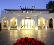
Pineland Hotel and Health Resort
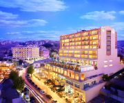
Cherry Blossom Boutique Hotel
SAFIR BHAMDOUN HOTEL
Videos from this area
These are videos related to the place based on their proximity to this place.
Snow in Lebanon
Off to the snow on a day trip to the mountains while touring round Beirut. A fun day was had by all.
HI Ramlieh Youth Hostel Tour - Lebanon
A tour of the Ramlieh Youth Hostel in Lebanon. To book this hostel visit http://www.hihostels.com Hostelling International is a non-profit membership organisation and is the only global...
Chateau BelleVue Winery - Bhamdoun - WorldFocus
Documentary Regarding Chateau Belle-Vue Winery in Bhamdoun - Lebanon. By WorldFocus.
Bhamdoun to Rweisset-el-Naamann Drive, part 1
Bhamdoun to Roueisset el Naamanne (Mount Lebanon) drive in the snow, part 1/2. Setting sun. Exceptional snow, after tempest Zina's passage. P1102234.
Chitlins Con Carne youtube - Video
Chitlins Con Carne . Rehearsal at Bssous with Pierre , Hadi, Ayman , Philippe & Ralph.
good friday hymn تراتيل ألجمعة ألعظيمة
join us on a facebook page for saint charbel and listen to all fairuz good friday hyms and many of saint charbel hymns by gawqit alsawt al3atik & many more https://www.facebook.com/Saint.charbel.lb.
Racing Park Mtein Aerial View
This is an overview of the newly opened Racing Kart Track in Mtein, Lebanon. Here's the location: 33.89249 35.76333 © www.karimsaad.net.
Hiking in Bchellema - Club des Vieux Sentiers
Dimanche 11 mars 2012 Randonnée à Bchéllema, Caza du Metn Longueur du circuit : 9 km Total des dénivelés : 350 m. Altitude entre 970 m et 1300 m Durée de mar...
Videos provided by Youtube are under the copyright of their owners.
Attractions and noteworthy things
Distances are based on the centre of the city/town and sightseeing location. This list contains brief abstracts about monuments, holiday activities, national parcs, museums, organisations and more from the area as well as interesting facts about the region itself. Where available, you'll find the corresponding homepage. Otherwise the related wikipedia article.
Ain Dara, Lebanon
Ain Dara is a village about 30 km from Beirut, in the governorate of Mount Lebanon, in the Aley District. Ain Dara Municipality has an area of 2,586 hectares (25.86 km² - 9.98196 mi²), with a population of approximately 8000 persons (1700 emigrants). It had 3,874 registered voters in 2010. Ain Dara is located on a southward facing slope overlooking the pine forests of the safa valley at an altitude of 1,300 meters. It is close to Mount Barouk, which is famous for its cedar forest.
Mudeirej Bridge
The Mudeirej Bridge or Mdairej Bridge is a bridge in Lebanon. It was partly destroyed on July 12, 2006 during the 2006 Lebanon-Israel conflict. The bridge was inaugurated in 1998 by the assassinated former Prime Minister Rafiq Hariri and built at a cost of $44 million. It stood 75 meters (246 feet) high, making it the highest bridge in Lebanon and lay along a mountainous route on the Beirut-Damascus highway.
Qarnayel
Qarnayel is a town and municipality in Qadaa Baabda, Lebanon. (Baabda district) of Mount Lebanon Governorate . The village is located between 1100–1250 metres above sea level in the western steep slopes of Mount Lebanon, in the upper Matn (Al Matn al A'la) section, 36 Kilometers to the east of Beirut بيروت. The village has a population of nearly 4,500 inhabitants who are Druze and Maronites.
Saoufar
Saoufar (Sofar) is a city town in Mount Lebanon, Caza Aley, and is located at an altitude of 1320 m and beside a main road linking Beirut, Lebanon's capital, to Damascus, the capital of Syria. With a population of about 3000 people (increases to around 15,000 people during the summer due to tourism), Saoufar gains its importance from its strategic and panoramic overlooking of Caza Matn, with the LaMartine Valley separating the two.


