Safety Score: 2,8 of 5.0 based on data from 9 authorites. Meaning we advice caution when travelling to Japan.
Travel warnings are updated daily. Source: Travel Warning Japan. Last Update: 2024-04-23 08:18:23
Delve into Minami
Minami in Shimajiri-gun (Okinawa) is located in Japan about 845 mi (or 1,360 km) south-west of Tokyo, the country's capital town.
Current time in Minami is now 02:53 AM (Wednesday). The local timezone is named Asia / Tokyo with an UTC offset of 9 hours. We know of 5 airports close to Minami. The closest airport in Japan is Minami Daito Airport in a distance of 2 mi (or 3 km), North-East. Besides the airports, there are other travel options available (check left side).
If you need a hotel, we compiled a list of available hotels close to the map centre further down the page.
While being here, you might want to pay a visit to some of the following locations: Amami, Nago, Uruma, Okinawa and Nanjo. To further explore this place, just scroll down and browse the available info.
Hotels and Places to Stay
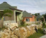
Minamidaito Cottage Kiraku (Minamidaitoshima)
Videos from this area
These are videos related to the place based on their proximity to this place.
110913琉球狐蝠大東亞種交配 A mating pair of Pteropus dasymallus daitoensis
非常珍貴的紀錄,運氣太好了! We're so lucky to recorded the excited moment!
絶海の孤島浪漫 南大東島 2012 / Minami-Daito
台風の気象情報ではよく聞く、絶海の孤島「南大東島」の風景をスライドショーに してみました。ガイドブックなどの情報が少ない、離島観光の...
北大東島 うふあがり島まるごと体験ツアー / 3 Days Trip on Kitadaito Island
Please join Our Facebook page! http://www.facebook.com/VisitOkinawa 沖縄最東端の島・北大東島で琉球一早く昇る「朝日」を浴びる3日間 うふあがり島まるごと体...
北大東月桃加工場 / Shell Ginger Processing Factory
Please join Our Facebook page! http://www.facebook.com/VisitOkinawa Shell Ginger Processing Factory In Kitadaito Village, Okinawa 月桃加工場(沖縄県 北大東島 北大東村) ...
Videos provided by Youtube are under the copyright of their owners.
Attractions and noteworthy things
Distances are based on the centre of the city/town and sightseeing location. This list contains brief abstracts about monuments, holiday activities, national parcs, museums, organisations and more from the area as well as interesting facts about the region itself. Where available, you'll find the corresponding homepage. Otherwise the related wikipedia article.
Philippine Airlines Flight 434
Philippine Airlines Flight 434 (PAL434, PR434) was the route designator of a flight from Ninoy Aquino International Airport, Pasay City, the Philippines, to New Tokyo International Airport, Narita near Tokyo, Japan, with one stop at Mactan-Cebu International Airport, Cebu, the Philippines. On December 11, 1994 the Boeing 747-283B, tail number EI-BWF, was flying on the second leg of the route, from Cebu to Tokyo, when a bomb planted by terrorist Ramzi Yousef exploded, killing one passenger.
Minamidaitō
, also spelt as Minami Daitō or Minami-Daitō, is the largest of the Daitō Islands, which are politically part of the Ryukyu (Nansei) Islands of Japan. Administratively, the whole island forms the village of Minamidaitō, Shimajiri District, Okinawa. The island was formally named South Borodino Island after being discovered by the Russian marine vessel Borodino in 1820.
Daitō Islands
Daitō Islands (大東諸島 Daitō Shotō or 大東島地方 Daitō-jima Chihō) are three islands that lie about 217 miles east of Okinawa. From north to south, the islands are: Data from 2004 Nov 20, 08:55 version of Japanese Wikipedia Although these islands have long been known in Okinawa as Ufuagari (the Great East), all of the islands were uninhabited until the Meiji period, when people from other parts of Japan arrived.
Minami-Daito Airport
Minami-Daito Airport is an airport in Minami Daito, Shimajiri District, Okinawa Prefecture, Japan. The prefecture operates the airport, which is classified as a third class airport. Only a round flight from Naha, to Minami-Daito and Kitadaito, back to Naha is operated everyday. The route differs on the day of the week. Flight from Kitadaito to Minami-Daito is the shortest flight in Japan, costs JPY¥7,600, and is only 12 km long, takes 3 minutes in the air.
Ooike (Okinawa)
The Ooike in Okinawa Prefecture or 大池 (沖縄) (Ooike(Okinawa)) or Ōike(Okinawa) is a karst pond in Minamidaito island, Okinawa Prefecture, Japan. Ooike is the largest pond containing both freshwater and seawater. It covers 0.31 square kilometres, the circumference is 5.50 kilometres, and it is 1.3 metres at its deepest point. Fresh water is mixed with seawater beneath.


