Safety Score: 3,0 of 5.0 based on data from 9 authorites. Meaning we advice caution when travelling to Italy.
Travel warnings are updated daily. Source: Travel Warning Italy. Last Update: 2024-04-23 08:18:23
Explore Baite di Bota
Baite di Bota in Provincia di Sondrio (Lombardy) is a city in Italy about 315 mi (or 507 km) north-west of Rome, the country's capital.
Local time in Baite di Bota is now 04:52 AM (Wednesday). The local timezone is named Europe / Rome with an UTC offset of 2 hours. We know of 8 airports in the vicinity of Baite di Bota, of which 3 are larger airports. The closest is airport we know is Samedan Airport in Switzerland in a distance of 31 mi (or 50 km). The closest airport in Italy is Bergamo / Orio Al Serio Airport in a distance of 37 mi (or 50 km), North-West. Besides the airports, there are other travel options available (check left side).
There are several Unesco world heritage sites nearby. The closest heritage site in Italy is Rock Drawings in Valcamonica in a distance of 14 mi (or 22 km), South-East. If you need a place to sleep, we compiled a list of available hotels close to the map centre further down the page.
Depending on your travel schedule, you might want to pay a visit to some of the following locations: Aprica, Bianzone, Villa, Teglio and Tirano. To further explore this place, just scroll down and browse the available info.
Local weather forecast
Todays Local Weather Conditions & Forecast: 7°C / 45 °F
| Morning Temperature | -5°C / 24 °F |
| Evening Temperature | 4°C / 39 °F |
| Night Temperature | -3°C / 26 °F |
| Chance of rainfall | 0% |
| Air Humidity | 48% |
| Air Pressure | 1004 hPa |
| Wind Speed | Gentle Breeze with 7 km/h (4 mph) from South |
| Cloud Conditions | Few clouds, covering 15% of sky |
| General Conditions | Rain and snow |
Thursday, 25th of April 2024
6°C (43 °F)
0°C (33 °F)
Rain and snow, gentle breeze, clear sky.
Friday, 26th of April 2024
5°C (42 °F)
3°C (37 °F)
Rain and snow, light breeze, overcast clouds.
Saturday, 27th of April 2024
8°C (46 °F)
5°C (40 °F)
Rain and snow, light breeze, overcast clouds.
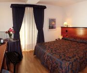
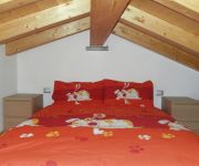
Hotels and Places to Stay
Aprica
Cristallo Club
Combolo
Bed & Breakfast San Bernardo
Videos from this area
These are videos related to the place based on their proximity to this place.
Aprica MTB 'Sentiero Alpini'
da Aprica, Pian di Gembro loc. Pisciè, loc. Antenne, seguire indicazioni per sentiero (single trail tecnico).
Aprica FatBike
Cari Amici di #Aprica Enjoy.. qui di seguito potrete godere delle immagini relative alla fantastica 2 giorni in Fat Bike che abbiamo organizzato nella nostra bellissima località. Da cornice...
Aprica in estate
Aprica, una montagna di emozioni. Una felice vacanza nelle montagne di Aprica: tutti gli sport, tutto il relax, tutti i divertimenti. Musica:2010-05-11T14:39:50+01:00 Unknown. Licensed to the...
Passo della Aprica (1.181 m.s.l.m.) - 29.06.2013
Il Passo dell'Aprica (1.181 m s.l.m.) è un valico alpino che mette in comunicazione la Valtellina con la Val Camonica ed è il confine amministrativo tra le provincia di Brescia e la provincia...
Powder Skiing in Aprica
Powder Training in Aprica, Italy, in January 2013. It's the second test on the snow of my GoPro HERO3, mounted on the helmet.
Videos provided by Youtube are under the copyright of their owners.
Attractions and noteworthy things
Distances are based on the centre of the city/town and sightseeing location. This list contains brief abstracts about monuments, holiday activities, national parcs, museums, organisations and more from the area as well as interesting facts about the region itself. Where available, you'll find the corresponding homepage. Otherwise the related wikipedia article.
Cime di Caronella
Cime di Caronella is a mountain of Lombardy, Italy. It is located within the Bergamo Alps.
Monte Torena
Monte Torena is a mountain of Lombardy, Italy. It is located within the Bergamo Alps.


