Safety Score: 3,4 of 5.0 based on data from 9 authorites. Meaning please reconsider your need to travel to India.
Travel warnings are updated daily. Source: Travel Warning India. Last Update: 2024-04-23 08:18:23
Explore Chorten
Chorten in Darjiling (West Bengal) is a city in India about 684 mi (or 1,100 km) east of New Delhi, the country's capital.
Local time in Chorten is now 04:04 PM (Tuesday). The local timezone is named Asia / Kolkata with an UTC offset of 5.5 hours. We know of 8 airports in the vicinity of Chorten. The closest airport in India is Bagdogra Airport in a distance of 24 mi (or 38 km), South. Besides the airports, there are other travel options available (check left side).
There is one Unesco world heritage site nearby. The closest heritage site is Sagarmatha National Park in Nepal at a distance of 106 mi (or 170 km). If you need a place to sleep, we compiled a list of available hotels close to the map centre further down the page.
Depending on your travel schedule, you might want to pay a visit to some of the following locations: Ilam, Gangtok, Jalpaiguri, Xarsingma and Samtse. To further explore this place, just scroll down and browse the available info.
Local weather forecast
Todays Local Weather Conditions & Forecast: 27°C / 81 °F
| Morning Temperature | 16°C / 61 °F |
| Evening Temperature | 28°C / 82 °F |
| Night Temperature | 18°C / 65 °F |
| Chance of rainfall | 0% |
| Air Humidity | 23% |
| Air Pressure | 1006 hPa |
| Wind Speed | Gentle Breeze with 8 km/h (5 mph) from North-East |
| Cloud Conditions | Clear sky, covering 1% of sky |
| General Conditions | Sky is clear |
Wednesday, 24th of April 2024
28°C (83 °F)
18°C (64 °F)
Sky is clear, gentle breeze, clear sky.
Thursday, 25th of April 2024
27°C (80 °F)
18°C (65 °F)
Sky is clear, gentle breeze, clear sky.
Friday, 26th of April 2024
28°C (82 °F)
19°C (65 °F)
Sky is clear, gentle breeze, clear sky.
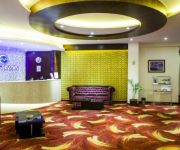
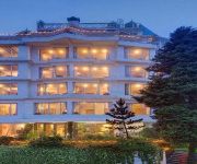
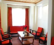
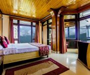
Hotels and Places to Stay
Ging Tea House
Little Tibet Resort
Montana Hotel
Hotel Viceroy
HOTEL IVY CASTLE DARJEELING
Villa Everest
Ramada Darjeeling Gandhi Road
Pine Tree Spa and Resorts
Central Nirvana Resort
Mayfair Darjeeling
Videos from this area
These are videos related to the place based on their proximity to this place.
Toy Train Darjeeling Himalayan Railways - World Heritage Site *HD*
Toy Train, Darjeeling, India: The narrow gauge train, opened in 1881, is listed as the Mountain Railways of India World Heritage Site in 1999, only the second railway to have this honour bestowed...
Steam in India 2005 -- Darjeeling Himalayan Railway Part 1
Darjeeling is a small town nearly 7000 feet above sea level in the foothills of the Himalayas in the north east corner of India. On a clear day the massive snow-clad peak of the third highest...
Inde 2013 : Darjeeling - Samten Choling gompa
Moines au Samten Choling gompa de Ghum, près de Darjeeling en Inde.
Darj Diaries | December 2017 | Weekend Trip
This was shot entirely on our trip to darjeeling in December 2017. Camera: One plus 5 Edited: Final Cut Pro.
Videos provided by Youtube are under the copyright of their owners.
Attractions and noteworthy things
Distances are based on the centre of the city/town and sightseeing location. This list contains brief abstracts about monuments, holiday activities, national parcs, museums, organisations and more from the area as well as interesting facts about the region itself. Where available, you'll find the corresponding homepage. Otherwise the related wikipedia article.
Darjeeling Himalayan Railway
The Darjeeling Himalayan Railway, also known as the "Toy Train", is a 2ft narrow gauge railway that runs between New Jalpaiguri and Darjeeling in West Bengal. Built between 1879 and 1881, the railway is about 78 kilometres long. Its elevation level varies from about 100 metres at New Jalpaiguri to about 2,200 metres at Darjeeling.
Senchal Lake
Senchal lake, located 10 km to the south-east of Darjeeling, is the main reservoir of potable water for the town of Darjeeling, India. The lake is located at an altitude of 8,160 ft atop a hill. The hill also has one of the highest golf courses in the world. Senchal is a favourite picnic spot. A tourist lodge at Senchal provides accommodation to tourists. This lake is a part of the Senchal Wildlife Sanctuary.
Lloyd's Botanical Garden
Lloyd's Botanical Garden, or Darjeeling Botanical Garden, is a botanical garden in Darjeeling in the Indian state of West Bengal.
Tiger Hill, Darjeeling
Tiger Hill is the summit of Ghoom, the highest railway station on the Darjeeling Himalayan Railway – a UNESCO World Heritage Site. It is famous for the panoramic views it offers of Mount Everest along with Kangchenjunga. It is 11 km from the town of Darjeeling and can be reached either by jeep or by foot through Chowrasta, Alubari (incidentally the oldest tea plantation in Darjeeling) or Jorebangla and then climbing up the incline to the summit, which takes about 2 hours at an easy pace.
Darjeeling (Lok Sabha constituency)
Darjeeling (Lok Sabha constituency) is one of the 543 parliamentary constituencies in India. The constituency centres on Darjeeling in West Bengal. While six assembly segments are in Darjeeling district, one assembly segment is in Uttar Dinajpur district.
Batasia Loop
The Batasia Loop is a spiral railway created to lower the gradient of ascent of the Darjeeling Himalayan Railway in Darjeeling district of West Bengal, India. At this point, the track spirals around over itself through a tunnel and over a hilltop. It was commissioned in 1919.
Windamere Hotel
Windamere Hotel, built in the 1930s, is a heritage hotel situated on Observatory Hill, in Darjeeling, India.
Southfield College
Southfield College was founded as Loreto College in Darjeeling in August 1961 as a women's college. At the request of the government of West Bengal, the Irish Branch of the Institute of the Blessed Virgin Mary, the Darjeeling Loreto Educational Society agreed to take care of its management. However, due to the lack of personnel, the Loreto nuns were compelled to hand over the college to the government of West Bengal, hence to be run as Southfield College.


