Safety Score: 2,8 of 5.0 based on data from 9 authorites. Meaning we advice caution when travelling to Hungary.
Travel warnings are updated daily. Source: Travel Warning Hungary. Last Update: 2024-04-23 08:18:23
Delve into Hársasi Erdészlak
The district Hársasi Erdészlak of Bélapátfalva in Heves megye is a subburb in Hungary about 72 mi north-east of Budapest, the country's capital town.
If you need a hotel, we compiled a list of available hotels close to the map centre further down the page.
While being here, you might want to pay a visit to some of the following locations: Eger, Ozd, Putnok, Petervasara and Fuzesabony. To further explore this place, just scroll down and browse the available info.
Local weather forecast
Todays Local Weather Conditions & Forecast: 10°C / 50 °F
| Morning Temperature | 2°C / 36 °F |
| Evening Temperature | 12°C / 54 °F |
| Night Temperature | 9°C / 48 °F |
| Chance of rainfall | 0% |
| Air Humidity | 67% |
| Air Pressure | 1015 hPa |
| Wind Speed | Gentle Breeze with 8 km/h (5 mph) from West |
| Cloud Conditions | Overcast clouds, covering 100% of sky |
| General Conditions | Light rain |
Wednesday, 24th of April 2024
9°C (48 °F)
5°C (41 °F)
Moderate rain, gentle breeze, overcast clouds.
Thursday, 25th of April 2024
11°C (51 °F)
6°C (43 °F)
Overcast clouds, moderate breeze.
Friday, 26th of April 2024
10°C (50 °F)
6°C (43 °F)
Light rain, light breeze, overcast clouds.
Hotels and Places to Stay
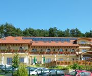
Szalajka Liget
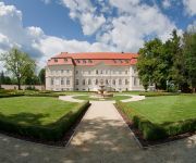
La Contessa Kastélyhotel****
Videos from this area
These are videos related to the place based on their proximity to this place.
Bél-kői tanösvény - Bélapátfalva az Élmények Völgye ajánlatában
http://www.elmenyekvolgye.hu/bukk-hegyseg/156-bel-koi-tanosveny.
Hutter Feri Fefe Drift Sierra
Ferikénk megy a hegyen felfelé tempóban ! V8 Bmw motor van a Ford Sierra kasztniban.
Drift King of Europe Bel-Ko Hungary Grinchuk vs Campling
http://kingofeurope.net Recorded and streamed on King of Europe drifting Pro Series Top 32 at track Bel-Ko, Hungary Recorded and streamed by http://videoteamhungary.com.
Vona Gábor lakossági fóruma Bélapátfalván 2012 december.
Vona Gábor A Jobbik Magyarországért Mozgalom elnöke tartott lakossági fórumot Bélapátfalván 2012 decemberben.
Videos provided by Youtube are under the copyright of their owners.
Attractions and noteworthy things
Distances are based on the centre of the city/town and sightseeing location. This list contains brief abstracts about monuments, holiday activities, national parcs, museums, organisations and more from the area as well as interesting facts about the region itself. Where available, you'll find the corresponding homepage. Otherwise the related wikipedia article.
Bélapátfalva
Bélapátfalva is a town in Heves county, in Hungary, located north of the city of Eger. The town is located inside the Eger-river valley at an altitude of 311 meters above sea-level. Facing the town is the Bél-kő mountain which rises 811 meters and is one of the highest peaks of the Bükk mountains. The town is the site of the best preserved Romanesque church building in Hungary, formerly part of a Cistercian abbey. The church was built after 1232 and later modified in Gothic style.
Ózd
Ózd is a city in Borsod-Abaúj-Zemplén county, Northern Hungary, 40 km away from county seat Miskolc. Ózd is the second largest city of the county.
Bükk
The Bükk Mountains (literally Beech Mountains) are a section of the North Hungarian Mountains of the Inner Western Carpathians. Much of the area is included in the Bükk National Park.
Castle of Eger
The Castle of Eger is a castle in Eger, Hungary. Historically, it is known for repelling the Turkish attack in 1552 during the Siege of Eger.
Bükk National Park
The Bükk National Park (Hungarian: Bükki Nemzeti Park) is a national park in the Bükk Mountains of Northern Hungary, near Miskolc. It was founded in 1976 as the third national park of the country. It contains 431.3 km² (of which 37.74 km² is under increased protection). It is the largest national park in Hungary with mountains and forests, situated in the Northern mountains, between Szilvásvárad and Lillafüred.
Sirok
Sirok is a historic village (population 2,100) in Heves county in Hungary, situated near Eger in Mátra mountains. Today it is most known for its 13th century castle ruins.
Egerland
The Egerland is a historical region in the far north west of Bohemia in the Czech Republic at the border with Germany. It is named after the German name Eger for the city of Cheb and the main river Ohře. Recently the northern parts around the town of Aš are also called Böhmisches Vogtland (Fojtsko) related to the adjacent German Vogtland region in Saxony, Thuringia and Bavaria, today constituent parts of the Egrensis Euroregion initiative.
Farkaslyuk
Farkaslyuk is a village in Borsod-Abaúj-Zemplén county, Hungary.
Egerszólát
Egerszólát is a small village in Heves county, in the north-eastern part of Hungary, west of Eger. It is located in Eger wine region and is famous in Hungary for its white wine called 'Egerszóláti Olaszrizling'.
Tarnaszentmária
Tarnaszentmária is a village at the foot of the Mátra Mountains in Hungary.
Bánkút (Nagyvisnyó)
Bánkút is a ski resort in Northern Hungary in the Bükk National Park. It lies 32 km west from Miskolc and 800–930 metres above sea level; officially belongs to the village of Nagyvisnyó. It has six ski trails of various difficulty and two beginner slopes, its eight ski lifts can lift 2000 persons per hour. There are two cross-country ski trails, 3.5 km and 8 km long. In ski season MVK Zrt.
Járdánháza
Járdánháza is a village in Borsod-Abaúj-Zemplén County in northeastern Hungary.
Lénárddaróc
Lénárddaróc is a village in Borsod-Abaúj-Zemplén County in northeastern Hungary.
Mályinka
Mályinka is a village in Borsod-Abaúj-Zemplén County in northeastern Hungary.
Nekézseny
Nekézseny is a village in Borsod-Abaúj-Zemplén County in northeastern Hungary.
Répáshuta
Répáshuta is a village in Borsod-Abaúj-Zemplén County in northeastern Hungary.
Ózd subregion
Ózd subregion Borsod-Abaúj-Zemplén second largest subregion. Area : 548,39 km². Population : 69 400 (2009)


