Safety Score: 4,0 of 5.0 based on data from 9 authorites. Meaning please reconsider your need to travel to Guyana.
Travel warnings are updated daily. Source: Travel Warning Guyana. Last Update: 2024-04-18 08:12:24
Delve into Nandy Park
The district Nandy Park of Providence in Demerara-Mahaica Region is a district located in Guyana a little south-west of Georgetown, the country's capital town.
In need of a room? We compiled a list of available hotels close to the map centre further down the page.
Since you are here already, you might want to pay a visit to some of the following locations: Georgetown, Vreed-en-Hoop, Bartica, Anna Regina and Fort Wellington. To further explore this place, just scroll down and browse the available info.
Local weather forecast
Todays Local Weather Conditions & Forecast: 27°C / 81 °F
| Morning Temperature | 25°C / 78 °F |
| Evening Temperature | 26°C / 78 °F |
| Night Temperature | 27°C / 80 °F |
| Chance of rainfall | 34% |
| Air Humidity | 87% |
| Air Pressure | 1012 hPa |
| Wind Speed | Gentle Breeze with 8 km/h (5 mph) from West |
| Cloud Conditions | Overcast clouds, covering 100% of sky |
| General Conditions | Moderate rain |
Saturday, 20th of April 2024
30°C (86 °F)
26°C (79 °F)
Light rain, gentle breeze, overcast clouds.
Sunday, 21st of April 2024
29°C (84 °F)
25°C (78 °F)
Light rain, gentle breeze, overcast clouds.
Monday, 22nd of April 2024
29°C (85 °F)
25°C (77 °F)
Light rain, gentle breeze, overcast clouds.
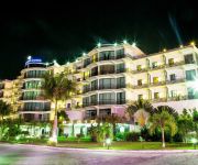
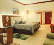
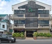
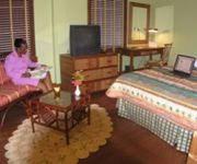
Hotels and Places to Stay
Guyana Marriott Hotel Georgetown
Kanhai's Center of Excellence
Julian Guest House
PRINCESS HOTEL GUYANA
RAMADA GEORGETOWN PRINCESS HOT
REGENCY SUITES HOTEL
an Ascend Hotel Collection Member The Opus Hotel
CARA SUITES
CARA LODGE HOTEL
Herdmanston Lodge
Videos from this area
These are videos related to the place based on their proximity to this place.
Helicopter Tour Flight | Georgetown, Guyana 2014
Helicopter Tour Flight around Georgetown, Guyana - 2014. Please turn on annotations. THANKS FOR WATCHING! Please click "LIKE" Took off from the National Stadium Grounds, circled the stadium,...
Tours-TV.com: Georgetown
Georgetown or “Garden City of the Caribbean” is the capital of Guyana. City's main income is from tourism: it attracts 86% visitors of the country. . Guyana. (乔治敦, ジョージタウ...
Fruit Man Selling Fruits | Guyana 2015
Man sells fruits from a cart in Georgetown, Guyana. THANKS FOR WATCHING!
Guyana Fashion Week Review 2011 Part 1
C.E.O Guyana Fashion Week - Sonia Noel and Creative Director Guyana Fashion Week - Richard Young review the journey of the Fifth installment of Guyana Fashion Week 2011. Find Us on Facebook: ...
VOICE OF THE PEOPLE OF .GUYANA.
ALL PROGRAMMING IS THE SOLD RIGHTS OF VOICE OF THE PEOPLE WHICH IS THE EXTENDED ARM OF :JUSTICE FOR ALL PARTY.(JFAP)
VOICE OF THE PEOPLE OF .GUYANA.
ALL PROGRAMMING IS THE SOLD RIGHTS OF VOICE OF THE PEOPLE WHICH IS THE EXTENDED ARM OF :JUSTICE FOR ALL PARTY.(JFAP)
Continuing Promise 2008 - Leaving Guyana
On the helo flight out of Georgetown, Guyana. You can clearly see the USS Kearsarge (LHD-3). Happy thoughts after finishing our last country, knowing we are on our way back home just in time...
Videos provided by Youtube are under the copyright of their owners.
Attractions and noteworthy things
Distances are based on the centre of the city/town and sightseeing location. This list contains brief abstracts about monuments, holiday activities, national parcs, museums, organisations and more from the area as well as interesting facts about the region itself. Where available, you'll find the corresponding homepage. Otherwise the related wikipedia article.
Georgetown, Guyana
Georgetown, estimated population 239,227 (2002 Guyana census), is the capital and largest city of Guyana, located in the Demerara-Mahaica region. It is situated on the Atlantic Ocean coast at the mouth of the Demerara River and it was nicknamed 'Garden City of the Caribbean. ' Georgetown is located at {{#invoke:Coordinates|coord}}{{#coordinates:6|48|N|58|10|W||| | |name= }}. The city serves primarily as a retail and administrative centre. It also serves as a financial services centre.
Demerara
Demerara is a historical region in the Guianas on the north coast of South America which is now part of the country of Guyana. It was a Dutch colony until 1815 and a county of British Guiana from 1838 to 1958. It was located about the lower courses of the Demerara River, and its main town was Georgetown. The name "Demerara" comes from a variant of the Arawak word "Immenary" or "Dumaruni" which means "river of the letter wood".
Demerara River
The Demerara River is a river in eastern Guyana that rises in the central rainforests of the country and flows to the north for 346 kilometres until it reaches the Atlantic Ocean. Georgetown, Guyana's largest seaport and capital, is situated on the east bank of the river's mouth. The Demerara's estuary is narrow and the flowrate is rapid. This scouring action maintains a 5-6 metre deep direct channel to the ocean.
National Milling Company of Guyana
National Milling Company of Guyana (NAMILCO), a subsidiary of U.S. based Seaboard Corporation, is the oldest commercial flour mill in Guyana. It started operations in 1969. The mill is located on Water Street, Agricola, Georgetown.
Bank of Guyana
The Bank of Guyana is the central bank of Guyana. It was established in 1965 in advance of the country's independence in 1966. {{#invoke:Coordinates|coord}}{{#coordinates:6.813438|-58.165361||||||| |primary |name= }}
St. Stanislaus College
St. Stanislaus College is a Grade A Senior Secondary School in Georgetown, Guyana. It has a student population of 500 and a teaching staff of forty. Admission to the school is normally through the Secondary Schools' Entrance Examination.
Providence Stadium
The Providence Stadium is a sports stadium in Guyana, replacing Bourda as the national stadium. The stadium was built specifically to host Super Eight matches in the 2007 Cricket World Cup, held in March and April 2007.
Stabroek Market
Stabroek Market is a large market located in the capital city of Guyana, Georgetown. In 1842, the Georgetown Town Council designated the current location of the market on Water Street, officially recognizing it as a market despite the fact that it had served such a capacity for quite some time. The market was designed and constructed by the Edgemoor Iron Company of Delaware, USA over the period 1880-1881.
St. George's Cathedral, Georgetown
St. George's Cathedral is an Anglican cathedral in Georgetown, Guyana and is one of the tallest wooden churches in the world, at a height of 43.5 metres . It is the seat of the Bishop of Guyana. St. George's was designed by Sir Arthur Blomfield and opened on 24 August 1892. The building was completed in 1899. It is located on Church Street in Georgetown, and has been designated a National Monument.
St. Andrew's Kirk, Georgetown
St. Andrews Kirk is the oldest building in Georgetown, Guyana continually in use for religious purposes. The Dutch Reformed congregation laid its foundations in 1811. However, due to financial difficulties it was acquired by Scottish Presbyterians and was formally opened for service on 28 February 1818. It was the first church built by the Europeans in which slaves were allowed to worship. It is situated near the Parliament Building on the north eastern corner of Brickdam. Rev.
State House, Guyana
State House (formerly "Government House") located in Georgetown, is the official residence of the President of Guyana. It was previously the official residence of the Governor of British Guiana before the colony gained independence and became Guyana. The building dates back to 1858. It was the residence of the Governor General and in 1970, the country's first president, Arthur Chung, resided there.
Georgetown City Hall
Georgetown City Hall is a nineteenth-century Gothic Revival building located on the corner of Regent Street and Avenue of the Republic in Georgetown, Guyana. The building was designed by architect Reverend Ignatius Scoles in 1887, and was completed in June 1889. The building houses the offices of the Mayor, the City Council, and the City Engineer.
Demerara-Essequibo
The colony of Demerara-Essequibo was created on 13 August 1814 when the British combined the colonies of Demerara and Essequibo. On 20 November 1815 the colony was formally ceded to Britain by the Netherlands. The colony continued to use Dutch denominations of currency even though under British control. The issued coins ranging from 3 bits up to 3 Guilder. These coins were minted with the colonies name on it, and were minted from 1809 to 1835.
Company Path Garden
Company Path Garden is a small garden on the west side of the Avenue of the Republic in Georgetown, Guyana, between Church and North Streets. During colonial times, “company path” was the name given to a road used by the propertied class as an access road from the river to their lands. The company path, in this case, extended from the side of the Demerara River along the path on which the Bank of Guyana was built and eastwards beyond the Avenue of the Republic.
Vreed en Hoop
Vreed en Hoop is a town at the mouth of the Demerara River on its left bank, in the Essequibo Islands-West Demerara Region of Guyana, located at an {{#invoke:Coordinates|coord}}{{#coordinates:6|47|59.9|N|58|10|59.9|W| |primary |name= }} altitude 0 metres. It is the location of the Regional Democratic Council Office thus making it the Administrative Center for the Essequibo Islands-West Demerara (Region #3) of Guyana.
Providence, Guyana
Providence is a community in the Demerara-Mahaica Region of Guyana, on the east bank of the Demerara River, located at {{#invoke:Coordinates|coord}}{{#coordinates:6|46|0|N|58|10|0|W|region:GY | |name= }}, altitude 1 metre (3 feet). Providence is approximately 3 kilometres south of the capital, Georgetown. Providence is the home of the Providence Stadium.
Guyana National Museum
Guyana National Museum was established on 13 February 1868. The idea of starting a museum was conceived by members of the Royal Agricultural and Commercial Society (RACS) of British Guiana. When RACS was established in 1844, one of its aims was to construct a Museum to house local minerals, soils, timbers, fruits, seeds, gums, resins, dyes and drugs, as well as the flora and fauna of the country. British explorer Robert Schomburgk, the German botanist Carl Ferdinand Appun, Mr Bratt, and W.H.
St. Rose's High School, Guyana
St. Rose's Secondary High School is a government school on Church Street in Georgetown, Guyana, serving students in grades 7-12 in Georgetown, Guyana. To be accepted into the school, the student must receive a certain grade in their Secondary Schools Entrance Examination (SSEE). This is the fourth highest school in Guyana, closely followed by St. Joseph High School (Guyana).
Roman Catholic Diocese of Georgetown
The Roman Catholic Diocese of Georgetown (erected 12 April 1837, as the Vicariate Apostolic of British Guiana) is a suffragan of the Archdiocese of Port of Spain. It was elevated to the Diocese of Georgetown on 29 February 1956. The diocese's cathedral, the Cathedral of the Immaculate Conception, is located in Georgetown, Guyana.
Unity Village, Guyana
Unity Village is a rural village in the East Coast district of the Demerara region of Guyana. The village is notable for being the birthplace of both Shivnarine Chanderpaul, former captain of the West Indies cricket team and Bharrat Jagdeo, president of Guyana.
The Business School Guyana
The Business School was founded in 1975 by Erma Bovell. Bovell, a deeply religious individual, started the school to provide secretarial training for girls from low-income households. These girls were unable to get an education in the public school system in Guyana. This training provided them opportunities to gain employment and to play a positive role in their curriculum. The Business School is located in the heart of Georgetown, Guyana at 43 Brickdam.
Capture of Demerara and Essequibo
The Capture of Demerara and Essequibo was a French military expedition sent in January 1782 as part of the American Revolutionary War. In 1781, the Dutch colonies of Essequibo and Demerara were captured by a British squadron of Admiral Lord Rodney's fleet; the French took possession of these settlements, compelling British Governor Robert Kinston to surrender. The peace of Paris, which occurred in 1783 restored these territories to the Dutch.
Ministry of Foreign Affairs (Guyana)
The Ministry of Foreign Affairs is the government ministry of Guyana responsible for directing the nation's external relations and the operations of its international diplomatic missions. Carolyn Rodrigues-Birkett has directed the ministry as Minister of Foreign Affairs since April 2008. The ministry is located in Guyana's capital city, Georgetown.
Bourda Cemetery, Guyana
Bourda Cemetery is an eighteenth-century cemetery situated on Bourda Street in Georgetown, Guyana. Formerly known as "Bourda's Walk", Bourda cemetery is the oldest cemetery in Georgetown, and the only surviving plantation cemetery in the city. It is considered a national landmark and has been listed as a national monument by the National Trust of Guyana.
Castellani House, Guyana
Castellani House is a large nineteenth-century building, which is situated on the corner of Vlissengen Road and Homestretch Avenue in Georgetown, Guyana. It was designed and constructed by the Maltese architect, Cesar Castellani, between 1879 and 1882. Originally serving as a residence for colonial government officials, Castellani House has been the home of Guyana's National Art Gallery since 1993.


