Safety Score: 4,0 of 5.0 based on data from 9 authorites. Meaning please reconsider your need to travel to Guam.
Travel warnings are updated daily. Source: Travel Warning Guam. Last Update: 2024-04-23 08:18:23
Delve into Pado
The district Pado of Mongmong-Toto-Maite Village in Mongmong-Toto-Maite Municipality is a subburb in Guam a little east of Hagatna, the country's capital town.
If you need a hotel, we compiled a list of available hotels close to the map centre further down the page.
While being here, you might want to pay a visit to some of the following locations: Tamuning-Tumon-Harmon Village, Sinajana Village, Barrigada Village, Guam Government House and Chalan Pago-Ordot Village. To further explore this place, just scroll down and browse the available info.
Local weather forecast
Todays Local Weather Conditions & Forecast: 30°C / 86 °F
| Morning Temperature | 27°C / 81 °F |
| Evening Temperature | 28°C / 83 °F |
| Night Temperature | 27°C / 81 °F |
| Chance of rainfall | 0% |
| Air Humidity | 67% |
| Air Pressure | 1012 hPa |
| Wind Speed | Moderate breeze with 12 km/h (7 mph) from West |
| Cloud Conditions | Few clouds, covering 12% of sky |
| General Conditions | Light rain |
Wednesday, 24th of April 2024
30°C (86 °F)
27°C (81 °F)
Light rain, moderate breeze, scattered clouds.
Thursday, 25th of April 2024
30°C (86 °F)
27°C (81 °F)
Overcast clouds, moderate breeze.
Friday, 26th of April 2024
30°C (86 °F)
27°C (81 °F)
Light rain, moderate breeze, overcast clouds.
Hotels and Places to Stay
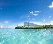
Hotel Nikko Guam
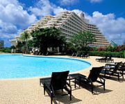
Dusit Thani Guam Resort
Sheraton Laguna Guam Resort
LOTTE HOTEL GUAM
Hilton Guam Resort Spa
The Westin Resort Guam
Dusit Thani Guam Resort
RAMADA HOTEL TAMUNING
Outrigger Guam Beach Resort
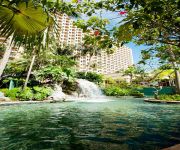
Hyatt Regency Guam
Videos from this area
These are videos related to the place based on their proximity to this place.
A trip to Guam episode2 グアムの旅!~木暮の挑戦~
グアムの旅episode2が遂に登場!w Kmartに買い物に行き、海で遊び、プールで遊びと大満喫♪ 夜は一人単独行動で、spike22に出稽古に行ってきたの...
Holiday Towers - Guam Condo for Rent and Sale
For More Information on Holiday Towers Guam, contact us at info@guamrealtyfinder.com or call (671) 788-RENT(7368). For other Guam condo for rent and Guam condo for sale, or any Guam real ...
Traditional Fire Chamorro Dancers in Guam.
A lively performance at the Chamorro Village's, Wednesday Night Market in Guam. This was quite a blast and a spirited performance by these beautiful girls, holding torches and performing...
Chamorro Warriors Spear Dance in Guam.
Brave Chamorro warriors also performed at the Wednesday evening market in the Chamorro Village on the island of Guam. In one of their dances they used a traditional spear, pretending they where...
Ninokuni Japanese trailer (with English subs)
This is a DS RPG made by Ghibli Studios and Level 5. First off, the subtitles were translated by me, and this took about 3 hours to do, so enjoy :) Second, I don't own this video in any way,...
Guam Trail Riders - Golfcarts On Steroids (part 1 of 2)
Guam Trail Riders have gotten the chance to meet a few good men along the familiar trails around Tank Farms behind Leo Palace Hotel. At first, we -dirtheads- have spotted them from a mile...
Marine Corps Drive, Guam
Marine Corps Drive, Guam. 괌 1번 도로 Marine Corps Drive를 타고 Hagatna 방면으로 가는 길.
HagatnaMED Clinic
HagatnaMED Clinic is the first, full-service (onsite labs and x-ray) walk-in/urgent care clinic serving the southernmost and central villages of Guam. Accessible Quality Care. Every Patient....
Videos provided by Youtube are under the copyright of their owners.
Attractions and noteworthy things
Distances are based on the centre of the city/town and sightseeing location. This list contains brief abstracts about monuments, holiday activities, national parcs, museums, organisations and more from the area as well as interesting facts about the region itself. Where available, you'll find the corresponding homepage. Otherwise the related wikipedia article.
Guam
Guam is an organized, unincorporated territory of the United States in the western Pacific Ocean. It is one of five U.S. territories with an established civilian government. Guam is listed as one of sixteen Non-Self-Governing Territories by the Special Committee on Decolonization of the United Nations. The island's capital is Hagåtña (formerly Agaña). Guam is the largest and southernmost of the Mariana Islands.
Geography of Guam
This article describes the geography of the United States territory of Guam. Location Oceania, island in the North Pacific Ocean, about a quarter of the way from the Philippines to Hawaii, U.S.A. Geographic coordinates {{#invoke:Coordinates|coord}}{{#coordinates:13|26|31|N|144|46|35|E| | |name= }} Map references Oceania Area Total: 541.3 km² Land: 541.3 km² Water: 0 km² Area (comparative) Three times the size of Washington, D.C.
Antonio B. Won Pat International Airport
Antonio B. Won Pat International Airport, also known as Guam International Airport, is an airport located in Tamuning and Barrigada, three miles east of the capital city of Hagåtña (formerly Agana) in the United States territory of Guam. It is named for Antonio Borja Won Pat, the first delegate from Guam to the United States House of Representatives, and is operated by the A.B.
Hagåtña, Guam
Hagåtña, formerly English Agana /əˈɡɑːnjə/ and in Spanish Agaña, is the capital of the United States territory of Guam. It is the island's second smallest village in both area and population. From the 18th through mid 20th century, it was Guam's population center. Today, it remains one of the island's major commercial districts in addition to being the seat of government.
Tamuning, Guam
Tamuning, also known as Tamuning-Tumon-Harmon is a municipality or village located on the western shore of the United States territory of Guam. The village of Tamuning can be viewed as the economic center of Guam, containing Tumon (the center of Guam's tourist industry), Harmon Industrial Park, and commercial districts in other parts of the municipality. Its central location along Marine Corps Drive (the island's main thoroughfare) has aided in its development.
Roman Catholic Archdiocese of Agaña
The Roman Catholic Archdiocese of Agaña is an ecclesiastical territory or diocese of the Roman Catholic Church in the United States. It comprises the overseas dependency of the island of Guam. The prelate is an archbishop which pastors the mother church, Dulce Nombre de Maria Cathedral-Basilica.
Agana Heights, Guam
Agana Heights is one of the nineteen villages in the United States territory of Guam. It is located in the hills south of Hagåtña (formerly Agana), in the central part of the island. The U.S. Naval Hospital is located in this largely residential village.
Legislature of Guam
The Legislature of Guam (Liheslaturan Guåhan in Chamorro) is the legislature in the United States territory of Guam. The legislative branch is unicameral, with a single house consisting of fifteen senators, each serving for a two year term. All members of the legislature are elected at-large. The Guam Legislature meets in the territorial capital of Hagåtña (formerly Agana). The current legislature building is located at 155 Hesler Place.
Sinajana, Guam
Sinajana is smallest (in terms of area) of the nineteen villages in the United States territory of Guam. It is located in the hills south of Hagåtña (formerly Agana). The village's name may have come from the word "china-jan," cookware used to cook wild yams that once grew in the area. Sinajana is one of a few villages that was urbanized as a result of a federal urban renewal program. Afame, Agana Springs, and Didigue are a few non-urbanized areas within this same village.
Mongmong-Toto-Maite, Guam
Mongmong-Toto-Maite is a municipality in the United States territory of Guam composed of three separate villages east of Hagåtña that experienced development after WW II. Mongmong is adjacent to the Hagåtña Swamp. Toto is situated to the northeast near Barrigada. Maite is located on the cliffs over Agana Bay. The village's population has increased slightly following the island's 2000 census.
Academy of Our Lady of Guam
Academy of Our Lady of Guam (AOLG) is an all-girls Catholic high school located at 233 Archbishop Felixberto C. Flores Street in Hagåtña, Guam, United States. AOLG, Guam's sole all-girls high school, has an average yearly enrollment of 400 students. In 2004 it was awarded the highest medal of recognition from the Archdiocese of Agaña. The school is accredited by the Western Association of Schools and Colleges.
Area code 671
The area code 671 is the local telephone area code of the United States territory of Guam. It was created in 1997, replacing Guam's previous country code 671.
Guam National Football Stadium
Guam National Football Stadium is a multi-use stadium in the village of Hagåtña in the United States territory of Guam. It is currently used mostly for football matches. The stadium holds 1,000.
Dulce Nombre de Maria Cathedral Basilica
Dulce Nombre de Maria Cathedral Basilica is a structure located on the site where the first Catholic church on the United States territory of Guam was constructed in 1669 under the guidance of Padre San Vitores. The present building looms above the palm trees and is a familiar landmark in downtown Hagåtña.
District Court of Guam
The District Court of Guam (in case citations, D. Guam) is a United States territorial court with jurisdiction over the United States territory of Guam. It sits in the capital, Hagåtña. The District Court of Guam was established in 1950 by The Organic Act of Guam 48 U.S.C. § 1424, to have the same jurisdiction as a United States district court. Its judges, however, do not have life tenure and is therefore not a true Article III court.
Paseo de Susana
Paseo de Susana is a peninsula that forms part of the city of Agana, Guam. It was built in the 1940s from rubble and debris left behind after World War II. The peninsula contains Guam's main sports stadium, markets, and Chief Quipuha Park.
Chief Quipuha Park
Chief Quipuha Park is located on the Paseo de Susana peninsula, in the north of the city of Agana, in the United States territory of Guam . Like the rest of the peninsula, it was created after World War II, based on bulldozed debris from the ruined city. It is named for Chief Quipuha, the highest ranking chief in the area at the time of the first European settlement on the island.
Naval Air Station Agana
Naval Air Station Agana is a former United States Navy air station located on Guam. It was opened by the Japanese Navy in 1943 and closed in 1995. During and after its closure, it was operated alongside Antonio B. Won Pat International Airport.
Agana Shopping Center
Agana Shopping Center is a shopping center located in downtown Hagåtña, in the United States territory of Guam. Opening in 1978, the mall is one of numerous malls on Guam. Main competitors include Micronesia Mall, Guam's largest shopping mall and Guam Premier Outlets in Tamuning. The mall includes five theatres called Agana Center Stadium Theatres because of its true stadium seating capacity. The shopping center was severely damaged when a typhoon struck the island in 2002.
Guam Premier Outlets
Guam Premier Outlets or GPO (formerly known as Guam Shopping Center and Guam Premium Outlets) is a shopping mall located in Tamuning, Guam. GPO is the only outlet mall in the United States territory of Guam. Located just north of the island's busiest intersection of Marine Corps Drive (Route 1) and Chalan San Antonio (Route 14), stores at GPO include Nine West, Anne Klein, BCBG, GUESS, Levi's, Nike Team Sports, Payless ShoeSource, Famous Footwear and ABC Store.
Father Dueñas Memorial School
Father Dueñas Memorial School (FDMS) is an all-male Catholic high school located in Mangilao, Guam, United States. It is within the territory of the Roman Catholic Archdiocese of Agaña. The school is accredited by the Western Association of Schools and Colleges. Most Rev. Appolinaris W. Baumgartner, OFM Cap. founded the school in 1948. It was named after Father Jesus Baza Dueñas, a Chamorro priest who was beheaded by Japanese forces during World War II.
St. Thomas Aquinas Catholic High School (Guam)
St. Thomas Aquinas Catholic High School is a coeducational college preparatory Roman Catholic school located at 131 Judge Sablan Street in Ordot, Guam, a United States territory in the Western Pacific Ocean. The school opened in the Fall of 2008, and is the newest Catholic High School on Guam, under the Archdiocese of Agana.
Chalan Pago-Ordot, Guam
Chalan Pago-Ordot is a municipality in the United States territory of Guam, containing the villages of Chalan-Pago and Ordot. It is located in the eastern-central part of the island and is part of the Kattan (Eastern) District. The village's population has increased slightly following the island's 2000 census.
Barrigada, Guam
Barrigada is a village in the United States territory of Guam. A largely residential municipality, its main village is located south of the Antonio B. Won Pat International Airport near the intersections of Routes 8, 10, and 16. The community east of the airport known as Barrigada Heights is considered an affluent neighborhood on the island, where homes have excellent views overlooking much of Guam including the island's airport and hotels at Tumon Bay.
Mangilao, Guam
Mangilao is a village on the eastern shore of the United States territory of Guam. The village's population has increased slightly following the island's 2000 census. Cliffs lie along much of the village's shoreline providing dramatic views, but few of Mangilao's beaches are available for recreational uses. The island's main prison is in Mangilao.


