Safety Score: 3,0 of 5.0 based on data from 9 authorites. Meaning we advice caution when travelling to Germany.
Travel warnings are updated daily. Source: Travel Warning Germany. Last Update: 2024-04-25 08:17:04
Delve into Niederberg
The district Niederberg of Koblenz in Rhineland-Palatinate is a district located in Germany about 290 mi south-west of Berlin, the country's capital town.
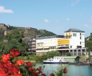
In need of a room? We compiled a list of available hotels close to the map centre further down the page.
Since you are here already, you might want to pay a visit to some of the following locations: Urbar, Niederwerth, Simmern, Miellen and Nievern. To further explore this place, just scroll down and browse the available info.
Local weather forecast
Todays Local Weather Conditions & Forecast: 8°C / 47 °F
| Morning Temperature | 0°C / 33 °F |
| Evening Temperature | 10°C / 50 °F |
| Night Temperature | 4°C / 40 °F |
| Chance of rainfall | 0% |
| Air Humidity | 60% |
| Air Pressure | 1006 hPa |
| Wind Speed | Gentle Breeze with 7 km/h (4 mph) from North-East |
| Cloud Conditions | Overcast clouds, covering 98% of sky |
| General Conditions | Light rain |
Friday, 26th of April 2024
12°C (53 °F)
7°C (44 °F)
Light rain, gentle breeze, broken clouds.
Saturday, 27th of April 2024
17°C (63 °F)
12°C (54 °F)
Light rain, gentle breeze, overcast clouds.
Sunday, 28th of April 2024
16°C (61 °F)
11°C (53 °F)
Light rain, moderate breeze, overcast clouds.
Hotels and Places to Stay
CONTEL Koblenz
Diehls Hotel
Mercure Hotel Koblenz
dingdong koblenz - city apartments
Stein Schiller`s Restaurant
Humboldtruh
Weinlaube
Hamm
Top Hotel Krämer
GHOTEL hotel & living
Videos from this area
These are videos related to the place based on their proximity to this place.
Koblenz - die Stadt am Vater Rhein und Mutter Mosel
Koblenz - die Stadt am Vater Rhein und Mutter Mosel Koblenz - the City on the Rhine and Mosel © Fixivideo Produktion - Hameckewood Film Studios -2010.
Koblenz Seilbahn übern Rhein - mit Glasbodenblick
Die Doppelmayr-Seilbahn quert angewinkelt den Rhein zwischen der Koblenzer St.Kastor-Kirche und der Festung Ehrenbreitstein. Bei der Fahrt mit der Glasboden-Kabine hatte ich zwei Kameras ...
DB Museum Koblenz-Lützel 08.06.2013
08.06.2013 Ein schöner Tag im DB Museum in Koblenz-Lützel. Eine Fahrt mit dem Adler und eine Lokparade. Die 218er sind leider wegen Akku wechseln nicht auf dem Video!
BUGA Koblenz 2011 - Seilbahn bei Traumwetter
BUGA 2011 Koblenz - Seilbahnfahrt mit Nationalhymne cable railway ride by perfect weather.
Seilbahn Koblenz : Rhein-Eifel.TV
http://www.rhein-eifel.tv/koblenz-seilbahn.htm - Die Seilbahn Koblenz wurde extra für die Bundesgartenschau 2011 gebaut, um die Koblenzer Innenstadt mit dem Schloss , der Kastorkirche und...
Hangrutsch in Vallendar
Zu einem Hangrutsch kam es in der Nacht zum 4. März in Vallendar. Oberhalb des Gebäudes in der Rheinstraße 132 setzten sich die Erdmassen in Bewegung.
Feuerwehr Vallendar Cold Water Challenge
Wir danken der Feuerwehr Kaltenengers für die Nominierung. Neu nominieren wir: Feuerwehr Niederwerth, Weißenthurm, Mülheim-Kärlich. Ihr habt 48 Stunden Zeit ein Video hochzuladen, sonst...
Tore und Torszenen JFV U13 vs. JSG Rheinhöhen Vallendar
Die besten Torszenen und Tore aus dem 1. Meisterschaftsspiel der D-Junioren Bezirksliga Mitte zwischen der JSG Rheinhöhen Vallendar/Urbar vs. JFV Rhein-Hunsrück am 12.09.2014 in Vallendar.
Cold-Water-Challenge Kirmesgesellschaft 1927 Vallendar ( Ende August 2014 in Vallendar )
Cold-Water-Challenge Kirmesgesellschaft 1927 Vallendar Die Kirmesgesellschaft 1927 Vallendar bedankt sich beim Bundesspielmannszug 1951 Vallendar e.V. für die Nominierung zur ...
Videos provided by Youtube are under the copyright of their owners.
Attractions and noteworthy things
Distances are based on the centre of the city/town and sightseeing location. This list contains brief abstracts about monuments, holiday activities, national parcs, museums, organisations and more from the area as well as interesting facts about the region itself. Where available, you'll find the corresponding homepage. Otherwise the related wikipedia article.
Moselle (river)
The Moselle is a river flowing through France, Luxembourg, and Germany. It is a left tributary of the Rhine, joining the Rhine at Koblenz. A small part of Belgium is also drained by the Moselle through the Our. Its name comes from the Latin Mosella, meaning the "Little Meuse". The river gave its name to two French départements: Moselle and Meurthe-et-Moselle.
Koblenz (region)
Koblenz was one of the - at last - three Regierungsbezirke of Rhineland-Palatinate, Germany, located in the north-east of the state. The region was created in 1815 as part of the Prussian Rhineland, becoming part of the new state of Rhineland-Palatinate in 1946. In 1968 the neighbouring Montabaur Region was dissolved and its territory annexed to Koblenz Region.
Rhin-et-Moselle
Rhin-et-Moselle is the name of a département of the First French Empire in present Germany. It is named after the rivers Rhine and Moselle. It was formed in 1798, when the left bank of the Rhine was annexed by France. Until the French occupation, its territory was divided between the Archbishopric of Cologne, the Archbishopric of Trier, and the Electorate of the Palatinate. Its territory is part of the present German states of Rhineland-Palatinate and North Rhine-Westphalia.
Ehrenbreitstein Fortress
Ehrenbreitstein Fortress is a fortress on the mountain of the same name on the east bank of the Rhine opposite the town of Koblenz in the German state of Rhineland-Palatinate. It was built as the backbone of the regional fortification system, Festung Koblenz, by Prussia between 1817 and 1832 and guarded the middle Rhine region, an area that had been invaded by French troops repeatedly before. The fortress was never attacked.
Koblenz radio transmitter
Transmitter Koblenz was a medium wave transmitter broadcasting in the Koblenz-Luetzel area. Until 1965, Transmitter Koblenz used a 107 metre tall wood tower, which was erected between 2 October 1934 and 15 November 1934. This tower had originally been one of the two towers of the transmitter Muehlacker, which was dismantled in 1934 in the course of a change of antenna system. In 1965 the wood tower had to be dismantled, because the City of Koblenz terminated the lease on the property.
Middle Rhine
Between Bingen and Bonn, Germany, the Rhine River flows as the Middle Rhine through the Rhine Gorge, a formation created by erosion, which happened at about the same rate as an uplift in the region, leaving the river at about its original level, and the surrounding lands raised. This gorge is quite deep, about 130 meters from the top of the rocks down to the average water-line. The "Middle Rhine" is one of four sections of the river between Lake Constance and the North Sea.
Niederlahnstein
Niederlahnstein is a part of the city of Lahnstein in Rhineland-Palatinate in Germany.
Moselle valley
The Moselle valley is a region in north-eastern France, south-western Germany, and eastern Luxembourg, centred on the river valley formed by the Moselle. The Moselle runs through, and along the borders of, the three different countries, and drains a fourth, Belgium.
Stadion Oberwerth
Stadion Oberwerth is a multi-use stadium in Koblenz, Germany. It is currently mostly used for football matches and is the home stadium of TuS Koblenz, who got relegated to the 3rd German division after the 2009/10 season. The stadium has a total capacity of 15,000 people including 4000 seats.
West Rhine Railway
|} The West Rhine railway is a famously picturesque, double-track electrified railway line running for 185 km from Cologne via Bonn, Koblenz, and Bingen to Mainz. It is situated close to the western (left) bank of the river Rhine and mostly aligned to allow 160 km/h operation between Cologne and Koblenz and between Bingen and Mainz. Line speed between Koblenz and Bingen is restricted by the meandering nature of the Rhine.
Koblenz Central Station
Koblenz Central Station (Koblenz Hauptbahnhof) is a railway station for the city of Koblenz in the German state of Rhineland-Palatinate. It is the focal point of rail transport in the Rhine-Moselle-Lahn area. It is a through station in southern Koblenz built below Fort Großfürst Konstantin and opened in 1902 in the Neustadt (new city), which was built after the demolition of the city walls in 1890.
Vallendar (Verbandsgemeinde)
Vallendar is a Verbandsgemeinde ("collective municipality") in the district Mayen-Koblenz, in Rhineland-Palatinate, Germany. The seat of the municipality is in Vallendar. The Verbandsgemeinde Vallendar consists of the following Ortsgemeinden ("local municipalities"): Niederwerth Urbar Vallendar
Koblenz-Arzheim
not to be confused with Arzheim, Stadtteil of Landau Since 1970 the village Arzheim has been incorporated into the jurisdiction of the city of Koblenz. Hence, the village of Arzheim is now being referred to as Koblenz-Arzheim. 2.200 people live in this suburb, in an area of 4,87km2.
DB Museum, Koblenz
The DB Museum in Koblenz was opened on 21 April 2001 as the first remote site of the Nuremberg Transport Museum. It is run by volunteer workers as part of the Stiftung Bahn-Sozialwerk (BSW), a kind of railway workers social service organisation, and has its origins in a BSW's 'Group for the Preservation of Historical Railway Vehicles' at Koblenz.
Schoenstatt Shrine
The Schoenstatt Shrine is a fundamental part of the Apostolic movement founded by Josef Kentenich in Germany in 1914, a place where the Virgin Mary is invited for protection and influence. A central point in the movement's dynamics and faith is the devotion to the Shrine, based on the first shrine in Schoenstatt where the movement started with a special devotion to Mary and of which there are dozens of replicas around the world.
German Army Command
Army Command in Falckenstein Barracks in Koblenz is one of the two leadership pillars of the German Army, together with the German Army Office. Since 1994, Army Command, as the supreme command authority, has directed the majority of military units within the Army. However, army troops on operations abroad are commanded by the Bundeswehr Operations Command of the Bundeswehr based at Potsdam. Currently Army Command has about 83,500 soldiers in its subordinate organisations.
Electoral Palace, Koblenz
The Electoral Palace in Koblenz, Germany was the residence of the last Archbishop and Elector of Trier, Clemens Wenceslaus of Saxony, who commissioned the building of the castle by the end of the 18th century. In the mid-19th century, the Prussian Crown Prince resided in the castle for a number of years as a Rhenish-Westphalian military governor. Today it is the location of various federal agencies.
Neuwied–Koblenz railway
|} The Koblenz–Neuwied railway is a two-track, electrified main line railway in the German state of Rhineland-Palatinate. It connects the Neuwied station on the Right (east) Rhine line to the major railway junction at Koblenz Hauptbahnhof (central station) and to the Left (west) Rhine and Moselle lines.
Koblenz Stadtmitte station
Koblenz Stadmitte station (German: Haltepunkt Koblenz Stadtmitte, freely translated as "Koblenz City Centre station") was opened on 14 April 2011 on the West Rhine Railway in central Koblenz in the German state of Rhineland Palatinate. The main purpose of this station is to improve public transport access to central Koblenz because it is more convenient than Koblenz Hauptbahnhof (main station).
Pfaffendorf Bridge
The Pfaffendorf Bridge is the oldest bridge over the Rhine at Koblenz in the German state of Rhineland-Palatinate. It carries federal highway B 49 over the Rhine and connects central Koblenz with the suburbs of Pfaffendorf and Ehrenbreitstein. The first bridge was completed in 1864. The current bridge was built in 1953 after this bridge was destroyed in the Second World War.
Basilica of St. Castor
The Basilica of St. Castor (German: Basilika St. Kastor or Kastorkirche) is the oldest church in Koblenz in the German state of Rhineland Palatinate. It is located near Deutsches Eck at the confluence of the Rhine and the Moselle. A fountain called Kastorbrunnen ("Castor well") was built in front of the basilica during Napoleon’s invasion of Russia in 1812. Pope John Paul II raised St. Castor to a basilica minor on 30 July 1991.
Koblenz-Ehrenbreitstein station
Koblenz-Ehrenbreitstein station is the only station on the right (eastern) bank in the city of Koblenz in the German state of Rhineland-Palatinate. It is on the East Rhine railway (German: Rechte Rheinstrecke, Right Rhine line) at the foot of Ehrenbreitstein hill in Ehrenbreitstein district, next to the Rhine.
III Corps (Bundeswehr)
III Corps was a corps of the German Army (Bundeswehr Heer) active from 1957 to 1994. The preparation of the staff of the corps took place from 16 March 1957 at Gneisenau-Kaserne, Koblenz; the corps was officially formed on 6 April 1957. Initially, the 2nd Panzergrenadier Division and 5th Panzer Division moved in 1957 from the II Corps to III Corps. The corps was integrated into defence planning from mid-1957, as part of NATO's Central Army Group, commanded by the commander of the U.S.
Koblenz-Lützel station
Koblenz-Lützel station is the oldest still-operating station in the city of Koblenz in the German state of Rhineland-Palatinate. It was built at the same time as the Koblenz Rhenish station, which was abandoned in 1902 with the opening of the Koblenz Central Station (Hautptbahnhof) and destroyed in World War II. The station is located in the Koblenz suburb of Lützel, near the Moselle river and the Moselle railway bridge. It includes a passenger station and a freight yard.
Koblenz Fortress
Koblenz Fortress was part of a Prussian fortress system near the city of Koblenz in Germany which consisted of the city fortifications of Koblenz and Ehrenbreitstein and exterior supporting constructions such as entrenchments and forts. Koblenz fortress was built in three stages: 1815-1830, 1859-1868 and 1871-1886. The designers were: Ernst von Aster and Gustav von Rauch. Individual parts of the fortication have been preserved, other parts were demolished over the course of time.


