Safety Score: 3,0 of 5.0 based on data from 9 authorites. Meaning we advice caution when travelling to Germany.
Travel warnings are updated daily. Source: Travel Warning Germany. Last Update: 2024-04-16 08:26:06
Touring Hommerdingen
Hommerdingen in Rhineland-Palatinate with it's 61 residents is a town located in Germany about 356 mi (or 572 km) south-west of Berlin, the country's capital place.
Time in Hommerdingen is now 10:45 AM (Tuesday). The local timezone is named Europe / Berlin with an UTC offset of 2 hours. We know of 11 airports nearby Hommerdingen, of which 4 are larger airports. The closest airport in Germany is Bitburg Airport in a distance of 11 mi (or 18 km), East. Besides the airports, there are other travel options available (check left side).
There are several Unesco world heritage sites nearby. The closest heritage site in Germany is Roman Monuments, Cathedral of St Peter and Church of Our Lady in Trier in a distance of 18 mi (or 29 km), South-East. Also, if you like the game of golf, there is an option about 26 mi (or 42 km). away. Need some hints on where to stay? We compiled a list of available hotels close to the map centre further down the page.
Being here already, you might want to pay a visit to some of the following locations: Kruchten, Nusbaum, Mettendorf, Lahr and Biesdorf. To further explore this place, just scroll down and browse the available info.
Local weather forecast
Todays Local Weather Conditions & Forecast: 6°C / 42 °F
| Morning Temperature | 4°C / 39 °F |
| Evening Temperature | 4°C / 40 °F |
| Night Temperature | 4°C / 39 °F |
| Chance of rainfall | 7% |
| Air Humidity | 96% |
| Air Pressure | 1006 hPa |
| Wind Speed | Strong breeze with 19 km/h (12 mph) from East |
| Cloud Conditions | Overcast clouds, covering 100% of sky |
| General Conditions | Moderate rain |
Wednesday, 17th of April 2024
4°C (39 °F)
2°C (35 °F)
Light rain, gentle breeze, overcast clouds.
Thursday, 18th of April 2024
10°C (50 °F)
4°C (39 °F)
Light rain, moderate breeze, scattered clouds.
Friday, 19th of April 2024
5°C (41 °F)
4°C (39 °F)
Light rain, moderate breeze, overcast clouds.
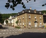
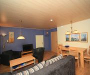
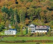
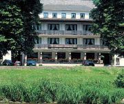
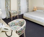
Hotels and Places to Stay
Hotel Dimmer
Dimmer Hotel-Restaurant
Altes Zollhaus
Waldhotel Sonnenberg
Ritschlay Eifel Selektion
Hauer
L'Ernz Noire
Auberge Altringer
Meyer
Videos from this area
These are videos related to the place based on their proximity to this place.
Rando-Moto.be 19-20-21 septembre 2014 WEEK-END EN EIFEL (Full HD)
Rando-Moto.be - 19-20-21 septembre 2014. WEEK-END EN EIFEL - HAUTE DÉFINITION. Info : http://www.rando-moto.be.
Kanufahren/-Verleih auf der Sauer
Die Sauer (französisch Sûre) entspringt im belgischen Teil der Ardennen und fließt in ihrem Oberlauf durch Belgien und Luxemburg. Der Fluss ist über einen längeren Streckenverlauf Grenzfluss...
Ree op de Hondsbierg 3
Regelmatige ''bezoekers'' van Bungalowpark Hondsbierg zijn reeën. Dit is een kort filmpje van een ree dat in de boomgaard van het Bungalowpark staat.
Reeen op de Hondsbierg 7
Ook in het voorjaar komen er Reeen in de boomgaard achter het Bungalowpark Hondsbierg.
Mountainbiking in Luxembourg
Short impression of a Mountainbike weekend in December in Dillingen Luxembourg.
Mandrack-Passage
Video(versuch) der Mandrack-Passage auf dem Felsenweg 2 im Naturpark delux. Hier der Link auf den dazugehörenden Blogeintrag ▻ http://goo.gl/TS4OWz.
Vlammen in de Eiffel
1st: Verstuuver, Suzuki SV650 2nd: TripleEdged, Suzuki GSX-R600 3rd: Hoogesteger, Suzuki GSX-R750 4th: Motorfreak, Kawasaki ZXR750.
Eifel Golf,Golfclub Südeifel,
Willkommen im Golfclub für Jedermann. Bei uns soll sich jeder wohlfühlen. Deshalb bieten wir ein wohliges Ambiente und besondere Angebote für die ganze Familie. Ob Profi, Anfänger oder...
Videos provided by Youtube are under the copyright of their owners.
Attractions and noteworthy things
Distances are based on the centre of the city/town and sightseeing location. This list contains brief abstracts about monuments, holiday activities, national parcs, museums, organisations and more from the area as well as interesting facts about the region itself. Where available, you'll find the corresponding homepage. Otherwise the related wikipedia article.
Our (river)
The Our is also the name of a stream in the municipality of Paliseul, Belgium, tributary of the Lesse. Our {{#invoke:InfoboxImage|InfoboxImage|image=Our_(river). JPG|size=|sizedefault=288px|alt=}}The Our near Vianden {{#invoke:InfoboxImage|InfoboxImage|image=KaartOur.
Wallendorf-Pont
Wallendorf-Pont is a village in the commune of Reisdorf, in eastern Luxembourg. As of 2001, the town has a population of 83. It is located on the Sauer river, on the border with Germany. It is connected to the German town of Wallendorf by a bridge.


