Safety Score: 3,0 of 5.0 based on data from 9 authorites. Meaning we advice caution when travelling to Germany.
Travel warnings are updated daily. Source: Travel Warning Germany. Last Update: 2024-04-19 08:03:45
Delve into Frohnhofen
Frohnhofen in Rhineland-Palatinate with it's 600 habitants is a town located in Germany about 340 mi (or 547 km) south-west of Berlin, the country's capital town.
Time in Frohnhofen is now 11:47 PM (Friday). The local timezone is named Europe / Berlin with an UTC offset of 2 hours. We know of 10 airports closer to Frohnhofen, of which 3 are larger airports. The closest airport in Germany is Zweibrücken Airport in a distance of 17 mi (or 28 km), South. Besides the airports, there are other travel options available (check left side).
There are several Unesco world heritage sites nearby. The closest heritage site in Germany is Völklingen Ironworks in a distance of 25 mi (or 40 km), South-West. In need of a room? We compiled a list of available hotels close to the map centre further down the page.
Since you are here already, you might want to pay a visit to some of the following locations: Altenkirchen, Krottelbach, Dunzweiler, Breitenbach and Dittweiler. To further explore this place, just scroll down and browse the available info.
Local weather forecast
Todays Local Weather Conditions & Forecast: 6°C / 43 °F
| Morning Temperature | 3°C / 38 °F |
| Evening Temperature | 7°C / 44 °F |
| Night Temperature | 3°C / 37 °F |
| Chance of rainfall | 10% |
| Air Humidity | 94% |
| Air Pressure | 1010 hPa |
| Wind Speed | Fresh Breeze with 15 km/h (9 mph) from North-East |
| Cloud Conditions | Overcast clouds, covering 100% of sky |
| General Conditions | Moderate rain |
Saturday, 20th of April 2024
6°C (42 °F)
1°C (34 °F)
Rain and snow, moderate breeze, overcast clouds.
Sunday, 21st of April 2024
5°C (42 °F)
3°C (38 °F)
Light rain, gentle breeze, overcast clouds.
Monday, 22nd of April 2024
8°C (46 °F)
1°C (34 °F)
Broken clouds, gentle breeze.
Hotels and Places to Stay
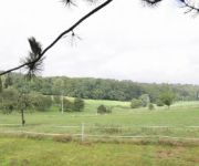
Waldziegelhütte Landhaus
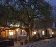
Wern's Mühle Landhaus im Ostertal
Videos from this area
These are videos related to the place based on their proximity to this place.
Freibad Waldmohr - rote Freirutsche Onride
Onride-Video der roten Freibad-Rutsche im Freibad Waldmohr. Mehr Infos und Bilder zum Freibad Waldmohr gibt es unter rutscherlebnis.de/schwimmbadverzeichnis/show/freibad-waldmohr/
Waldmohr [D] - Pfarrkirche St. Georg - Vollgeläute (Turmaufnahme)
Disposition: es' - ges' - as' - ces" Läutedauer: 08.50 Uhr - 08.59 Uhr Die katholische Pfarrkirche St. Georg wurde zwischen 1959 und 1960 mit Unterkirche erbaut. Der Turm verfügt über...
Christoph Saarbrücken 16 Waldmohr Mai 2012
Der RTH Christoph Saarbrücken 16 startet nach einem Einsatz in Waldmohr. Als Landeplatz hat sich der RTH eine leere Pferdekoppel in der Schmittweilerstraße ausgesucht.
Tenerife Spring Break 2k14
BenJanesTV - Pure Entertainment©. Hello Viewers! Please remember to leave a like, comment, and subscribe for Pure Entertainment. Google Plus - http://goo.gl/LrhkIa Stalk me on Instagram!...
Homburg (Saar)-Jägersburg [D] - Pfarrkirche St. Josef - Vollgeläute (Turmaufnahme)
Disposition: d' - fis' - a' - h' Läutedauer: 18.20 Uhr - 18.30 Uhr Das heutige Pfarrheim war 1902 als Notkirche fungiert. Pläne zum Bau der Kirche wurden wegen mehrfacher Finanzierungsprobleme...
Winterlandschaft
Ein Flüg über die schöne Winterlandschaft zwischen Kübelberg und Schmittweiler. War ziemlich böhig und arschkalt :-D.
Ortsportrait/Werbefilm: Verbandsgemeinde Schönenberg-Kübelberg (VGSK)
Eine Produktion von rec it media http://www.rec-it-media.de im Auftrag der Verbandsgemeinde Schönenberg.Kübelberg http://www.vgsk.de.
Videos provided by Youtube are under the copyright of their owners.


!['Waldmohr [D] - Pfarrkirche St. Georg - Vollgeläute (Turmaufnahme)' preview picture of video 'Waldmohr [D] - Pfarrkirche St. Georg - Vollgeläute (Turmaufnahme)'](https://img.youtube.com/vi/12HCGm20csg/mqdefault.jpg)


!['Homburg (Saar)-Jägersburg [D] - Pfarrkirche St. Josef - Vollgeläute (Turmaufnahme)' preview picture of video 'Homburg (Saar)-Jägersburg [D] - Pfarrkirche St. Josef - Vollgeläute (Turmaufnahme)'](https://img.youtube.com/vi/eGSawtRx_kk/mqdefault.jpg)


