Safety Score: 3,0 of 5.0 based on data from 9 authorites. Meaning we advice caution when travelling to Germany.
Travel warnings are updated daily. Source: Travel Warning Germany. Last Update: 2024-04-19 08:03:45
Discover Burgsteinfurt
The district Burgsteinfurt of Steinfurt in Regierungsbezirk Münster (North Rhine-Westphalia) is a district in Germany about 258 mi west of Berlin, the country's capital city.
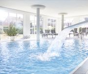
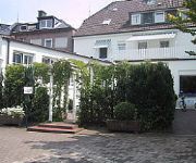
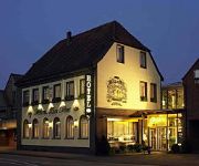
Looking for a place to stay? we compiled a list of available hotels close to the map centre further down the page.
When in this area, you might want to pay a visit to some of the following locations: Wettringen, Laer, Neuenkirchen, Schoppingen and Metelen. To further explore this place, just scroll down and browse the available info.
Local weather forecast
Todays Local Weather Conditions & Forecast: 10°C / 50 °F
| Morning Temperature | 6°C / 43 °F |
| Evening Temperature | 8°C / 46 °F |
| Night Temperature | 6°C / 42 °F |
| Chance of rainfall | 9% |
| Air Humidity | 68% |
| Air Pressure | 1006 hPa |
| Wind Speed | Fresh Breeze with 17 km/h (10 mph) from South-East |
| Cloud Conditions | Overcast clouds, covering 100% of sky |
| General Conditions | Moderate rain |
Saturday, 20th of April 2024
8°C (47 °F)
5°C (41 °F)
Light rain, gentle breeze, overcast clouds.
Sunday, 21st of April 2024
8°C (47 °F)
4°C (39 °F)
Light rain, moderate breeze, broken clouds.
Monday, 22nd of April 2024
7°C (45 °F)
3°C (37 °F)
Overcast clouds, moderate breeze.
Hotels and Places to Stay
Schünemann
Posthotel Riehemann
Zur Post
Holskenbänd
zur Lindenwirtin
Videos from this area
These are videos related to the place based on their proximity to this place.
LS 2013 - My BIG Country V 1.1 mit Wasser Mod - Map Test
Hier teste ich für euch mal die My Big Country Map, Die Map sie ist komplett neu aufgebaut. Es gibt 15 Felder das grösste Feld hat ca. 27 H. Die Kuhweide, Hühnerweide (Direkt am Hof) Schafe...
LS 2013 - Meyenburg 2013 - Map Test
Hier teste ich für euch mal die Meyenburg 2013 Map. Es ist eine schöne Map und sie ist komplett neu aufgebaut. Die Hühner, Schafe und Kühe sind auf dem Haupthof auch die Kuh braucht Wasser...
LS 2013 - KleinberghofenV1 Map Test
Hier teste ich für euch mal die , Kleinberghofen Map, Die Map sie ist komplett neu aufgebaut. Die Hühner und Kühe befinden sich auf dem Hof. Es gibt keine Schafe, aber einen Landhandel als...
Nachwehen Literaturkurs 13 Gymnasium Borghorst (1989)
Der Film "Nachwehen" des Literaturkurses 13 des Gymnasiums Borghorst aus dem Jahr 1989. Aufzeichnung WDR Fernsehen (Schüler machen Filme), 08.06.1989. Bildqualität: VHS.
LS 2013 - CoursePlay Tutorial - Gras sammeln und abfahren
Ich mache für euch ein Tutorial über den CoursePlay für den Landwirtschafts Simulator 2013, in diesen Videos werde ich euch genau zeigen wie die Handhabung des Courseplay stattfinden sollte....
GardenScapes - LetsPlay - Teil 2
Heute mache ich über das Spiel GardenScapes mein 2tes LetsPlay, hier muss man einen Garten gestalten. Um das Geld dafür zu verdienen macht man einen Trödelmarkt im Haus. Ich heute werden...
LS 2013 - Papenburger Map V1 Map Test
Hier ist für euch ein kleiner Einblick in die Papenburger Map, Diese Map ist eine komplett neu aufgebaute Map. Ich finde sie sehr gut da sie viele Neuerungen hat funktionierende Ampelanlage,...
LS 2013 - CoursePlay Tutorial - Ballen sammeln
Ich mache für euch ein Tutorial über den CoursePlay für den Landwirtschafts Simulator 2013, in diesen Videos werde ich euch genau zeigen wie die Handhabung des Courseplay stattfinden sollte....
LS 2013 - Nordhausen - Map Vorstellung
Ich bin heute mal die Nordhausen V1.1 Map abgefahren, Am Teich in der Kuhweide und beim Wollverkauf können Wassertrailer gefüllt werden es gibt eine schöne BGA, und viele Bäume. Im PDA...
Videos provided by Youtube are under the copyright of their owners.
Attractions and noteworthy things
Distances are based on the centre of the city/town and sightseeing location. This list contains brief abstracts about monuments, holiday activities, national parcs, museums, organisations and more from the area as well as interesting facts about the region itself. Where available, you'll find the corresponding homepage. Otherwise the related wikipedia article.
Münster (region)
Münster is one of the five Regierungsbezirks of North Rhine-Westphalia, Germany, located in the north of the state, and named after the capital city of Münster. It includes the area which in medieval times was known as the Dreingau. Regierungsbezirk Münster mostly covers rural lands of the Münsterland which is famous for its castles, e.g. Castle Nordkirchen and Castle Ahaus. The region offers more the 100 castles, all linked up by the bike path 100 Schlösser Route.
Mesum
Mesum is a village south of Rheine, located in the district Steinfurt, part of North Rhine-Westphalia. The current population in 2004 is about 8500. Mesum was first mentioned in 1373 in a document listing the church. That old church still exists as the oldest building of the village. The village grew in the 19th century with the textile industry. At that time, it was part of the Prussian Kingdom.
Schüttorf (Samtgemeinde)
Schüttorf is a Samtgemeinde ("collective municipality") in the district of the County of Bentheim, in Lower Saxony, Germany. Its seat is in the municipality Schüttorf. The Samtgemeinde Schüttorf consists of the following municipalities: Engden Isterberg Ohne Quendorf Samern
Ebbinghof
Ebbinghof is a locality in the municipality Schmallenberg in the district Hochsauerlandkreis in North Rhine-Westphalia, Germany.
Offlumer See
Offlumer See is a lake in Kreis Steinfurt, North Rhine-Westphalia, Germany. At an elevation of 46 m, its surface area is 0.5 km².
Steinfurter Bagno
The Steinfurter Bagno is a park near the town of Burgsteinfurt in the German state of North Rhine-Westfalia. It was founded in 1765 by Count Charles Paul Ernest of Bentheim-Steinfurt with the intention to create a summer residence for his family. The initial design followed the tradition of the French garden which imposes strict order and symmetry on the layout.
Rheine station
Rheine is a railway station located in Rheine, Germany. The station is located on the Löhne–Rheine, Emsland Railway and the Münster–Rheine lines. The train services are operated by Deutsche Bahn and the Westfalenbahn.
Rheine-Mesum station
Rheine-Mesum is a railway station located in Mesum, Germany.
Schüttorf railway station
Schüttorf is a railway station located in Schüttorf, Germany. The station is located on the Almelo - Salzbergen railway. The train services are operated by Westfalenbahn.
Frischebach
Frischebach is a river of North Rhine-Westphalia, Germany.
Frischhofsbach
Frischhofsbach is a river of North Rhine-Westphalia, Germany.
Hemelter Bach
Hemelter Bach is a river of North Rhine-Westphalia, Germany.
Steinfurter Aa
Steinfurter Aa is a river of North Rhine-Westphalia, Germany.
Freilichtbühne Billerbeck
Freilichtbühne Billerbeck is a theatre in North Rhine-Westphalia, Germany.


