Safety Score: 3,0 of 5.0 based on data from 9 authorites. Meaning we advice caution when travelling to Germany.
Travel warnings are updated daily. Source: Travel Warning Germany. Last Update: 2024-04-18 08:12:24
Delve into Ober Karthausen
Ober Karthausen in Regierungsbezirk Arnsberg (North Rhine-Westphalia) is a city located in Germany about 267 mi (or 430 km) west of Berlin, the country's capital town.
Current time in Ober Karthausen is now 11:41 AM (Thursday). The local timezone is named Europe / Berlin with an UTC offset of 2 hours. We know of 9 airports closer to Ober Karthausen, of which 5 are larger airports. The closest airport in Germany is Dortmund Airport in a distance of 22 mi (or 35 km), North. Besides the airports, there are other travel options available (check left side).
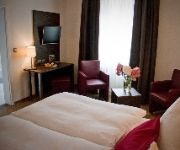
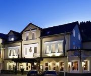
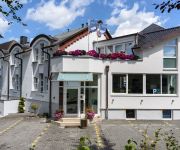
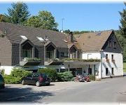
There are several Unesco world heritage sites nearby. The closest heritage site in Germany is Zollverein Coal Mine Industrial Complex in Essen in a distance of 28 mi (or 45 km), North-West. We saw 4 points of interest near this location. In need of a room? We compiled a list of available hotels close to the map centre further down the page.
Since you are here already, you might want to pay a visit to some of the following locations: Schalksmuehle, Luedenscheid, Marienheide, Nachrodt-Wiblingwerde and Hagen. To further explore this place, just scroll down and browse the available info.
Local weather forecast
Todays Local Weather Conditions & Forecast: 9°C / 48 °F
| Morning Temperature | 3°C / 38 °F |
| Evening Temperature | 9°C / 48 °F |
| Night Temperature | 3°C / 38 °F |
| Chance of rainfall | 0% |
| Air Humidity | 59% |
| Air Pressure | 1019 hPa |
| Wind Speed | Gentle Breeze with 7 km/h (4 mph) from South-East |
| Cloud Conditions | Broken clouds, covering 80% of sky |
| General Conditions | Light rain |
Friday, 19th of April 2024
7°C (45 °F)
4°C (38 °F)
Moderate rain, moderate breeze, overcast clouds.
Saturday, 20th of April 2024
7°C (45 °F)
0°C (32 °F)
Rain and snow, moderate breeze, overcast clouds.
Sunday, 21st of April 2024
6°C (43 °F)
0°C (32 °F)
Rain and snow, moderate breeze, overcast clouds.
Hotels and Places to Stay
Passmann
Dresel
Böving Hotel Garni
Lemberg Waldhotel & Restaurant
Haus Koppelberg
Videos from this area
These are videos related to the place based on their proximity to this place.
Monstertruck_Teil 1
Vorstellung vom 30.09.2012 in Halver Zweiter Teil: http://www.youtube.com/watch?v=GkmS9wN7Lg8 Teil 1 von 3 http://www.dynamit-auf-raedern.com/ Aufgenommen mit einer Canon PowerShot ...
Escha-Nordic-Day 2012-Strecke
Vom Freibad geht`s an den Fischteichen vorbei über den Damm auf die "Schnurrenstrecke"; hier sind die Aufnahmen entstanden.
Wie bediene ich Google Earth? Ameteurvideo
Dies ist eine Anleitung, wie ich Google Earth bediene. Hoffe es hilft euch weiter...:)
Halveraner Kirmes 2012 Bonner Break Dance
Das ist ein Schönes video von Bonner Break Dance und wenn ich ehrlich bin sind die LED Tafel garnicht so dunkel wie ihr alle immer behauptet es sind zwar sehr viele aber dunkel ist er nicht ;)
Hülscheid im Sauerland
Ein paar schöne Bilder aus dem lieblichen Sauerland. Hülscheid ist ein Ortsteil von Schalksmühle und liegt zwischen Lüdenscheid und Hagen. Da beginnt dann das Ruhrgebiet *** Some...
Rauchgasdurchzündungsanlage 1 - Feuerwehr Hagen
Im Innenraum des Containers befindet sich eine Gruppe von Feuerwehrleuten mit ihren Ausbildern. In einer speziellen Kammer brennen Paletten, durch öffnen der Türen wird die Durchzündung...
DRF Flugrettung Christoph Dortmund startet durch
Die am Flughafen Dortmund stationierte Maschine des Typs BK 117 mit dem Funkrufnamen Christoph Dortmund DRF Luftrettung wurde heute gegen 10 Uhr zur Volmestrasse Kreuzung Lösenbacher ...
Besoffene an der Glör Part I
Einer der durchaus schwülen Tage im MK, 2 Jungs wollten an der Glör etwas entspannen..... Doch dann wurden Sie unsanft geweckt von ein paar besoffenen lustigen Typen... Dabei entstand dieses...
Videos provided by Youtube are under the copyright of their owners.
Attractions and noteworthy things
Distances are based on the centre of the city/town and sightseeing location. This list contains brief abstracts about monuments, holiday activities, national parcs, museums, organisations and more from the area as well as interesting facts about the region itself. Where available, you'll find the corresponding homepage. Otherwise the related wikipedia article.
Ennepe
The Ennepe is a river and a left tributary of the Volme in Northern Sauerland.


