Safety Score: 3,0 of 5.0 based on data from 9 authorites. Meaning we advice caution when travelling to Germany.
Travel warnings are updated daily. Source: Travel Warning Germany. Last Update: 2024-04-19 08:03:45
Discover Üdorf
Üdorf in Cologne District (North Rhine-Westphalia) is a place in Germany about 299 mi (or 480 km) south-west of Berlin, the country's capital city.
Current time in Üdorf is now 02:15 AM (Saturday). The local timezone is named Europe / Berlin with an UTC offset of 2 hours. We know of 10 airports near Üdorf, of which 5 are larger airports. The closest airport in Germany is Cologne Bonn Airport in a distance of 7 mi (or 12 km), North-East. Besides the airports, there are other travel options available (check left side).
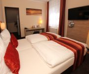
There are several Unesco world heritage sites nearby. The closest heritage site in Germany is Castles of Augustusburg and Falkenlust at Brühl in a distance of 6 mi (or 10 km), North-West. We encountered 2 points of interest in the vicinity of this place. If you need a hotel, we compiled a list of available hotels close to the map centre further down the page.
While being here, you might want to pay a visit to some of the following locations: Alfter, Bonn, Wachtberg, Cologne and Siegburg. To further explore this place, just scroll down and browse the available info.
Local weather forecast
Todays Local Weather Conditions & Forecast: 4°C / 40 °F
| Morning Temperature | 4°C / 39 °F |
| Evening Temperature | 7°C / 45 °F |
| Night Temperature | 5°C / 42 °F |
| Chance of rainfall | 4% |
| Air Humidity | 96% |
| Air Pressure | 1021 hPa |
| Wind Speed | Moderate breeze with 9 km/h (6 mph) from South-East |
| Cloud Conditions | Overcast clouds, covering 100% of sky |
| General Conditions | Light rain |
Sunday, 21st of April 2024
10°C (49 °F)
6°C (42 °F)
Moderate rain, gentle breeze, overcast clouds.
Monday, 22nd of April 2024
9°C (49 °F)
6°C (43 °F)
Overcast clouds, light breeze.
Tuesday, 23rd of April 2024
7°C (44 °F)
6°C (42 °F)
Light rain, light breeze, overcast clouds.
Hotels and Places to Stay
Best Western Hotel Domicil
Clostermanns Hof
Collegium Leoninum
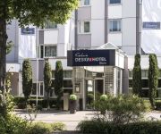
Galerie Design Hotel Bonn
Kaiser Karl Apartmenthotel
Zur Krone Hotel-Gasthaus
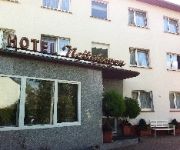
Nettekoven
Zur Boersch
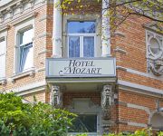
Mozart
Aigner
Videos from this area
These are videos related to the place based on their proximity to this place.
Wetterpilz auf dem Rheidter Werth (Niederkassel) 2014
Wetterpilz-Impression - www.Wetterpilze.de: "Der Wetterpilz lebt, wie seine rechtsrheinisch in Mondorf und Köln-Porz und -Poll gelegenen Nachbarn, von seiner Lage am "Vater Rhein", dem großen...
380 kV Siegtal Nord-Süd - neues Kabel
Arbeiter ziehen an der 380 kV Freileitung Siegtal Nord|Süd ein neues Kabel ein. Diese Leitung verläuft von der linksrheinischen Station Sechtem über den Rhein, zwischen Niederkassel und...
Kampfmittelräumung Röhll
Traktor der Firma Kampfmittelräumung Röhll mit Spezialanhänger, 9. Juli 2012 in Niederkassel Rheidt. --------------------------------- "M B N T" CC NC-sampling+ BY Ant http://www.jamendo.com/...
Blitze - 2012-06-21
Ein paar Blitze vom Gewitter am 21 Juni 2012 über der Kölner Bucht. Gefilmt von Niederkassel Rheidt aus, Kamera etwa in Richtung Troisdorf.
Yanmar Sv 08 minibagger leihen mieten Krings Bonn Bornheim Köln Bagger Hennef Maschinenverleih
Hier Laden wir gerade unseren neuen Sv 08 Yanmar minibagger von unserem lkw ab. Grabtiefe ca 1,5m, Breite 73cm ( geht also durch jede 80" Türe), Durchfahrtshöhe ist 1,55, Gewicht 1080kg bei...
Hublift Arbeitsbühne Bonn Köln Mieten Bluelift Spyder Kettenlift Bornheim Niederkassel Baumfällen
Hier zeigen wir euch unsere neue Kettenarbeitsbühne Von Bluelift auf Kettenfahrwerk. Sie ist sehr geländegängig und schaft auch die 30 grad Rampenwinkel spielend. Wahlweise kann man mit...
EasyStar mit Kamera über Bonn/Bornheim
Zweitflug mit einem Modellflugzeug überhaupt, Erstflug mit einer Kamera.
Videos provided by Youtube are under the copyright of their owners.
Attractions and noteworthy things
Distances are based on the centre of the city/town and sightseeing location. This list contains brief abstracts about monuments, holiday activities, national parcs, museums, organisations and more from the area as well as interesting facts about the region itself. Where available, you'll find the corresponding homepage. Otherwise the related wikipedia article.
Sieg
The Sieg is a river in North Rhine-Westphalia and Rhineland-Palatinate, Germany named after the Sigambrer. It is a right tributary of the Rhine and 153 kilometres in length. The source is located in the Rothaargebirge mountains. From here the river runs southwestwards to the city of Siegen and the hills of Siegerland, both named after the river. Further west the Sieg valley forms the boundary of the Bergisches Land (northern) and Westerwald (southern).
Tannenbusch
Tannenbusch is a section of Bonn, Germany with approx. 17,000 inhabitants. It is split between the subsections Alt-Tannenbusch and Neu-Tannenbusch. The roads in Tannenbusch are almost exclusively named after places in the former East German areas (e.g. Schlesienstrasse, Oppelner road, west Prussia route). Around 1949 – 1960 there was a US military camp in Tannenbusch.
Roisdorf station
Roisdorf station is a through station in the district of Roisdorf of the town of Bornheim in the German state of North Rhine-Westphalia. It was opened on 1 March 1844 on the Left Rhine line, which was opened between Cologne and Bonn on 15 February 1844. It has two platform tracks and it is classified by Deutsche Bahn as a category 5 station.


