Safety Score: 3,0 of 5.0 based on data from 9 authorites. Meaning we advice caution when travelling to Germany.
Travel warnings are updated daily. Source: Travel Warning Germany. Last Update: 2024-04-19 08:03:45
Explore Orsbach
Orsbach in Cologne District (North Rhine-Westphalia) is located in Germany about 339 mi (or 546 km) west of Berlin, the country's capital.
Local time in Orsbach is now 11:20 PM (Friday). The local timezone is named Europe / Berlin with an UTC offset of 2 hours. We know of 11 airports in the wider vicinity of Orsbach, of which 5 are larger airports. The closest airport in Germany is Aachen-Merzbrück Airport in a distance of 8 mi (or 13 km), East. Besides the airports, there are other travel options available (check left side).
There are several Unesco world heritage sites nearby. The closest heritage site in Germany is Aachen Cathedral in a distance of 4 mi (or 6 km), East. Also, if you like golfing, there are multiple options in driving distance. We found 2 points of interest in the vicinity of this place. If you need a place to sleep, we compiled a list of available hotels close to the map centre further down the page.
Depending on your travel schedule, you might want to pay a visit to some of the following locations: Aachen, UEbach-Palenberg, Gangelt, Selfkant and Roetgen. To further explore this place, just scroll down and browse the available info.
Local weather forecast
Todays Local Weather Conditions & Forecast: 8°C / 46 °F
| Morning Temperature | 4°C / 39 °F |
| Evening Temperature | 7°C / 45 °F |
| Night Temperature | 4°C / 39 °F |
| Chance of rainfall | 13% |
| Air Humidity | 88% |
| Air Pressure | 1008 hPa |
| Wind Speed | Fresh Breeze with 16 km/h (10 mph) from North-East |
| Cloud Conditions | Overcast clouds, covering 100% of sky |
| General Conditions | Moderate rain |
Saturday, 20th of April 2024
4°C (39 °F)
4°C (38 °F)
Moderate rain, moderate breeze, overcast clouds.
Sunday, 21st of April 2024
7°C (45 °F)
2°C (36 °F)
Light rain, moderate breeze, overcast clouds.
Monday, 22nd of April 2024
8°C (46 °F)
3°C (37 °F)
Overcast clouds, gentle breeze.
Hotels and Places to Stay
Van der Valk Hotel Kasteel Bloemendal (Aachen Region)
Bilderberg Kasteel Vaalsbroek (Aachen region)
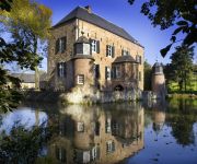
Fletcher Kasteelhotel Erenstein
Campus Boardinghouse
B&B Kasteel Nijswiller
Golden Tulip Parkstad Zuid Limburg
Hotel SnowWorld & Conference
WinselerHof
Overste Hof Hotel & Restaurant
Benelux
Videos from this area
These are videos related to the place based on their proximity to this place.
De PvdA en Vaals een ijzersterke combinatie!
Laten zien wat je ooit in 2010 hebt aangekondigd. Laten zien waar je vanaf nu tot 2018 aan gaat werken. De PvdA draagt een gedegen en doeltreffende visie uit. Een aanpak die voortvloeit uit...
International Bugatti Rally 2012, Vaals, The Netherlands
International Bugatti Rally 2012, Vaals, The Netherlands Organised by Bugatti Club Nederland Mail: Sundog[@]hetnet.nl ©Sundog 2012.
Drielandenpunt Vaals Zuid-Limburg
Impressie van een dagje op de Vaalserberg. Met dank aan het team van de Ontmoeting.
Mtb @ Vaals, Drielandenpunt
Leuke bike-locatie ontdekt - Vaals, Drielandenpunt Soul in the Woods ;o)
Sixsens ~ World of Pleasure
Op een paar minuten afstand van Aachen, in Lemiers-Vaals NL, bevindt zich een van de mooiste nieuwe saunaclubs van Europa. U kunt zich hier eventueel met uw partner, vrienden of zakenrelatie...
Artiola Toska-Balla - Këngë të ndryshme (Live)
Artiola Toska-Balla, Shkelzen Jetishi-Xeni dhe Imer Mehmeti-Baksi kane kenduar ne Vaals te Holandes me daten 05.04.2015.
Videos provided by Youtube are under the copyright of their owners.
Attractions and noteworthy things
Distances are based on the centre of the city/town and sightseeing location. This list contains brief abstracts about monuments, holiday activities, national parcs, museums, organisations and more from the area as well as interesting facts about the region itself. Where available, you'll find the corresponding homepage. Otherwise the related wikipedia article.
Simpelveld
Simpelveld is a municipality and a town in the southeastern Netherlands. Simpelveld has a heritage railway station and is the homebase of the South Limburg Railway Compagny ZLSM . On one weekend in October there is a Day out with Thomas from the children's television series Thomas and Friends.
Vaals
Vaals is a town in the extreme southeastern part of the Dutch province of Limburg, which in its turn finds itself in the southeastern part of the Netherlands. The municipality covers an area of 23.90 km² in the foothills of the Ardennes–Eifelrange and is located about 23 km east of Maastricht and 5 km west of the city centre of Aachen. It borders on both Belgium and Germany. The three borders meet on the Drielandenpunt, a few meters from the highest point of the Netherlands, the Vaalserberg.
Baneheide
Baneheide is a town in the Dutch province of Limburg. It is a part of the municipality of Simpelveld, and lies about 9 km southwest of Kerkrade. In 2001, Baneheide had 65 inhabitants. The built-up area of the town was 0.03 km² and contained 27 residences.
Bocholtz
Bocholtz is a town in the Dutch province of Limburg. It is a part of the municipality of Simpelveld, and lies about 7 km southwest of Kerkrade. Until 1982, it was a separate municipality. In January 2007, Bocholtz had 5,573 inhabitants. The built-up area of the town was 0.76 km², and contained 1,810 residences.
Holset, Netherlands
Holset is a small village in the Dutch province of Limburg. It is located in the municipality of Vaals, about 2 km west of the town of Vaals itself. Holset is about 15 minutes by car from Aachen, just inside the Dutch border in South Limburg. Holset has about 120 inhabitants, a church, hotel, bed-and-breakfast, and pub.
Zuid-Limburgse Stoomtrein Maatschappij
Valkenburg–KerkradeMiljoenenlijntje
Vijlen
Vijlen is a village in the South-East part of the Dutch province of Limburg. The village is constituted of a number of hamlets, among which Mamelis, Camerig, Harles and Cottessen. Including these hamlets, Vijlen has around 1,500 inhabitants (in 2005) and is part of the municipality of Vaals. Located at 200 meters above Normaal Amsterdams Peil, on top of the Vijlenerberg (Vijlener hill), it is the highest situated town in the Netherlands. The neo-gothic and Catholic St.


