Safety Score: 3,0 of 5.0 based on data from 9 authorites. Meaning we advice caution when travelling to Germany.
Travel warnings are updated daily. Source: Travel Warning Germany. Last Update: 2024-04-24 08:14:40
Delve into Flittard
The district Flittard of Leverkusen in Cologne District (North Rhine-Westphalia) is a subburb in Germany about 294 mi west of Berlin, the country's capital town.
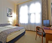
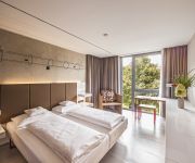
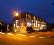
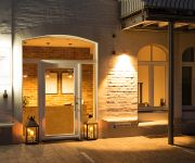
If you need a hotel, we compiled a list of available hotels close to the map centre further down the page.
While being here, you might want to pay a visit to some of the following locations: Cologne, Odenthal, Bergisch Gladbach, Solingen and Mettmann. To further explore this place, just scroll down and browse the available info.
Local weather forecast
Todays Local Weather Conditions & Forecast: 7°C / 45 °F
| Morning Temperature | 4°C / 40 °F |
| Evening Temperature | 7°C / 45 °F |
| Night Temperature | 4°C / 40 °F |
| Chance of rainfall | 8% |
| Air Humidity | 71% |
| Air Pressure | 1009 hPa |
| Wind Speed | Moderate breeze with 9 km/h (6 mph) from South-East |
| Cloud Conditions | Overcast clouds, covering 97% of sky |
| General Conditions | Moderate rain |
Thursday, 25th of April 2024
9°C (47 °F)
7°C (44 °F)
Light rain, gentle breeze, overcast clouds.
Friday, 26th of April 2024
13°C (55 °F)
9°C (47 °F)
Light rain, light breeze, overcast clouds.
Saturday, 27th of April 2024
14°C (57 °F)
12°C (53 °F)
Moderate rain, gentle breeze, overcast clouds.
Hotels and Places to Stay
Viktoria
Kasino
BURNS Art Cologne
Centro Hotel Ayun DELUXE
1st Floor Köln 2
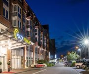
Hotel Park Consul
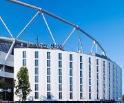
Lindner Hotel Bay Arena
Kaiser
ipartment Concrete
Best Western Leoso Leverkusen
Videos from this area
These are videos related to the place based on their proximity to this place.
Freundschaftsspiel U8 Bayer 04 Leverkusen vs. FC Deetz
Die F-Junioren des FC Deetz erlebten bei Bayer Leverkusen ein Wochenende der besonderen Art!!! Am vergangenen Wochenende (09.05.2014) folgte eine 47 Personen starke Deetzer Delegation ...
Leverkusen: SparkassenKugel eingeweiht (05.12.2014)
Aufgenommen am Ludwig-Erhard-Platz http://www.leverkusen.com/presse/db/presse.php?view=00030856.
Freundschaftsspiel U8 Bayer 04 Leverkusen vs. FC Deetz incl. 3. Halbzeit
Die F-Junioren des FC Deetz erlebten bei Bayer Leverkusen ein Wochenende der besonderen Art!!! Am vergangenen Wochenende (09.05.2014) folgte eine 47 Personen starke Deetzer Delegation ...
D-MODL Dynamic WT9 Rundflug über Leverkusen EDKL
Der erste Versuch einen Flug aufzunehmen mit 2 Kameras und dem Funk + Intercom. Leider läuft das Aufnahmegerät erst ab 01:45, davor der schlechte Ton der GoPros. Schnitt ist auch noch nicht...
Schützenfest Der Große Zapfenstreich der St. Sebastianus Bruderschaft Köln Niehl v. 1849 e. V. 2014
Vor St. Katharina Kirche erklang nach dem Gottesdienst der großen Zapfenstreich. Wo auch sich Gastbrunderschaft aus Zollstock und Weidenpesch ein befunden hatten. Auch Bürger aus Niehl ...
Schützenfest Freitag St. Engelbert Köln Riehl 2013
Aufmarsch beim amtierenden Königspaar von verschiedenen Bruderschaften aus den anderen Stadtteile und Region Bruderschaften in kleine Abordungen mit ihren Majestäten aus St. Donatus Efferen ...
Blockheizkraftwerk Köln-Stammheim
Technische Anlagen des neuen BHKW auf der Kläranlage Köln Stammheim. Technical equipment of the new power station at the WWTP Cologne Stammheim.
Stadtentwässerungsbetriebe Köln, AöR (StEB Köln) - Wunderwerk Klärwerk
Wie funktioniert ein Klärwerk? Anhand des Großkläwerks in Köln Stammheim wird gezeigt, wie ein Klärwerk funktioniert.
AG Rheinblick - Begrüßungsstein
Im Sommer 2008 wurde am südlichen Ortseingang von Köln-Stammheim im Rahmen der Neugestaltung des Rheinufers ein Begrüßungsstein feierlich eingeweiht. Der Stein trägt eine ...
Videos provided by Youtube are under the copyright of their owners.
Attractions and noteworthy things
Distances are based on the centre of the city/town and sightseeing location. This list contains brief abstracts about monuments, holiday activities, national parcs, museums, organisations and more from the area as well as interesting facts about the region itself. Where available, you'll find the corresponding homepage. Otherwise the related wikipedia article.
BayArena
The BayArena is a football stadium in Leverkusen, North Rhine-Westphalia, Germany, which has been the home ground of Bundesliga club Bayer Leverkusen since 1958. It is not a UEFA 5-star stadium, however is in the process of being one. It is iconic due to a few reasons (listed below).
Bayer Cross Leverkusen
The Bayer Cross in the German city of Leverkusen is the largest illuminated advertisement in the world. The advertisement is for Bayer, the multinational pharmaceutical company based in Leverkusen. The advertisement, installed in 1958, shows the emblem of the company Bayer. It hangs on two 118-metre steel towers and possesses a diameter of 51 metres and a weight of 300 tons. It takes 1,712 40-Watt bulbs to light the display. In 2003, the Bayer cross was overhauled completely.
Cologne Zoological Garden
The Aktiengesellschaft Cologne Zoological Garden is the zoo of Cologne, Germany. It features over 7,000 animals of more than 700 species on more than 20 hectares. The internationally renowned zoo with an attached aquarium and invertebrate exhibit has an emphasis on primates such as bonobos and lemurs, and is active in preservational breeding of animals that are in danger of becoming extinct.
Leverkusen-Bürrig water tower
Water Tower Leverkusen-Bürrig is a 72.45 metre high water tower built in 1978 in Leverkusen-Bürrig. It has a water reservoir for 4000 cubic metres with a diameter of 42 metres. The Water Tower Leverkusen-Bürrig should be transformed by special markings in world's largest compass. It has also an observation deck for visitors.
Mülheim, Cologne
Mülheim is a city district of Cologne in Germany and a formerly independent town (Mülheim am Rhein). Mülheim is located on the right bank of the Rhine opposite the old town of Cologne. The district borders Leverkusen to the north, Bergisch Gladbach to the east, the Cologne districts of Kalk and Innenstadt to the south. The river Rhine lies west of Mülheim, on the other riverbank lies the Cologne borough of Nippes.
Mülheim Bridge, Cologne
The Mülheim Bridge (Mülheimer Brücke) in Cologne is a suspension bridge on the river Rhine in Western Germany. It has a main span of 315 metres. The bridge was originally completed in 1929 and rebuilt between 1949 and 1951, having been destroyed in 1944. It connects the city district Riehl on the west side of the river with Mülheim on the east side, after which the bridge is named.
Köln-Stammheim station
Köln-Stammheim is a railway station situated at Stammheim, Cologne in western Germany. It is served by the S6 line of the Rhine-Ruhr S-Bahn.
Flora und Botanischer Garten Köln
The Flora und Botanischer Garten Köln (11.5 hectares) is a municipal formal park and botanical garden located adjacent to Cologne Zoological Garden at Amsterdamer Straße 34, Cologne, North Rhine-Westphalia, Germany. It is open daily without charge.
Nippes, Cologne
Nippes is the Fifth city district of Cologne, Germany. Nippes was merged into the city of Cologne in 1888, the district was formed in 1975. In Niehl, the North-eastern part of the district lies the large Ford Europe production plant. The district borders with the Cologne districts of Chorweiler to the North, Mülheim to the East, Innenstadt to the South and Ehrenfeld to the South-West.
Cologne-Weidenpesch Racecourse
The Cologne-Weidenpesch Racecourse (Galopprennbahn Köln-Weidenpesch) is a horse racing track at Weidenpescher Park in Nippes, Cologne. As the only race course in Germany, hosting more than one European pattern Group 1 race, Weidenpesch is one of the most prominent tracks in the country. Cologne-Weidenpesch is also one of Germany's oldest horse-racing tracks, having been established as a race course in 1897.
Stammheim, Cologne
Stammheim is a municipal part of Cologne, Germany and part of the district of Mülheim. Stammheim lies on the right bank of the river Rhine, between Mülheim (proper) and Flittard. The city part has 7.473 inhabitants (as of 31 December 2008) and covers an area of 3,75 km².
Leverkusen Mitte station
Leverkusen Mitte (Bahnhof Leverkusen Mitte) is a railway station on the Cologne–Duisburg railway, located in Leverkusen, Germany. It is served by regional trains of Deutsche Bahn and the S6 line of the Rhine-Ruhr S-Bahn.
Bayerwerk station
Bayerwerk is a railway station on the Cologne–Duisburg railway, situated in Leverkusen in western Germany. It is served by the S6 line of the Cologne S-Bahn. It is named after the nearby Bayer chemical production plants.
Zoo/Flora (KVB)
Zoo/Flora is a station on the Cologne Stadtbahn line 18, located in the Cologne district of Nippes. The station lies on Riehler Straße, adjacent to nearby Cologne Zoological Garden and Flora & Botanischer Garten, after which the station is named. Also within walking distance lies a station of the Cologne Cable Car (Seilbahn). The station was opened in 1974, substantially renovated in 2010, and consists of two side platforms with two rail tracks.
Boltensternstraße (KVB)
Boltensternstraße is a station on the Cologne Stadtbahn line 18, located in the Cologne district of Nippes. The station lies on Riehler Straße, adjacent to nearby Boltensternstraße, after which the station is named. The station was opened in 1974 and consists of two side platforms with two rail tracks.
Slabystraße (KVB)
Slabystraße is an interchange station on the Cologne Stadtbahn lines 13 and 18, located in the Cologne district of Nippes. The station lies within the western feeder to the Cologne Mülheim Bridge. The station was opened in 1974 and consists of four side platforms with four rail tracks.
Neusser Straße/Gürtel (KVB)
Neusser Straße/Gürtel is an interchange station on the Cologne Stadtbahn lines 12, 13 and 15, located in the Cologne district of Nippes, Germany. The station lies on the Neusser Straße at the place where the Cologne Belt road (Gürtel) would have intersected it, if this section of it had been built. Even though the street was never built, the station carries the steet name in its name.
Amsterdamer Straße/Gürtel (KVB)
Amsterdamer Straße/Gürtel is an interchange station on the Cologne Stadtbahn lines 13 and 16, located in the Cologne district of Nippes. The station lies on the junction of Amsterdamer Straße with the Cologne Belt (Gürtel), after which the station is named. The station was opened in 1974 and consists of both an elevated and an at-grade station, each with two side platforms and two rail tracks.
Wiener Platz (KVB)
Wiener Platz is an interchange station and hub on the Cologne Stadtbahn lines 4, 13 and 18 in the Cologne district of Mülheim. The station is located at Wiener Platz, the center of Mülheim. The station consists of an at-grade station for line 4 and an underground station for line 13 and 18. The underground station was opened in 1997.
Cologne Mülheim Protestant Cemetery
The Protestant cemetery (German: Evangelischer Friedhof Köln-Mülheim) Bergisch Gladbach road (Highway 506) in Mülheim district of Cologne existed since the beginning of the 17th century and is one of the oldest preserved cemeteries in Cologne, Germany. The cemetery is still in operation and used for burials.
Leverkusen-Schlebusch station
Leverkusen-Schlebusch station is a through station in the district of Schlebusch of the city of Leverkusen in the German state of North Rhine-Westphalia. It was opened on 25 August 1867 on the Gruiten–Köln-Deutz railway, which was completed between the former Bergisch-Märkische Railway Company (BME) station in Mülheim and Opladen by the BME on 1 May 1868. It has three platform tracks and it is classified by Deutsche Bahn as a category 5 station.
2004 Cologne bombing
On 9 June 2004, a pipe bomb detonated in Cologne, Germany, in a business area popular with immigrants from Turkey. 22 people were wounded, four sustained serious injuries. A barber's shop was completely destroyed, many shops and numerous parked cars were seriously damaged by the explosion and the nails added to the bomb for extra damage.
RTHC Bayer Leverkusen
Ruder Tennis Hockey Club Bayer Leverkusen (RTHC Bayer Leverkusen e.V. ) is a German rowing, field hockey and tennis club, one of the projects supported by Bayer 04 Leverkusen and Bayer AG and with 2500 members is one of the largest sports clubs in Leverkusen. To take care of the number of athletes are 18 full-time employees and 20 coaches and trainers. The sports facilities of RTHC Bayer Leverkusen are at three locations.
Bayer-Hochhaus
Bayer-Hochhaus is a 32-storey, 122 m, skyscraper in Leverkusen, Germany. When completed in 1963, it was the tallest building in Germany for nine years until 1972 when City-Hochhaus Leipzig was built. {{#invoke: Gallery | gallery}}
Jüdischer Friedhof Köln-Mülheim
Jüdischer Friedhof Köln-Mülheim is a Jewish cemetery in the former city of Mülheim am Rhein, which since 1914 has been incorporated into the district of Cologne, Germany. The cemetery was built in 1774.


