Safety Score: 3,0 of 5.0 based on data from 9 authorites. Meaning we advice caution when travelling to Germany.
Travel warnings are updated daily. Source: Travel Warning Germany. Last Update: 2024-04-19 08:03:45
Discover Höllen
Höllen in Cologne District (North Rhine-Westphalia) is a city in Germany about 316 mi (or 509 km) west of Berlin, the country's capital city.
Local time in Höllen is now 02:43 AM (Saturday). The local timezone is named Europe / Berlin with an UTC offset of 2 hours. We know of 9 airports in the vicinity of Höllen, of which 5 are larger airports. The closest airport in Germany is Norvenich Airport in a distance of 12 mi (or 20 km), South-East. Besides the airports, there are other travel options available (check left side).
There are several Unesco world heritage sites nearby. The closest heritage site in Germany is Aachen Cathedral in a distance of 21 mi (or 33 km), South-West. We discovered 1 points of interest in the vicinity of this place. Looking for a place to stay? we compiled a list of available hotels close to the map centre further down the page.
When in this area, you might want to pay a visit to some of the following locations: Titz, Niederzier, Elsdorf, Merzenich and Juchen. To further explore this place, just scroll down and browse the available info.
Local weather forecast
Todays Local Weather Conditions & Forecast: 5°C / 42 °F
| Morning Temperature | 3°C / 37 °F |
| Evening Temperature | 6°C / 43 °F |
| Night Temperature | 5°C / 40 °F |
| Chance of rainfall | 5% |
| Air Humidity | 85% |
| Air Pressure | 1022 hPa |
| Wind Speed | Fresh Breeze with 13 km/h (8 mph) from South-East |
| Cloud Conditions | Overcast clouds, covering 100% of sky |
| General Conditions | Light rain |
Sunday, 21st of April 2024
10°C (49 °F)
4°C (40 °F)
Light rain, moderate breeze, overcast clouds.
Monday, 22nd of April 2024
9°C (47 °F)
4°C (39 °F)
Overcast clouds, gentle breeze.
Tuesday, 23rd of April 2024
5°C (42 °F)
4°C (40 °F)
Light rain, gentle breeze, overcast clouds.
Hotels and Places to Stay
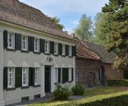
Gut Hohenholz
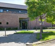
Burg Obbendorf
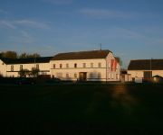
Gut Alte Burg
Videos from this area
These are videos related to the place based on their proximity to this place.
Harlem Shake MGN Maigesellschaft Maifreunde Niederzier
Eines Tages beim Plüme machen für den Dorfmai. Im Räumchen der Maigesellschaft Maifreunde Niederzier.
16.09.2007 Start Chr Europa 1 Niederzier
Am 16.09.2007 war Christoph Europa 1 Gast beim Feuerwehrfest in Niederzier. Eine Alarmierung unterbrach den Besuch.
Streckeninfo - Die Broisterd-Runde des Monte Sophia
Vilvo filmt - http://www.vilvo.de : Eine Orientierungstour über die 5,3Km lange Broisterd-Runde, dem 2012 neu hinzugekommenen Jedermannlauf beim Monte Sophia ...
CATERPILLAR 966E Wheeldozer / Raddozer, Rheinbraun ( RWE ), 1989.
Caterpillar 966E Wheeldozer / Raddozer, Rheinbraun ( RWE ), 1989.
01.09.2012 - Straßenlauf Hambach
Vilvo filmt - http://www.vilvo.de : Eindrücke vom 5er, 10er und Halbmarathon des Hambacher Straßenlaufes http://www.djk-loewe-hambach.de.
SDE 2012 - Das Team Counter Entropy der RWTH Aachen feiert Richtfest
Am 15. Juni 2012 haben Studenten der RWTH Aachen zum Richtfest geladen. Das multidisziplinär besetzte Team stellte damit sein Gebäude erstmals in natura vor, mit dem es im September in Madrid.
Streckeninfo - Monte Sophia (Teil 1)
Vilvo filmt - http://www.vilvo.de : Der Monte Sophia im Training gelaufen und erläutert - Teil 1 http://www.tv-huchem-stammeln.de/la.
Videos provided by Youtube are under the copyright of their owners.
Attractions and noteworthy things
Distances are based on the centre of the city/town and sightseeing location. This list contains brief abstracts about monuments, holiday activities, national parcs, museums, organisations and more from the area as well as interesting facts about the region itself. Where available, you'll find the corresponding homepage. Otherwise the related wikipedia article.
Sophienhöhe
The Sophienhöhe (301.8 m AMSL) is the largest artificial hill worldwide created by surface mining at the open cast lignite mine Tagebau Hambach operated by RWE Power AG in North Rhine-Westphalia, Germany.


