Safety Score: 3,0 of 5.0 based on data from 9 authorites. Meaning we advice caution when travelling to Germany.
Travel warnings are updated daily. Source: Travel Warning Germany. Last Update: 2024-04-24 08:14:40
Discover Mengdorf
Mengdorf in Lower Saxony is a city in Germany about 154 mi (or 247 km) west of Berlin, the country's capital city.
Local time in Mengdorf is now 09:35 AM (Thursday). The local timezone is named Europe / Berlin with an UTC offset of 2 hours. We know of 8 airports in the vicinity of Mengdorf, of which 3 are larger airports. The closest airport in Germany is Celle Airport in a distance of 17 mi (or 27 km), South-East. Besides the airports, there are other travel options available (check left side).
There are several Unesco world heritage sites nearby. The closest heritage site in Germany is St Mary's Cathedral and St Michael's Church at Hildesheim in a distance of 44 mi (or 71 km), South. We discovered 3 points of interest in the vicinity of this place. Looking for a place to stay? we compiled a list of available hotels close to the map centre further down the page.
When in this area, you might want to pay a visit to some of the following locations: Bad Fallingbostel, Wietze, Hademstorf, Essel and Bomlitz. To further explore this place, just scroll down and browse the available info.
Local weather forecast
Todays Local Weather Conditions & Forecast: 8°C / 46 °F
| Morning Temperature | 3°C / 37 °F |
| Evening Temperature | 8°C / 47 °F |
| Night Temperature | 5°C / 42 °F |
| Chance of rainfall | 3% |
| Air Humidity | 76% |
| Air Pressure | 1005 hPa |
| Wind Speed | Gentle Breeze with 8 km/h (5 mph) from East |
| Cloud Conditions | Overcast clouds, covering 100% of sky |
| General Conditions | Light rain |
Friday, 26th of April 2024
8°C (46 °F)
7°C (45 °F)
Overcast clouds, gentle breeze.
Saturday, 27th of April 2024
16°C (61 °F)
11°C (51 °F)
Few clouds, light breeze.
Sunday, 28th of April 2024
21°C (70 °F)
12°C (54 °F)
Light rain, gentle breeze, overcast clouds.
Hotels and Places to Stay
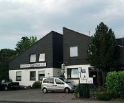
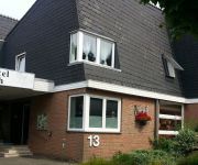
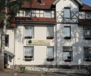
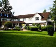
Hotel Heide-Kröpke
Pension Strohm Im Lieth-Cafe
Lieth-Hotel-Grünreich
Haus am Walde
Parkhotel Berlin
Videos from this area
These are videos related to the place based on their proximity to this place.
Bannetze begrüßt die Vizemeisterin Daniela Wollschläger
Daniela Wollschläger wurde auf der German Open in Kreuth Vizemeister im Senior Trail und im Horse & Dog Trail belegte sie den 2. Platz im Bundesfinale. Im Euro Cup holte sie mit der deutschen...
Fallingbostel 16 Tank Transporter RCT/RLC 1987 (4)
A film of the area around Fallingbostel lager/ Kraft Factory/ Queens Avenue/ BAB 7.
Kajaktour auf der Böhme: Dorfmark - Walsrode
Eine Kajaktour Anfang August 2014 auf dem schönen Heidefluss Böhme von Dorfmark bis nach Walsrode. Das Wehr in Bad Fallingbostel wurde 2012 umgebaut und ist nun die im Film zu sehende ...
Chemie-Unfall bei Kraft Foods
16. Oktober 2012 | Stundenlanger Katastrophenalarm in Bad Fallingbostel (Heidekreis, Niedersachsen): Beim Lebensmittelhersteller Kraft Foods wurden Salpetersäure und Natronlauge vermischt....
Friedhelm Kändler Freme Bekannte
Friedhelm Kändler im Kulturgottesdienst am Samstagabend: Am Anfang war das Wort - ein WOWOistischer Gottesdienst Weitere Infos unter www.kulturgottesdienste.de.
Friedhelm Kändler Predikt
Predikt von Friedhelm Kändler im Kulturgottesdienst am Samstagabend. Am Anfang war das Wort - ein WOWOistischer Gottesdienst Weitere Infos unter www.kulturgottesdienste.de.
Seniorenzentrum Schriebers Hof
Geborgenheit und Sicherheit sind elementare Bedürfnisse und gehören zu Lebensqalität. Wie bieten liebevolle Betreuung mit Herz und Verstand in allen Pflegestufen. In einer der landschaftlich...
WOHNIDEE-Haus 2012
Schon zum vierten Mal hat Viebrockhaus in Zusammenarbeit mit der Zeitschrift WOHNIDEE und hochwertigen Partnern, jeder Menge Leidenschaft, Überzeugung und fachlichem Know-how ein ...
Videos provided by Youtube are under the copyright of their owners.
Attractions and noteworthy things
Distances are based on the centre of the city/town and sightseeing location. This list contains brief abstracts about monuments, holiday activities, national parcs, museums, organisations and more from the area as well as interesting facts about the region itself. Where available, you'll find the corresponding homepage. Otherwise the related wikipedia article.
Sieben Steinhäuser
The Sieben Steinhäuser is a group of five dolmens on the Lüneburg Heath in the NATO training area of Bergen-Hohne, in the state of Lower Saxony in northern Germany. The stones are considered to be part of the funnelbeaker culture (3,500 - 2,800 B.C.). The gravesite was granted protected cultural monument status in 1923.
Hartem
Hartem was a village in the Heidmark, an area within the Lüneburg Heath in Lower Saxony, Germany. In 1935/1936 Hartem disappeared from the map. The German armed forces, the Wehrmacht established a military training area (today the largest of its kind in Europe, the Bergen-Hohne Training Area). Its inhabitants were resettled.
Benhorn
Benhorn was a village in the old district of Fallingbostel, on the Heidmark in Lower Saxony in North Germany. It disappeared from the map in 1935/36, because the German Wehrmacht wanted to establish the Bergen-Hohne Training Area, today the largest military training area in Germany. The inhabitants were resettled.


