Safety Score: 3,0 of 5.0 based on data from 9 authorites. Meaning we advice caution when travelling to Germany.
Travel warnings are updated daily. Source: Travel Warning Germany. Last Update: 2024-04-24 08:14:40
Delve into Altendorf
The district Altendorf of Holzminden in Lower Saxony is a district located in Germany about 174 mi west of Berlin, the country's capital town.
In need of a room? We compiled a list of available hotels close to the map centre further down the page.
Since you are here already, you might want to pay a visit to some of the following locations: Heinsen, Hoexter, Arholzen, Brevorde and Pegestorf. To further explore this place, just scroll down and browse the available info.
Local weather forecast
Todays Local Weather Conditions & Forecast: 7°C / 44 °F
| Morning Temperature | 2°C / 36 °F |
| Evening Temperature | 7°C / 45 °F |
| Night Temperature | 3°C / 37 °F |
| Chance of rainfall | 3% |
| Air Humidity | 82% |
| Air Pressure | 1006 hPa |
| Wind Speed | Gentle Breeze with 8 km/h (5 mph) from East |
| Cloud Conditions | Overcast clouds, covering 100% of sky |
| General Conditions | Rain and snow |
Friday, 26th of April 2024
10°C (50 °F)
6°C (43 °F)
Light rain, gentle breeze, overcast clouds.
Saturday, 27th of April 2024
16°C (61 °F)
9°C (49 °F)
Light rain, light breeze, clear sky.
Sunday, 28th of April 2024
20°C (69 °F)
11°C (51 °F)
Light rain, gentle breeze, overcast clouds.
Hotels and Places to Stay
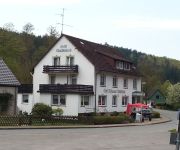
Hellers Krug
Schleifmühle
Weserhotel Schwager
Kiekenstein
Waldschloß
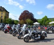
Gasthaus Reimer Bikerhaus
Buntrock
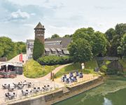
Tonenburg Hotel- Restaurant & Eventlocation
Steinkrug Landhaus
Videos from this area
These are videos related to the place based on their proximity to this place.
Daniel Norgren & Band - Whatever Turns You On - Forstwirtschaft, Bevern-Forst - 06.10.2012
Daniel Norgren's first ever gig in Germany was done at the ten year anniversary of Club Musik Holzminden. www.facebook.com/pages/Daniel-Norgren/54884290308 www.superpumarecords.com ...
Freistaat Oberschlesien - Niepodległy Górny Śląsk [1/2]
Po Wielkiej Wojnie zakończonej 11 listopada 1918 roku w Europie Środkowej wrzało. Niepodległość "z marszu" uzyskały Czechosłowacja i Polska. Nie wszyscy wiedzą jednak, że istniały...
Beveraner Tuning Freakz
Wir sind ein Marken offener Autoclub. Bei uns geht es nicht nur um Tuning sondern auch um Schrauben an den KFZ und Spaß am KFZ. Wir haben zum Beispiel auch Quads und Buggys im Club und ...
2012 Fronleichnam St-Josef Holzminden 1.MOV
Beginn der Fronleichnamsprozession am 07.06.2012. Pfarrer Stefan Reinecke.
Weihnachtsmarkt Holzminden 2014
Weihnachtsmarkt Holzminden mit "Eiszauber" vom 24.11.2014 bis 04.01.2015 Die Weihnachtszeit ist für viele die schönste Zeit des Jahres. Der Weihnachtsmarkt in Holzminden mit seiner Hauptattrakti.
Eiskunstlaufen Holzminden Theodore and Jean Phillips
After 3 years dedicated Inline Speedskating, both Theo and Jean have returned to the ice and gave the crowd at Holzminden/Germany christmas market a small show from what they enjoy doing best....
Kurvenjäger | motorradfahrer-unterwegs.de im Weserbergland (1)
Kurvenjäger | motorradfahrer-unterwegs.de reiste am vergangenen Wochenende ins Weserbergland und arbeite insbesondere an der Perfektionierung der erlernten Kurvenfahrtechik. Mehr Lesen: ...
Holzminden kleiner Jahresrückblick 2014
ein kleiner Jahresrückblick mit Bildern und Ton von H. Schwendler bearbeitet mit Magix Foto auf DVD und Magix Musikmaker für unsere Facebook-Gruppe ...
Videos provided by Youtube are under the copyright of their owners.
Attractions and noteworthy things
Distances are based on the centre of the city/town and sightseeing location. This list contains brief abstracts about monuments, holiday activities, national parcs, museums, organisations and more from the area as well as interesting facts about the region itself. Where available, you'll find the corresponding homepage. Otherwise the related wikipedia article.
Holzminden (district)
Holzminden is a district in Lower Saxony, Germany. It is bounded by (from the north and clockwise) the districts of Hamelin-Pyrmont, Hildesheim and Northeim, and by the state of North Rhine-Westphalia.
Weser Uplands
The Weser Uplands is a hill region (Bergland = uplands, hills or hill region) in Germany (Lower Saxony, Hesse, and North Rhine-Westphalia, between Hannoversch Münden and Porta Westfalica near the river Weser. Important cities of this region include Bad Karlshafen, Holzminden, Höxter, Bodenwerder, Hameln, Rinteln, and Vlotho.
Imperial Abbey of Corvey
The Imperial Abbey of Corvey was a Benedictine monastery on the River Weser, 2 km northeast of Höxter, now in North Rhine-Westphalia, Germany.
Bodenwerder (Samtgemeinde)
Bodenwerder was a Samtgemeinde ("collective municipality") in the district of Holzminden, in Lower Saxony, Germany. Its seat was in the town Bodenwerder. On 1 January 2010, it merged with the former Samtgemeinde Polle to form the new Samtgemeinde Bodenwerder-Polle. The Samtgemeinde Bodenwerder consisted of the following municipalities: Bodenwerder Halle Hehlen Heyen Kirchbrak
Boffzen (Samtgemeinde)
Boffzen is a Samtgemeinde ("collective municipality") in the district of Holzminden, in Lower Saxony, Germany. Its seat is in the municipality Boffzen. The Samtgemeinde Boffzen consists of the following municipalities: Boffzen Derental Fürstenberg
Polle (Samtgemeinde)
Polle was a Samtgemeinde ("collective municipality") in the district of Holzminden, in Lower Saxony, Germany. Its seat was in the village Polle. On 1 January 2010, it merged with the former Samtgemeinde Bodenwerder to form the new Samtgemeinde Bodenwerder-Polle. The Samtgemeinde Polle consisted of the following municipalities: Brevörde Heinsen Ottenstein Polle
Stadtoldendorf (Samtgemeinde)
Stadtoldendorf was a Samtgemeinde ("collective municipality") in the district of Holzminden, in Lower Saxony, Germany. Its seat was in the town Stadtoldendorf. On 1 January 2011, it merged with the former Samtgemeinde Eschershausen to form the new Samtgemeinde Eschershausen-Stadtoldendorf. The Samtgemeinde Stadtoldendorf consisted of the following municipalities: Arholzen Deensen Heinade Lenne Stadtoldendorf
Amelungsborn Abbey
Amelungsborn Abbey, also Amelunxborn Abbey (Kloster Amelungsborn) near Negenborn and Stadtoldendorf, in the Landkreis of Holzminden in the Weserbergland, was the second oldest Cistercian foundation in Lower Saxony, Germany, after Walkenried Abbey. It survived the Reformation by becoming Lutheran, and with Loccum Abbey, also previously Cistercian, is one of the only two Lutheran monasteries in Germany with an uninterrupted tradition. The abbey church, St.
Solling
The Solling is a range of hills up to 527.8 m above sea level high in the Weser Uplands in the German state of Lower Saxony, whose extreme southerly foothills extend into Hesse and North Rhine-Westphalia. Inside Lower Saxony it is the second largest range of hills and the third highest after the Harz and the Kaufungen Forest. The Solling is a cultural landscape consisting mainly of spruce and beech forests. Oak also grows in some areas.
Vogler
The Vogler is a range of hills, up to 460.4 m high, in the Weser Uplands in southern Lower Saxony. Together with the Solling, the Vogler forms the Solling-Vogler Nature Park which lies a couple of kilometres further south.
Ottenstein Plateau
The Ottenstein Plateau (German: Ottensteiner Hochebene or Ottensteiner Hochfläche) is part of the Lower Saxon Weser Uplands and lies between Bodenwerder and Bad Pyrmont. Compared with the surrounding area of the Weser and Emmer valleys, the plateau is a largely open plain, about 200 m higher, and which lies between 250 and 350 metres above sea level. Its highest elevation is 376 m AMSL and lies not far from the village of Eichenborn. Agriculture and wind power characterise the landscape.
Bodenwerder-Polle
Bodenwerder-Polle is a Samtgemeinde ("collective municipality") in the district of Holzminden, in Lower Saxony, Germany. Its seat is in the town Bodenwerder. It was formed on 1 January 2010 by the merger of the former Samtgemeinden Bodenwerder and Polle. The Samtgemeinde Bodenwerder-Polle consists of the following municipalities: Bodenwerder Brevörde Halle Hehlen Heinsen Heyen Kirchbrak Ottenstein Pegestorf Polle
Upper Weser Valley
The Upper Weser Valley in central Germany has been formed by the Upper Weser river cutting through the Weser Uplands for around 200 kilometres between the towns of Hann. Münden and Minden. It lies in the German federal states of Lower Saxony, Hesse and North Rhine-Westphalia.
Ebersnacken
At 460 metres above sea level the Ebersnacken is the highest hill in the forested uplands of the Vogler in Lower Saxony, Germany. The hill is situated in the district of Holzminden about half way as the crow flies between Bodenwerder to the northwest and Stadtoldendorf to the southeast.
Solling-Vogler Nature Park
The Solling-Vogler Nature Park is a nature park in South Lower Saxony in Germany. It has an area of 52,000 hectares and was established in 1966. The nature park includes the hill ranges of the Solling and the Vogler but also the Burgberg which lies east of Weser valley between the two upland regions. It is looked after by the Zweckverband Naturpark Solling-Vogler, whose sponsors are the districts of Holzminden and Northeim and the state of Lower Saxony.
Burgberg (ridge)
The Burgberg (also called the Burgberge) is a ridge of hills up to 345.2 m above sea level high in the German federal state of Lower Saxony.
Fürstenberg China
The Fürstenberg China Factory was founded on 11 January 1747 in Fürstenberg an der Weser by Johann Georg von Langen at the direction of Duke Charles I of Brunswick-Wolfenbüttel and is the second oldest porcelain manufacturer in Germany that still operates on its original site. From 1888 the operation was turned into a public limited company.
Höxter Rathaus station
Höxter Rathaus is a railway station located in Höxter, Germany.
Wehrden station
Wehrden is a railway station located in Wehrden, Germany.
Eschershausen-Stadtoldendorf
Eschershausen-Stadtoldendorf is a Samtgemeinde ("collective municipality") in the district of Holzminden, in Lower Saxony, Germany. Its seat is in the town Stadtoldendorf. It was formed on 1 January 2011 by the merger of the former Samtgemeinden Eschershausen and Stadtoldendorf. The Samtgemeinde Eschershausen-Stadtoldendorf consists of the following municipalities: Arholzen Deensen Dielmissen Eimen Eschershausen Heinade Holzen Lenne Lüerdissen Stadtoldendorf
Dürre Holzminde
Dürre Holzminde is a river of Lower Saxony, Germany.
Hasselbach (Dürre Holzminde)
Hasselbach is a river of Lower Saxony, Germany.
Holzminde
Holzminde is a river of Lower Saxony, Germany.
Grube (Weser)
Grube (Weser) is a river of North Rhine-Westphalia, Germany.
Nethe
Nethe is a river of North Rhine-Westphalia, Germany. In 1912, Natko Nodilo sustained injuries at river Nethe that would eventually lead to his death.


!['Freistaat Oberschlesien - Niepodległy Górny Śląsk [1/2]' preview picture of video 'Freistaat Oberschlesien - Niepodległy Górny Śląsk [1/2]'](https://img.youtube.com/vi/TkiM7JgLADY/mqdefault.jpg)


