Safety Score: 3,0 of 5.0 based on data from 9 authorites. Meaning we advice caution when travelling to Germany.
Travel warnings are updated daily. Source: Travel Warning Germany. Last Update: 2024-04-24 08:14:40
Discover Oberlistingen
Oberlistingen in Regierungsbezirk Kassel (Hesse) is a town in Germany about 193 mi (or 310 km) south-west of Berlin, the country's capital city.
Current time in Oberlistingen is now 04:27 AM (Thursday). The local timezone is named Europe / Berlin with an UTC offset of 2 hours. We know of 12 airports near Oberlistingen, of which 5 are larger airports. The closest airport in Germany is Kassel-Calden Airport in a distance of 7 mi (or 11 km), East. Besides the airports, there are other travel options available (check left side).
There are several Unesco world heritage sites nearby. The closest heritage site in Germany is Bergpark Wilhelmshöhe in a distance of 11 mi (or 18 km), South-East. We discovered 2 points of interest in the vicinity of this place. Looking for a place to stay? we compiled a list of available hotels close to the map centre further down the page.
When in this area, you might want to pay a visit to some of the following locations: Breuna, Calden, Rhoden, Espenau and Kassel. To further explore this place, just scroll down and browse the available info.
Local weather forecast
Todays Local Weather Conditions & Forecast: 8°C / 46 °F
| Morning Temperature | 2°C / 35 °F |
| Evening Temperature | 7°C / 45 °F |
| Night Temperature | 2°C / 36 °F |
| Chance of rainfall | 2% |
| Air Humidity | 69% |
| Air Pressure | 1006 hPa |
| Wind Speed | Moderate breeze with 9 km/h (6 mph) from East |
| Cloud Conditions | Overcast clouds, covering 100% of sky |
| General Conditions | Light rain |
Friday, 26th of April 2024
10°C (50 °F)
5°C (42 °F)
Overcast clouds, gentle breeze.
Saturday, 27th of April 2024
16°C (60 °F)
9°C (48 °F)
Light rain, gentle breeze, few clouds.
Sunday, 28th of April 2024
19°C (66 °F)
11°C (52 °F)
Light rain, gentle breeze, overcast clouds.
Hotels and Places to Stay
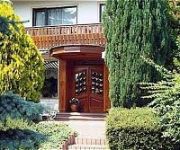
Sonneneck Landhotel
Franzbäcker Pension
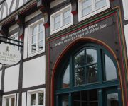
Alt Warburg
Rosbacher Stuben Landgasthof
Videos from this area
These are videos related to the place based on their proximity to this place.
Mittelaltermarkt, Mittelalter-Spektakel in Warburg am 14.4.2013 von tubehorst1
Mittelalter- Spektakel in Warburg am 14.4.2013. Mittelalterfest und Ritterkämpfe.
Fliegen auf dem Desenberg
Da habe ich versucht das unmögliche zu wagen und bin oben auf dem Desenberg gestartet und von der Burg aus immer stückchenweise während des Fluges weiter runter gegangen, da oben die ...
Unimog 406 mit 3m Federzinkengrubber
Unimog 406 mit Grubber in Daseburg nähe Desenberg. Schöner Heidehof im Hintergrund.
Lkw-Unfall auf der A44 bei Breuna
Breuna, 10. Dezember 2014: Am Mittwochvormittag hat es nach Angaben der Polizei auf der A44 bei Breuna einen Unfall mit einem Lkw gegeben. Der Fahrer wurde dabei leicht verletzt. Es kam zu...
Mann bei Unfall auf der A44 zwischen Breuna und Zierenberg schwer verletzt
http://www.youtube.com/hnaonline - Breuna/Zierenberg. Nach einem Unfall am Donnerstagmorgen auf der A44 zwischen den Anschlussstellen Breuna und Zierenberg hat es am Mittag einen weiteren ...
Wickeltanz zum Kirmesabschluss in Breuna
Breuna, 16. Juli 2013: Wenn Küsse ein Muss sind und am Ende eines Strohtunnels die Tanzfläche wartet, kann das nur eins bedeuten: Wickeltanz zum Kirmesabschluss in Breuna.
Unfall auf A44 mit Lastwagen zwischen Breuna und Warburg
Breuna, 26.07.2013: Unverletzt blieb ein 35-jähriger Lkw-Fahrer aus Ungarn, der am Freitag gegen 11 Uhr mit seinem Sattelzug auf der A 44 zwischen den Anschlussstellen Breuna und Warburg ...
A44: Lastwagen verunglückte zwischen Breuna und Zierenberg
Breuna, 31. Mai 2014: Am Samstagmorgen war ein Lastwagen auf der A44 ins Schleudern geraten und hatte sich in Fahrtrichtung Kassel verkeilt. Auf Höhe des Rasthofes Bühleck kam er zum Stehen.
Videos provided by Youtube are under the copyright of their owners.
Attractions and noteworthy things
Distances are based on the centre of the city/town and sightseeing location. This list contains brief abstracts about monuments, holiday activities, national parcs, museums, organisations and more from the area as well as interesting facts about the region itself. Where available, you'll find the corresponding homepage. Otherwise the related wikipedia article.
Escheberg (mountain)
Escheberg (Berg) is a mountain of Hesse, Germany.
Igelsbett
Igelsbett is a mountain of Hesse, Germany.
Eggel
Eggel is a river of Hesse, Germany.


