Safety Score: 3,0 of 5.0 based on data from 9 authorites. Meaning we advice caution when travelling to Germany.
Travel warnings are updated daily. Source: Travel Warning Germany. Last Update: 2024-04-19 08:03:45
Discover Achner
Achner in Upper Bavaria (Bavaria) is a place in Germany about 351 mi (or 565 km) south of Berlin, the country's capital city.
Current time in Achner is now 06:37 AM (Saturday). The local timezone is named Europe / Berlin with an UTC offset of 2 hours. We know of 12 airports near Achner, of which 5 are larger airports. The closest is airport we know is Innsbruck Airport in Austria in a distance of 24 mi (or 39 km). The closest airport in Germany is Oberpfaffenhofen Airport in a distance of 34 mi (or 39 km), South. Besides the airports, there are other travel options available (check left side).
There are several Unesco world heritage sites nearby. The closest heritage site in Germany is Pilgrimage Church of Wies in a distance of 27 mi (or 43 km), West. We encountered 3 points of interest in the vicinity of this place. If you need a hotel, we compiled a list of available hotels close to the map centre further down the page.
While being here, you might want to pay a visit to some of the following locations: Jachenau, Benediktbeuern, Lenggries, Bichl and Bad Heilbrunn. To further explore this place, just scroll down and browse the available info.
Local weather forecast
Todays Local Weather Conditions & Forecast: 3°C / 38 °F
| Morning Temperature | 2°C / 35 °F |
| Evening Temperature | 3°C / 38 °F |
| Night Temperature | 2°C / 35 °F |
| Chance of rainfall | 2% |
| Air Humidity | 97% |
| Air Pressure | 1019 hPa |
| Wind Speed | Gentle Breeze with 6 km/h (4 mph) from East |
| Cloud Conditions | Overcast clouds, covering 99% of sky |
| General Conditions | Rain and snow |
Sunday, 21st of April 2024
4°C (40 °F)
-3°C (26 °F)
Light snow, light breeze, overcast clouds.
Monday, 22nd of April 2024
5°C (41 °F)
-2°C (29 °F)
Light rain, light breeze, overcast clouds.
Tuesday, 23rd of April 2024
8°C (47 °F)
2°C (36 °F)
Rain and snow, light breeze, broken clouds.
Hotels and Places to Stay
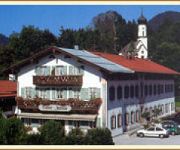
Gasthof Jachenau
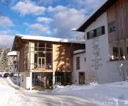
Jäger von Fall
Videos from this area
These are videos related to the place based on their proximity to this place.
October Shredding - Bikepark Lenggries Fall 2013
Snow, Sunshine, Whips, Flips, Nacs, Slow-mos and a riding Sister ! This is my Edit of the last two weekends of the 2013 season at Bikepark Lenggries. Cameras: GoPro HD Hero 3+, Sony NEX FS...
Gleitschirmfliegen am Brauneck (Lenggries/Bad Tölz) erster Thermikflug
Am 17. März 2012 war es soweit, mit dem Bayernticket fuhren Sandra und ich bis ins ferne Lenggries zum Paragliden, wo ich meine ersten Thermikerfahrungen mit Joachim machte =). Es wurde ein...
1st Ride@Bikepark - Lenggries Mai2014
1st Ride im Bikepark in Lenggries mit meinem Lapierre X-160 Line: Flow Ride / Bavarian A-Line Sound: Left Boy - Jack Sparrow.
Hochseilgarten Isarwinkel in Lenggries (Bayerische Voralpen) - Bayern, Deutschland
Der Hochseilgarten Isarwinkel in Lenggries. Bilder unter: http://www.christianengl.de/brauneck.shtml.
Skiopening Brauneck / Lengriess 2009 Impressionen
Skiopening Brauneck / Lengriess 2009 Impressionen. Infos unter http://www.ganz-muenchen.de/umland/lenggries/brauneck/winter/skiopening.html.
Traveler - eng sub - Germany - Bavaria - peak Kohlberg 1046m ASL
Podróżnik - Niemcy - Bawaria, Szczyt Kohlberg 1046m n.p.m. 2013-08-15 - zwiedzam podliskie góry i szczyt Kohlberg w Obermurbach - Lenggries, około 65km na południe od Monachium.
Brauneck Stie-Alm webcam time lapse 2011-2012
http://www.wintersporters.nl - Bekijk hoe het seizoen 2011-2012 in Brauneck Stie-Alm is verlopen. Een prachtige webcam time lapse.
Videos provided by Youtube are under the copyright of their owners.
Attractions and noteworthy things
Distances are based on the centre of the city/town and sightseeing location. This list contains brief abstracts about monuments, holiday activities, national parcs, museums, organisations and more from the area as well as interesting facts about the region itself. Where available, you'll find the corresponding homepage. Otherwise the related wikipedia article.
Staffel (mountain)
Staffel (Berg) is a mountain of Bavaria, Germany.


