Safety Score: 3,0 of 5.0 based on data from 9 authorites. Meaning we advice caution when travelling to Germany.
Travel warnings are updated daily. Source: Travel Warning Germany. Last Update: 2024-04-25 08:17:04
Delve into Buch
Buch in Regierungsbezirk Unterfranken (Bavaria) is located in Germany about 200 mi (or 321 km) south-west of Berlin, the country's capital town.
Current time in Buch is now 03:16 PM (Thursday). The local timezone is named Europe / Berlin with an UTC offset of 2 hours. We know of 12 airports close to Buch, of which 5 are larger airports. The closest airport in Germany is Bamberg-Breitenau Airport in a distance of 15 mi (or 25 km), South. Besides the airports, there are other travel options available (check left side).
There are several Unesco world heritage sites nearby. The closest heritage site in Germany is Town of Bamberg in a distance of 17 mi (or 27 km), South. We encountered 3 points of interest near this location. If you need a hotel, we compiled a list of available hotels close to the map centre further down the page.
While being here, you might want to pay a visit to some of the following locations: Untermerzbach, Pfarrweisach, Gerach, Reckendorf and Kirchlauter. To further explore this place, just scroll down and browse the available info.
Local weather forecast
Todays Local Weather Conditions & Forecast: 6°C / 43 °F
| Morning Temperature | 2°C / 35 °F |
| Evening Temperature | 6°C / 43 °F |
| Night Temperature | 1°C / 34 °F |
| Chance of rainfall | 2% |
| Air Humidity | 70% |
| Air Pressure | 1008 hPa |
| Wind Speed | Gentle Breeze with 8 km/h (5 mph) from East |
| Cloud Conditions | Overcast clouds, covering 100% of sky |
| General Conditions | Rain and snow |
Friday, 26th of April 2024
11°C (52 °F)
5°C (42 °F)
Broken clouds, gentle breeze.
Saturday, 27th of April 2024
17°C (62 °F)
8°C (47 °F)
Scattered clouds, light breeze.
Sunday, 28th of April 2024
20°C (68 °F)
11°C (52 °F)
Broken clouds, gentle breeze.
Hotels and Places to Stay
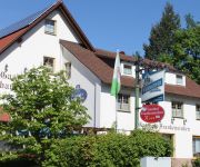
Frankenstuben Gasthof
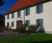
Zur Alten Kaserne Landhotel
Pörtnerhof
Post Gasthof
Fränkische Landherberge Hotel Garni
Eisfelder Gasthof
Videos from this area
These are videos related to the place based on their proximity to this place.
Christenstein 2005 Teil2
Felsenführung 2005 von Irene und Oswald Tränkenschuh am Christenstein bei Heilgersdorf Ufr. Germany. Felsgruppe Schalensteine, Partnerstein, Hexentanzplatz. Siehe auch Hompage www.
FPV Flug über die Altstadt von Ebern - Teil 2
Lange hat es gedauert aber nun ist er fertig der Teil 2 von der Eberner Altstadt. Ebern ist meine Heimatstadt. Ein unterfränkische Kleinstadt im Landkreis Haßberge zwischen Bamberg,Coburg...
Kopter Luftaufnahmen Alte Kaserne Ebern im Herbst 2013
HD Luftaufnahmen über der alten Kaserne Ebern im Oktober 2013. Aufgenommen mit Quadrocopter Walkera QR X350 mit angehängter Gopro Hero 3 Kamera.
FPV Rundflug ehemaliges Panzergelände Ebern Teil 2
Ein Rundflug über das Panzergelände der ehemaligen Kaserne Ebern. 12 Jahre nachdem sie geschlossen wurde gibt es immer noch vieles von damals. Im zweiten Teil gibt es einen ...
FPV Rundflug ehemaliges Panzergelände Ebern Teil 1
Ein Rundflug über bzw. um das Panzergelände der ehemaligen Kaserne Ebern. 12 Jahre nachdem sie geschlossen wurde gibt es immer noch vieles von damals. Beginnend vom Solarfeld im Südosten...
Ebern Hambach BMW M3 Coupé V8
Die beliebte Motorradfahrer Strecke zwischen Untermerzbach und Ebern. Macht auch mit dem Auto Spaß. Ein Zusammenschnitt einiger Fahrten aus dem Sommer. Aufgenommen mit unterschiedlichen ...
Flug über Teile der Altstadt von Ebern FPV Kopterflug Teil 1
FPV Flug über Teile der Eberner Altstadt im November 2013.
FPV Luftaufnahmen Jugendkartslalom Ebern am 21.04.2014
Ein kleines Video vom Jugendkartslalom am 21.04.2014 in der alten Kaserne Ebern, aufgenommen mit einem Hexakopter und GoPro Hero 3 Kamera.
D. Dinkel - T. Berthold Hassbergrallye Ebern WP5
Dominik Dinkel - Tjerk Berthold Citroen C2R2max 17. FTE-Hassberg-Rallye Ebern 2014 Wertungsprüfung 5.
Slalom AC Ebern 15.04.2012 alte Kaserne
20min Mitschnitt vom ADAC Slalom in der alten Kaserne Ebern am 15.04.2012.
Videos provided by Youtube are under the copyright of their owners.
Attractions and noteworthy things
Distances are based on the centre of the city/town and sightseeing location. This list contains brief abstracts about monuments, holiday activities, national parcs, museums, organisations and more from the area as well as interesting facts about the region itself. Where available, you'll find the corresponding homepage. Otherwise the related wikipedia article.
Rotenhan Castle
Rotenhan Castle is a castle ruin about two kilometres north of the village of Eyrichshof in Lower Franconia in the south German state of Bavaria. Eyrichshof lies within the borough of Ebern in the district of Haßberge. The castle is the ancestral home (Stammsitz) of the House of Rotenhan, a family of imperial knights.


