Safety Score: 3,0 of 5.0 based on data from 9 authorites. Meaning we advice caution when travelling to Germany.
Travel warnings are updated daily. Source: Travel Warning Germany. Last Update: 2024-04-18 08:12:24
Discover Schlag
Schlag in Lower Bavaria (Bavaria) is a city in Germany about 249 mi (or 400 km) south of Berlin, the country's capital city.
Local time in Schlag is now 02:17 AM (Friday). The local timezone is named Europe / Berlin with an UTC offset of 2 hours. We know of 11 airports in the vicinity of Schlag, of which 5 are larger airports. The closest airport in Germany is Straubing Airport in a distance of 33 mi (or 53 km), West. Besides the airports, there are other travel options available (check left side).
There are several Unesco world heritage sites nearby. The closest heritage site is Holašovice Historical Village Reservation in Czechia at a distance of 46 mi (or 74 km). The closest in Germany is Old town of Regensburg with Stadtamhof in a distance of 52 mi (or 74 km), East. We discovered 1 points of interest in the vicinity of this place. Looking for a place to stay? we compiled a list of available hotels close to the map centre further down the page.
When in this area, you might want to pay a visit to some of the following locations: Rinchnach, Eppenschlag, Innernzell, Schofweg and Frauenau. To further explore this place, just scroll down and browse the available info.
Local weather forecast
Todays Local Weather Conditions & Forecast: 3°C / 38 °F
| Morning Temperature | 0°C / 32 °F |
| Evening Temperature | 1°C / 33 °F |
| Night Temperature | 1°C / 33 °F |
| Chance of rainfall | 20% |
| Air Humidity | 94% |
| Air Pressure | 1012 hPa |
| Wind Speed | Fresh Breeze with 13 km/h (8 mph) from North-East |
| Cloud Conditions | Overcast clouds, covering 100% of sky |
| General Conditions | Snow |
Saturday, 20th of April 2024
1°C (35 °F)
-5°C (23 °F)
Snow, gentle breeze, overcast clouds.
Sunday, 21st of April 2024
2°C (36 °F)
-3°C (27 °F)
Light snow, gentle breeze, scattered clouds.
Monday, 22nd of April 2024
3°C (37 °F)
1°C (35 °F)
Rain and snow, light breeze, overcast clouds.
Hotels and Places to Stay
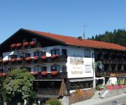
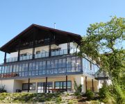
Hotel Haus am Berg
Hotel & Residence Hochriegel
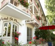
St. Florian
Hubertus Landgasthof
Haus Inge Pension
Videos from this area
These are videos related to the place based on their proximity to this place.
2011-04-09 groundhandling langfurth
2011-04-09: groundhandling an einem zu windigen samstag am startplatz langfurth (startplatzinfos unter: http://www.dgcb.de)
Treffen der Motorradfreunde Bayern 13.-15.06.2014
Ein paar Clips von dem Treffen und der Ausfahrten.
Skilift Glasberg in Zwiesel 10.12.2014
Am Glasberg laufen die Schneekanonen bereits auf Hochtouren!!!
Bodenmais Moped - Wallfahrt 2010 nach Frauenau, Eisch-Kapelle
3. Bodenmaiser Mopedwallfahrt über Brandten, Rabenstein nach Frauenau zur Eisch-Kapelle in Zell, Heimfahrt über Regen, Oberauerkiel und Böbrach.
BÜ Frauenau mit RegioShuttle
Dieses Video ist Teil meiner Serie von Videos, die in meinem Kurzurlaub entstanden sind. Da ich letzten Herbst leider durch ein technisches Problem keine Gelegenheit hatte, die Wanderbahn im...
Frauenau wie s singt und lacht
Prunksitzung in der Bürgerhalle 18.01.2014 Prinzessin Christina I und Prinz Manu I beim Eröffnungstanz.
Videos provided by Youtube are under the copyright of their owners.
Attractions and noteworthy things
Distances are based on the centre of the city/town and sightseeing location. This list contains brief abstracts about monuments, holiday activities, national parcs, museums, organisations and more from the area as well as interesting facts about the region itself. Where available, you'll find the corresponding homepage. Otherwise the related wikipedia article.
Rinchnach Priory
Rinchnach Priory (Kloster Rinchnach) was a Benedictine house at Rinchnach in Bavaria, Germany.
Gsengetstein
Gsengetstein is a mountain of Bavaria, Germany.
Wagensonnriegel
Wagensonnriegel is a mountain of Bavaria, Germany.


