Safety Score: 3,0 of 5.0 based on data from 9 authorites. Meaning we advice caution when travelling to Germany.
Travel warnings are updated daily. Source: Travel Warning Germany. Last Update: 2024-04-19 08:03:45
Touring Greffern
Greffern in Karlsruhe Region (Baden-Württemberg) with it's 1,984 residents is a town located in Germany about 352 mi (or 566 km) south-west of Berlin, the country's capital place.
Time in Greffern is now 05:16 PM (Friday). The local timezone is named Europe / Berlin with an UTC offset of 2 hours. We know of 11 airports nearby Greffern, of which 4 are larger airports. The closest airport in Germany is Karlsruhe Baden-Baden Airport in a distance of 4 mi (or 6 km), North-East. Besides the airports, there are other travel options available (check left side).
There are several Unesco world heritage sites nearby. The closest heritage site is Strasbourg – Grande île in France at a distance of 17 mi (or 28 km). The closest in Germany is Maulbronn Monastery Complex in a distance of 41 mi (or 28 km), South-West. Need some hints on where to stay? We compiled a list of available hotels close to the map centre further down the page.
Being here already, you might want to pay a visit to some of the following locations: Rheinmuenster, Roppenheim, Hugelsheim, Ottersweier and Sasbach. To further explore this place, just scroll down and browse the available info.
Local weather forecast
Todays Local Weather Conditions & Forecast: 5°C / 41 °F
| Morning Temperature | 5°C / 41 °F |
| Evening Temperature | 7°C / 45 °F |
| Night Temperature | 5°C / 41 °F |
| Chance of rainfall | 7% |
| Air Humidity | 91% |
| Air Pressure | 1015 hPa |
| Wind Speed | Moderate breeze with 13 km/h (8 mph) from North-East |
| Cloud Conditions | Overcast clouds, covering 100% of sky |
| General Conditions | Moderate rain |
Saturday, 20th of April 2024
5°C (42 °F)
6°C (42 °F)
Light rain, gentle breeze, overcast clouds.
Sunday, 21st of April 2024
4°C (40 °F)
4°C (38 °F)
Light rain, moderate breeze, overcast clouds.
Monday, 22nd of April 2024
10°C (50 °F)
5°C (41 °F)
Overcast clouds, moderate breeze.
Hotels and Places to Stay
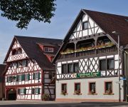
Engel Hotel-Restaurant
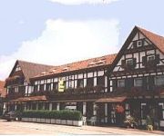
Blume Landgasthof
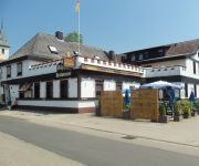
Zum Rössel
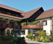
Ratz Landgasthof
Landgasthof Engel
Videos from this area
These are videos related to the place based on their proximity to this place.
Landung am Flughafen Karlsruhe / Baden-Baden -EDSB-
Landeanflug und Landung Piste 03 (Länge 3000m und Breite 60m) am Baden-Airpark (Flughafen Karlsruhe / Baden-Baden) mit einer Cessna 172 des Flugsportvereins FSV Karlsruhe 1910. Rechts ist.
Katana DA 20 Approach EDSB 03
Blick aus dem Cockpit einer Katana DA 20 beim Sichtanflug auf Landebahn 03 in Karlsruhe/Baden-Baden.
Start vom Flughafen Karlsruhe / Baden-Baden -EDSB-
Start auf der Piste 03 am Baden-Airpark (Flughafen Karlsruhe / Baden-Baden) mit einer Cessna 172, Kennung D-ELPD, des Flugsportvereins FSV Karlsruhe 1910.
ASB KA beim BVS Fahrsicherheitstraining f. Einsatzkräfte 2013: ASB, DRK, Feuerwehr, MHD, PM, THW
Dieser Film zeigt einige Ausschnitte unseres Fahrertrainings für Einsatzkräfte, das am 07.12.2013 am Fahrsicherheitszentrum Baden Airpark stattgefunden hat. Nahezu alle in Karlsruhe tätigen...
Lamborghini Esperienza 2012
Date: 19.10.2012 Training: Drift session Event: Lamborghini Esperienza (Pilot program) Track: Driving Centre Baden, Rheinmünster, Germany Car: Lamborghini Gallardo Spyder LP550-2 Race driver:...
Afrika-Abend in Schwarzach
Afrika-Abend in Schwarzach bei der Straußenfarm, afrikanische Percussion am Lagerfeuer.
OTTERSWEIER-ZELL Kapelle St. Rochus - Plenum
An einer Straßenkreuzung in Zell steht die katholische Kapelle St. Rochus. Über dem Portal ist das Erbauungsjahr 1864 eingelassen. Die Kapelle präsentiert sich als ein kleiner, aber schmucker...
Videos provided by Youtube are under the copyright of their owners.
Attractions and noteworthy things
Distances are based on the centre of the city/town and sightseeing location. This list contains brief abstracts about monuments, holiday activities, national parcs, museums, organisations and more from the area as well as interesting facts about the region itself. Where available, you'll find the corresponding homepage. Otherwise the related wikipedia article.
Acher
The Acher is a river in the district of Ortenau, Baden-Württemberg, Germany and a right tributary of the Rhine River. It flows in an eastwesterly direction from the Black Forest toward the Rhine, between the Rench River to the South and the Oos River to the North. Its source is located near the top of Schliffkopf Mountain (Black Forest) at an elevation of 1,054 metres above sea level, above Ottenhöfen.
Rench
The Rench is a river in the district of Ortenau, Baden-Württemberg, Germany and a right-side tributary of the Rhine River. Its source is near Kniebis Mountain not far from Bad Griesbach in the Black Forest. It runs for 59 km before it discharges into the Rhine River near Rheinau/Lichtenau. The Rench runs along the Rench Valley through Bad Peterstal, Oppenau, Lautenbach, Oberkirch and Renchen. In Oppenau the Lierbach discharges into the Rench.


