Safety Score: 3,0 of 5.0 based on data from 9 authorites. Meaning we advice caution when travelling to Germany.
Travel warnings are updated daily. Source: Travel Warning Germany. Last Update: 2024-04-24 08:14:40
Discover Hinterer Geisberg
Hinterer Geisberg in Freiburg Region (Baden-Württemberg) is a city in Germany about 380 mi (or 611 km) south-west of Berlin, the country's capital city.
Local time in Hinterer Geisberg is now 07:04 AM (Thursday). The local timezone is named Europe / Berlin with an UTC offset of 2 hours. We know of 9 airports in the vicinity of Hinterer Geisberg, of which 3 are larger airports. The closest airport in Germany is Lahr Airport in a distance of 11 mi (or 18 km), North-West. Besides the airports, there are other travel options available (check left side).
There are several Unesco world heritage sites nearby. The closest heritage site is Strasbourg – Grande île in France at a distance of 26 mi (or 42 km). The closest in Germany is Monastic Island of Reichenau in a distance of 62 mi (or 42 km), North-West. We discovered 2 points of interest in the vicinity of this place. Looking for a place to stay? we compiled a list of available hotels close to the map centre further down the page.
When in this area, you might want to pay a visit to some of the following locations: Schuttertal, Hofstetten, Steinach, Seelbach and Biberach. To further explore this place, just scroll down and browse the available info.
Local weather forecast
Todays Local Weather Conditions & Forecast: 6°C / 43 °F
| Morning Temperature | 2°C / 35 °F |
| Evening Temperature | 7°C / 45 °F |
| Night Temperature | 1°C / 34 °F |
| Chance of rainfall | 1% |
| Air Humidity | 70% |
| Air Pressure | 1010 hPa |
| Wind Speed | Gentle Breeze with 6 km/h (4 mph) from East |
| Cloud Conditions | Overcast clouds, covering 93% of sky |
| General Conditions | Rain and snow |
Friday, 26th of April 2024
9°C (48 °F)
6°C (43 °F)
Light rain, light breeze, overcast clouds.
Saturday, 27th of April 2024
17°C (63 °F)
10°C (51 °F)
Light rain, gentle breeze, scattered clouds.
Sunday, 28th of April 2024
19°C (67 °F)
10°C (50 °F)
Overcast clouds, gentle breeze.
Hotels and Places to Stay
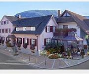
Adler
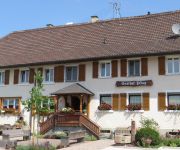
Ochsen Landgasthof
Hirschen-Dorfmühle Gasthaus
Schmieders-Ochsen
Zum Pflug Landgasthof
Videos from this area
These are videos related to the place based on their proximity to this place.
Dummer Noob im hochseilpark alde gott
Voll der spaßt wer dem seine page zuspammen will geht auf kenzingen-city.npage.de xD.
Frühling im Schuttertal, Schwarzwald Mitte/Nord. Ortenau
Impressionen aus dem Schuttertal im Schwarzwald Mitte/´Nord. Schuttertal ist eine Gemeinde im Ortenaukreis in Baden-Württemberg. Seit der Gemeindereform 1974 besteht die Gemeinde Schuttertal...
Cold Water Challenge 2014 - DIE EGERLÄNDER - IM ERNST WIR MOSCHEN WEITER
Wir danken für die Nominierung der Miliz- und Trachtenkapelle aus Oberharmersbach. In den nächsten 72 Stunden können unsere Nominierten, die Bla Bli Bla Blasmusik aus Oberharmersbach, die...
Specialized Enduro Evo 2013
11 April 2013 Heute ist es endlich beim Händler angekommen ! Mein Specialized Enduro Evo 2013 Gewicht ohne Pedale 16Kg in Größe L Fahrbericht und weitere Bilder folgen !
Hubertus Pflingsteck Hotel im Schwarzwald
Das reizende Anwesen in Freiamt, auf der Grenze von Ottoschwanden nach Schuttertal-Schweighausen, liegt umgeben von Wiesen und Wäldern in 495 m Höhe. Sie haben einen herrlichen Rundblick.
Videos provided by Youtube are under the copyright of their owners.
Attractions and noteworthy things
Distances are based on the centre of the city/town and sightseeing location. This list contains brief abstracts about monuments, holiday activities, national parcs, museums, organisations and more from the area as well as interesting facts about the region itself. Where available, you'll find the corresponding homepage. Otherwise the related wikipedia article.
Schutter (Kinzig)
The Schutter is a 55 kilometer long river in Baden-Württemberg, Germany, a left tributary of the Kinzig. The source is located at the Hünersedel at 680 m height. From there the Schutter runs firstly westwards through the Schuttertal and after an almost right-angled crease in a northerly direction it passes the towns of Seelbach and Lahr. It leaves then the Black Forest and flows parallel to the Rhine through the Upper Rhine Graben until it joins the Kinzig at Kehl.


