Safety Score: 3,0 of 5.0 based on data from 9 authorites. Meaning we advice caution when travelling to Germany.
Travel warnings are updated daily. Source: Travel Warning Germany. Last Update: 2024-04-23 08:18:23
Explore Elend
Elend in Freiburg Region (Baden-Württemberg) is a city in Germany about 405 mi (or 651 km) south-west of Berlin, the country's capital.
Local time in Elend is now 02:41 PM (Tuesday). The local timezone is named Europe / Berlin with an UTC offset of 2 hours. We know of 12 airports in the vicinity of Elend, of which 5 are larger airports. The closest is airport we know is EuroAirport Basel-Mulhouse-Freiburg Airport in France in a distance of 24 mi (or 39 km). The closest airport in Germany is Donaueschingen-Villingen Airport in a distance of 32 mi (or 39 km), South-West. Besides the airports, there are other travel options available (check left side).
There are several Unesco world heritage sites nearby. The closest heritage site is Prehistoric Pile dwellings around the Alps in Austria at a distance of 44 mi (or 71 km). The closest in Germany is Monastic Island of Reichenau in a distance of 58 mi (or 71 km), South-East. We found 4 points of interest in the vicinity of this place. If you need a place to sleep, we compiled a list of available hotels close to the map centre further down the page.
Depending on your travel schedule, you might want to pay a visit to some of the following locations: Wieden, Horben, Bollen, Solden and Bollschweil. To further explore this place, just scroll down and browse the available info.
Local weather forecast
Todays Local Weather Conditions & Forecast: 9°C / 49 °F
| Morning Temperature | 1°C / 33 °F |
| Evening Temperature | 7°C / 45 °F |
| Night Temperature | 2°C / 36 °F |
| Chance of rainfall | 0% |
| Air Humidity | 49% |
| Air Pressure | 1015 hPa |
| Wind Speed | Gentle Breeze with 8 km/h (5 mph) from South |
| Cloud Conditions | Broken clouds, covering 81% of sky |
| General Conditions | Light rain |
Wednesday, 24th of April 2024
3°C (37 °F)
3°C (37 °F)
Rain and snow, gentle breeze, overcast clouds.
Thursday, 25th of April 2024
5°C (41 °F)
1°C (33 °F)
Rain and snow, light breeze, overcast clouds.
Friday, 26th of April 2024
13°C (56 °F)
6°C (43 °F)
Scattered clouds, light breeze.
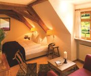
Hotels and Places to Stay
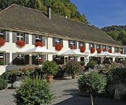
Spielweg Romantik Hotel
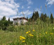
Wiedener Eck Berghotel
Naturhotel Heiderose auf Gut Lilienfein
Waldhotel am Notschrei
Historisches Landgasthaus zur Linde
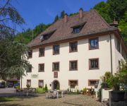
Alte Klostermühle
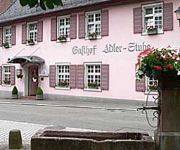
Adler-Stube
Grüner Baum
Zum Hirschen Landgasthof
Sonne Parkhotel
Videos from this area
These are videos related to the place based on their proximity to this place.
Schauinsland mit K1300R
https://mapsengine.google.com/map/edit?mid=zE0qiTrVGOg8.khu_GgZYvek0 Die rund zwölf Kilometer lange Strecke von Günterstal bis zum Gipfel des 1284 Meter hohen Schauinslands galt mit ihren.
Schauinsland - KTM 1190 Adventure - Bergrennstrecke
Fahrt von Horben über die historische Bergrennstrecke zum Schaunsland. Gefahren mit einer KTM 1190 Adventure.
Auffahrt zum Schauinsland
Diese Strecke macht einfach Spaß! Hinweis: Diese Strecke ist an Wochenenden für Motorräder gesperrt.
Rollerstrecke Schauinsland - Teil 1
Downinsland-Rollerstrecke Schauinsland. Vom Start an der Bergstation der Schauinslandbahn auf 1.220 m Höhe rollt man durch das naturschutzgebiet Schauinsland über 8 km und 750 Höhenmetern ...
Rollerstrecke Schauinsland - Teil 2
Vom Start an der Bergstation der Schauinslandbahn auf 1.220 m Höhe rollt man durch das naturschutzgebiet Schauinsland über 8 km und 750 Höhenmetern bergab.
Berg Schwarzwald Belchen
Der Belchen ist mit 1414m der vierthöchste Berg im Schwarzwald. Ein Rundgang vom Gipfelkreuz aus mit Aussicht auf das Nebelmeer im Tal von ...
Videos provided by Youtube are under the copyright of their owners.
Attractions and noteworthy things
Distances are based on the centre of the city/town and sightseeing location. This list contains brief abstracts about monuments, holiday activities, national parcs, museums, organisations and more from the area as well as interesting facts about the region itself. Where available, you'll find the corresponding homepage. Otherwise the related wikipedia article.
St. Ulrich's Priory in the Black Forest
St. Ulrich's Priory in the Black Forest (St. Ulrich im Schwarzwald) was a priory of Cluny Abbey founded in the valley of the River Möhlin in the Black Forest in about 1083. St. Ulrich is now part of the municipality of Bollschweil, in the district of Breisgau-Hochschwarzwald, Baden-Württemberg, Germany.


