Safety Score: 2,8 of 5.0 based on data from 9 authorites. Meaning we advice caution when travelling to Gambia.
Travel warnings are updated daily. Source: Travel Warning Gambia. Last Update: 2024-04-18 08:12:24
Explore Sinki
Sinki in West Coast is a city in Gambia a little south-west of Banjul, the country's capital.
Local time in Sinki is now 10:52 PM (Thursday). The local timezone is named Africa / Banjul with an UTC offset of zero hours. We know of 8 airports in the vicinity of Sinki, of which one is a larger airport. The closest airport in Gambia is Banjul International Airport in a distance of 4 mi (or 7 km), South-East. Besides the airports, there are other travel options available (check left side).
There are several Unesco world heritage sites nearby. The closest heritage site in Gambia is Kunta Kinteh Island and Related Sites in a distance of 70 mi (or 113 km), East. If you need a place to sleep, we compiled a list of available hotels close to the map centre further down the page.
Depending on your travel schedule, you might want to pay a visit to some of the following locations: Banjul, Brikama, Kerewan, Ziguinchor and Kaolack. To further explore this place, just scroll down and browse the available info.
Local weather forecast
Todays Local Weather Conditions & Forecast: 37°C / 98 °F
| Morning Temperature | 22°C / 72 °F |
| Evening Temperature | 24°C / 74 °F |
| Night Temperature | 25°C / 76 °F |
| Chance of rainfall | 0% |
| Air Humidity | 21% |
| Air Pressure | 1009 hPa |
| Wind Speed | Fresh Breeze with 13 km/h (8 mph) from South-East |
| Cloud Conditions | Clear sky, covering 0% of sky |
| General Conditions | Sky is clear |
Friday, 19th of April 2024
24°C (75 °F)
22°C (72 °F)
Sky is clear, fresh breeze, clear sky.
Saturday, 20th of April 2024
23°C (73 °F)
21°C (70 °F)
Overcast clouds, fresh breeze.
Sunday, 21st of April 2024
22°C (71 °F)
21°C (70 °F)
Sky is clear, moderate breeze, clear sky.
Hotels and Places to Stay
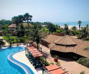
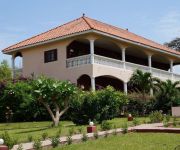
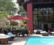
Seafront Residence
Kololi Beach Club
Oasis Relax Lodge
Lemon Creek Hotel Resort
Hibiscus House
Sand Beach Hotel
Holiday Beach Club Hotel
GOLDEN BEACH HOTEL
Videos from this area
These are videos related to the place based on their proximity to this place.
have a break: one-day trip to the Senegal in march 2009
on our trip by jeep to the Senegal, we had a drinking break on the so called smugglers-road between the Senegal and the Gambia. It was a very narrow, sandy road on which you could only drive...
New clinic! Old problems: Puppy, found with cut off ears and tail.
She was found by some customers of mine in a village, tail and ears missing. Obviously done by somebody without a clue of what he/she was doing. She will make it! And: We have moved! New location ...
Chasing another dog with an embedded collar!
Finally I saw him again on the way to drop my son at school: https://www.youtube.com/watch?v=g0CQtPmms6g It's been over 3 months and nobody reported him at all although we had put out flyers...
Tanjeh Tye n Dye
This is one of three parts of a video made for the Tanjeh villiage museum as a classroom teaching aid aimed at keeping local skills and traditions alive. The Village museum is run by Abdoulie...
London Corner School, Serrekunda, The Gambia
An impression of the London Corner School in Serrekunda, The Gambia. Children of this school are sponsored by the Yamah Youth Foundation: www.yamahyouth.com.
Nathaniel Fatty Miracle Video NEEM CREAM (director's cut)
Peace Corps: The Gambia brings you informative and entertaining Do-It-Yourself training videos for various Agriculture/Forestry and Environmental Education subjects. We hope this will better...
Videos provided by Youtube are under the copyright of their owners.
Attractions and noteworthy things
Distances are based on the centre of the city/town and sightseeing location. This list contains brief abstracts about monuments, holiday activities, national parcs, museums, organisations and more from the area as well as interesting facts about the region itself. Where available, you'll find the corresponding homepage. Otherwise the related wikipedia article.
Yundum
Yundum is a small town in Gambia, east of the capital, Banjul. It is situated adjacent to the country's international airport.
Sukuta
Sukuta is a town located in the Western Division of the Gambia. It had a population of 16,667 as of the 1993 census.
Nema Kunku
Nema Kunku is a village in Foni Jarrol district in the Western Division of the Gambia. Nema kunku is a surrounding village of Gambia's largest town Serekunda. The population of the village is 99% local (Gambian) people.
Lamin, Western Division, Gambia
Lamin is the largest village in Kombo NorthWestern Division of the Gambia. A village with two large clans, Bojang, and Manneh, as the founders, and all the rest are considered "lountan" meaning "strangers" in Manidinko. There is a village leader, "AlKalo" who is from the lineage of the Bojang. Until recently the village was divided into zones marked by tribes, the Mandinkos in Sateba, the Jolas in Sanchaba, the Manjako in Wayoto and all the other tribes in Temasu.
Kombo North/Saint Mary
Kombo North/Saint Mary is one of the nine districts of the Gambia's Western Division, which is located to the south of the Gambia River in the southwest of the country. Kombo North/Saint Mary is in the northwest of the division, between Kombo South and Banjul Division. It is the only district in the Western Division with coasts on both the Atlantic Ocean and the Gambia River.
Abuko Nature Reserve
Abuko National Park is a nature reserve in the Gambia lying south of the town of Abuko. It is a popular tourist attraction and was the country's first designated wildlife reserve.
Banjulunding
Banjulunding is a town in western Gambia. It is located in Kombo North/Saint Mary District in the Western Division. As of 2008, it has an estimated population of 8,029.
Salagi Forest Park
Salagi Forest Park is a forest park in the Gambia. Established on January 1, 1954, it covers 262 hectares.


