Safety Score: 3,0 of 5.0 based on data from 9 authorites. Meaning we advice caution when travelling to France.
Travel warnings are updated daily. Source: Travel Warning France. Last Update: 2024-04-25 08:17:04
Discover Cheux
Cheux in Calvados (Normandy) with it's 1,141 citizens is a town in France about 132 mi (or 212 km) west of Paris, the country's capital city.
Current time in Cheux is now 08:54 PM (Thursday). The local timezone is named Europe / Paris with an UTC offset of 2 hours. We know of 13 airports near Cheux, of which 5 are larger airports. The closest airport in France is Caen-Carpiquet Airport in a distance of 3 mi (or 6 km), East. Besides the airports, there are other travel options available (check left side).
There are several Unesco world heritage sites nearby. The closest heritage site in France is Le Havre, the City Rebuilt by Auguste Perret in a distance of 36 mi (or 59 km), North-East. Looking for a place to stay? we compiled a list of available hotels close to the map centre further down the page.
When in this area, you might want to pay a visit to some of the following locations: Caen, Bayeux, Vire, Saint-Lo and Notre-Dame-de-Fresnay. To further explore this place, just scroll down and browse the available info.
Local weather forecast
Todays Local Weather Conditions & Forecast: 12°C / 54 °F
| Morning Temperature | 4°C / 38 °F |
| Evening Temperature | 12°C / 53 °F |
| Night Temperature | 6°C / 42 °F |
| Chance of rainfall | 0% |
| Air Humidity | 52% |
| Air Pressure | 1007 hPa |
| Wind Speed | Gentle Breeze with 8 km/h (5 mph) from North-East |
| Cloud Conditions | Few clouds, covering 20% of sky |
| General Conditions | Light rain |
Friday, 26th of April 2024
13°C (56 °F)
6°C (43 °F)
Moderate rain, moderate breeze, overcast clouds.
Saturday, 27th of April 2024
12°C (54 °F)
10°C (49 °F)
Heavy intensity rain, gentle breeze, overcast clouds.
Sunday, 28th of April 2024
10°C (50 °F)
4°C (40 °F)
Light rain, fresh breeze, overcast clouds.
Hotels and Places to Stay
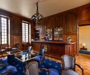
Château d'Audrieu
Videos from this area
These are videos related to the place based on their proximity to this place.
Handivol, des ailes à la portée de tous
Didier Berhault nous parle de son parcours et de l'association Handivol de Carpiquet.
[PPL] First Solo Flight / Laché
Mon Premier Vol Solo ! / My first solo flight ! Aéroport : Caen - Carpiquet (LFRK) Avion : Robin DR400/120 Date : Mercredi 2 Avril 2014 à 14H35 Caméra : GoPro Hero 3.
Voyage à bord du Volvo 7700 A twisto n°352
Je vous proposes un petit voyage à bord du Volvo 7700 A n°352 mise en service sur le réseau twisto en février 2010. Et circulant ici sur la liane 3 CARPIQUET Rue des Ecoles -- Hérouville...
REMORQUES VERENE
www.remorques-verene.fr vous présente ses locaux situés à Rots dans le Calvados. Vous trouverez plus de 200 modèles de remorques exposées sur 20000 m² de terrain et un show room de 1000 m².
B.a.D Airsoft - Touche avec un Black Eagle Airsoft
La preuve qu'il est possible de toucher avec un Black Eagle dans une partie d'airsoft ^^ Caméraman: Matt Association loi 1901, basé en Normandie Vous pouvez nous contacter par notre forum...
Bains de balles à Festyland.wmv
Lors de notre escapade en Normandie, petit délire dans la piscine à balles du parc Festyland à Caen.
F-GCRS vole vers Caen dans le crépuscule du 1er XII 09.wmv
Vol de (fin ) de nuit de Cherbourg à Caen, et atterrissage sur la 13 à Caen.
verson concours 4x18 nov 2011
LES ARCHERS DE L ODON Individuel 2012 LIGUE DE NORMANDIE DE TIR A L ARC Formule : 2X(2X18M)
Videos provided by Youtube are under the copyright of their owners.
Attractions and noteworthy things
Distances are based on the centre of the city/town and sightseeing location. This list contains brief abstracts about monuments, holiday activities, national parcs, museums, organisations and more from the area as well as interesting facts about the region itself. Where available, you'll find the corresponding homepage. Otherwise the related wikipedia article.
Battle of Le Mesnil-Patry
The Battle of Le Mesnil-Patry was the last big operation conducted by Canadian land forces in Normandy during June 1944. The Queen's Own Rifles of Canada, supported by the 6th Canadian Armoured Regiment attempted to take the town of Le Mesnil-Patry in Normandy as part of a southwards move on the right flank of Cheux towards high ground (Hill 107) as part of the strategy of taking the city of Caen. The battle resulted in a German victory.


!['[PPL] First Solo Flight / Laché' preview picture of video '[PPL] First Solo Flight / Laché'](https://img.youtube.com/vi/bBhxulx6TWw/mqdefault.jpg)


