Safety Score: 3,3 of 5.0 based on data from 9 authorites. Meaning please reconsider your need to travel to El Salvador.
Travel warnings are updated daily. Source: Travel Warning El Salvador. Last Update: 2024-04-24 08:14:40
Touring Colonia Dolores
The district Colonia Dolores of San Salvador in Departamento de San Salvador is a subburb located in El Salvador and is a district of the nations capital.
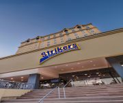
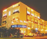
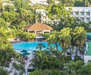
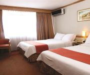
Need some hints on where to stay? We compiled a list of available hotels close to the map centre further down the page.
Being here already, you might want to pay a visit to some of the following locations: Santa Tecla, Cojutepeque, Zacatecoluca, San Vicente and Chalatenango. To further explore this place, just scroll down and browse the available info.
Local weather forecast
Todays Local Weather Conditions & Forecast: 32°C / 89 °F
| Morning Temperature | 21°C / 70 °F |
| Evening Temperature | 26°C / 78 °F |
| Night Temperature | 23°C / 73 °F |
| Chance of rainfall | 1% |
| Air Humidity | 41% |
| Air Pressure | 1014 hPa |
| Wind Speed | Gentle Breeze with 6 km/h (4 mph) from North-East |
| Cloud Conditions | Broken clouds, covering 54% of sky |
| General Conditions | Light rain |
Thursday, 25th of April 2024
30°C (86 °F)
23°C (74 °F)
Moderate rain, light breeze, scattered clouds.
Friday, 26th of April 2024
32°C (90 °F)
22°C (71 °F)
Light rain, gentle breeze, clear sky.
Saturday, 27th of April 2024
32°C (90 °F)
22°C (72 °F)
Light rain, gentle breeze, few clouds.
Hotels and Places to Stay
Barcelo San Salvador
THE TERRAZA HOTEL-COLONIA ESCALON
Sheraton Presidente San Salvador Hotel
Hotel de la Escalón Morrison
BEST WESTERN PLUS HTL TERRAZA
Hotel San Jose Hostal
Hotel La Posada del Angel
Árbol de Fuego Eco-Hotel
Hotel y Casino Siesta
Clarion Suites Las Palmas
Videos from this area
These are videos related to the place based on their proximity to this place.
Tragedia del Bus (Elim), Colonia Malaga, San Salvador
Video de elsalvador.com Al menos 27 personas están desaparecidas después de que una crecida del río Acelhuate arrastrara un autobús de la Iglesia Elim a la quebrada. Esta ha sido...
Amanecer Montserrat, San Salvador
Timelapse de un amanecer en San Salvador, con vista a la colonia montserrat y el cerro de San Jacinto.
Fiestas de Yoloaiquín en honor a San Marcos (2008)
Serie: Fiestas patronales Primera emisión: 01 de mayo de 2008 Las Fiestas Patronales en honor a San Marcos Evangelista, celebradas en el oriental municipio de Yoloaiquín son una muestra de...
San Marcos. La ciudad que descansa entre los cerros (2007)
Serie: Municipio Primera emisión: 24 de mayo de 2007 El municipio de San Marcos es conocido por ser un municipio dormitorio. Se caracteriza por la industria maquilera, que es la mayor fuente...
Elecciones- Votaciones en Antiguo Cuscatlán (2006)
Especial de Elecciones 2006 (Varias notas que se trabajaron para Tecnovisión)
Boulevard Diego de Holguín. Financiado por la naturaleza (2007)
Primera emisión: 21 de junio 2007 El boulevard Diego de Holguín, una carretera diseñada para disminuir el tráfico en el área metropolitana de San Salvador es un proyecto más que amenaza...
FIHIDRO. Agua segura ¿Para quién? (2010)
Primera emisión: 17 de abril de 2010 FIHIDRO es un proyecto privado que nació en 2006, bajo el lema de llevar agua a las comunidades de Zaragoza, San José Villanueva, Santa Tecla y Antiguo...
Río Lempa. Imponente y majestuoso (2007)
Serie: Medio Ambiente / Ríos Primera emisión: 3 de mayo de 2007 Este antiguo río, el más grande de El Salvador, tiene sus orígenes en las montañas volcánicas de las mesetas centrales...
Himno de El Salvador en Estadio Cuscatlan
Quien no sienta escalofríos al escuchar y ver este video es porque no es salvadoreño de corazón, no importa si la selecta vaya a Brasil o no, ese es tema aparte, lo importante es que vean...
Videos provided by Youtube are under the copyright of their owners.
Attractions and noteworthy things
Distances are based on the centre of the city/town and sightseeing location. This list contains brief abstracts about monuments, holiday activities, national parcs, museums, organisations and more from the area as well as interesting facts about the region itself. Where available, you'll find the corresponding homepage. Otherwise the related wikipedia article.
Farabundo Martí National Liberation Front
The Farabundo Martí National Liberation Front is, since 1992, a left-wing political party in El Salvador and formerly a coalition of five guerrilla organizations.
San Salvador Department
For the department in Entre Ríos, Argentina, see San Salvador Department, Entre Ríos. San Salvador Flag of San Salvador Department Coat of Arms of San Salvador Department Location Location of San Salvador Department Statistics Created 1824 Capital San Salvador Area •% 886 km² Population •(2009) 2,404,097 ISO 3166-2 SV-SS San Salvador is a department of El Salvador in the west central part of the country. The capital is San Salvador, which is also the national capital.
Legislative Assembly of El Salvador
The Legislative Assembly is the legislative branch of the government of El Salvador. The Salvadoran legislature is a unicameral body. It is made up of 84 deputies, all of who are elected by direct popular vote according to open-list proportional representation to serve three-year terms and are eligible for immediate re-election. Of these, 64 are elected in 14 multi-seat constituencies, corresponding to the country's 14 departments, which return between 3 and 16 deputies each.
Teatro Nacional de El Salvador
Teatro Nacional de El Salvador, or National Theatre of El Salvador, is the oldest theatre in Central America. It began construction on November 3, 1911, by the French architect Daniel Beylard; and inaugurated March 1, 1917. It is of French Renaissance style with modern touches. It was decorated by the Italian architect Lucio Capellaro, and its Great Hall is one of the most beautiful and elegant in Central America.
Delgado, San Salvador
Delgado, or Ciudad Delgado, is a municipality in the San Salvador department of El Salvador.
Cuscatancingo
Cuscatancingo is a municipality in the San Salvador department of El Salvador. It is located about 4 kilometers from the city of San Salvador and has a population of about 50,000. The geographical coordinates are {{#invoke:Coordinates|coord}}{{#coordinates:13.73611|N|89.18139|W||||| | |name= }}
Mejicanos
Mejicanos is a San Salvador suburb in the San Salvador department of El Salvador. Mejicanos is a city located in San Salvador, El Salvador. At the 2009 estimate it had 160,751 inhabitants. It has been characterized by its typical food "Yuca Frita con Merienda". It has a municipal market, where the local citizens can buy groceries, vegetables, dairy products, meat, pupusas, etc. Many of the things available in the local market are produced in the surrounding villages, like vegetables.
Panchimalco
Panchimalco is a town in the San Salvador department of El Salvador. Panchimalco ("The Place of Flags and Shields," from the Nahuatl, "Pant," meaning banner or flag; "Chimal," meaning shield or herald, and "co," place) is Its 35,000 inhabitants, sometimes called "Panchos," are descendants of Pipil Indians fleeing the Spanish takeover of San Salvador during the 16th century, into areas originally inhabited by Mayan and Nahuatl peoples.
Soyapango
Soyapango is a municipality in the San Salvador department of El Salvador. Soyapango is a commercial center; it is home to a new modern mall called Plaza Mundo. The municipality is the third most populated area in the country, with 290,412 inhabitants. Soyapango is a main thoroughfare between San Salvador and the eastern part of the country, and nearly 70,000 vehicles travel through it every day. The nickname for this small city is Soya.
Academia Británica Cuscatleca
The Academia Británica Cuscatleca (ABC) is a selective, mixed bi-lingual and bi-cultural school from Pre-Kinder to Grade 12 situated in Santa Tecla, El Salvador. The school has some 1,450 students in the Primary and Secondary Schools. The student body is mainly Salvadorian with an increasing number of international students attending the school. One third of the teaching staff is British with the remainder largely Salvadorian.
Estadio Cuscatlán
Monumental Estadio Cuscatlán is a football stadium located in San Salvador, El Salvador. It is the largest stadium in Central America with a capacity of 39,023. The stadium is the home ground of the El Salvador national football team as well as club team Alianza FC.
Central American University
"UCA" redirects here. For other uses of the name UCA, see UCA (disambiguation). “José Simeón Cañas” Central American University {{#invoke:InfoboxImage|InfoboxImage|image=|size=|sizedefault=frameless|alt=}}Motto University for Social ChangeEstablished September 15, 1965Type Private Non-ProfitRector Andreu OlivaUndergraduates 8,000Postgraduates 664Location San Salvador, El SalvadorCampus Urban, 15 haNickname UCAMascot OwlAffiliations Society of JesusWebsite www. uca. edu.
1932 Salvadoran peasant massacre
The 1932 Salvadoran peasant massacre occurred on January 22 of that year, in the western departments of El Salvador when a brief peasant-led rebellion was brutally suppressed by the government, then led by Maximiliano Hernández Martínez. The Salvadoran army, being vastly superior in terms of weapons and soldiers, executed those who stood against it.
Señorío of Cuzcatlán
The Señorío of Cuzcatlán, or The Lordship of Cuzcatlán, was a pre-Columbian Nahuat nation of the Post-Classical period that extended from the Paz river to the Lempa river (covering most of the western and central zones of the present Republic of El Salvador), this was the nation of Pipils/Cuzcatlecs. No codices or written accounts survive that shed light on this señorío.
San Salvador Cathedral
The Metropolitan Cathedral of the Holy Savior (Catedral Metropolitana de San Salvador) is the principal church of the Roman Catholic Archdiocese of San Salvador and the seat of the Archbishop of San Salvador. The church was twice visited by Pope John Paul II who said that the cathedral was "intimately allied with the joys and hopes of the Salvadoran people.
Torre Cuscatlán
Torre Cuscatlán (Cuscatlán Tower in English; formerly known as Torre Democracia or Tower of Democracy) is one of the tallest buildings in San Salvador, El Salvador. Finished in 1989, it is 74 meters high and has 18 floors. Ricardo Jiménez Castillo, who is considered one of the most representative architects of El Salvador, was in charge of the building's design. It is influenced by modern style, using a complete glass cladding for the exterior.
University of El Salvador
The University of El Salvador or Universidad de El Salvador (UES) is the oldest and one of the most prominent university institutions in El Salvador. It serves as the national university of the country. The main campus, Ciudad Universitaria, is located in the capital of San Salvador, but there are also branches of the university in other Salvadoran cities such as Santa Ana, San Miguel and San Vicente.
Torre El Pedregal
Torre El Pedregal is the tallest building in El Salvador by Mexican architect Ricardo Legorreta, located in Antiguo Cuscatlan. It was built by Grupo Roble. It is 28 stories or 112 m
Gimnasio Nacional José Adolfo Pineda
Gimnasio Nacional José Adolfo Pineda (known as the National Gymnasium in some English sources) is an indoor sporting arena located in San Salvador, El Salvador. The capacity of the arena is 12,500 spectators. It is mainly used to host basketball and other indoor sporting events. It also hosted the Miss Universe 1975 competition.
World Trade Center San Salvador
San Salvador World Trade Center consists of many buildings, the tallest being Torre Futura at 96 meters in height makes this tower one of the tallest buildings in El Salvador.
Monumento al Divino Salvador del Mundo
Monumento al Divino Salvador del Mundo (English: Monument to the Divine Savior of the World) is a monument located on Plaza El Salvador del Mundo (The Savior of the World Plaza) in San Salvador City, El Salvador. It consists of a statue of Jesus Christ standing a global sphere of planet earth, placed on top of the tall four-sided concrete base pedestal. It is a landmark located in the country's capital San Salvador.
1985 Zona Rosa attacks
The Zona Rosa attack was a guerrilla attack that took place in the Zona Rosa nightclub area of San Salvador, El Salvador at approximately 21:30 on June 19, 1985, during the Salvadoran Civil War. The attack was conducted by gunmen dressed as Salvadoran soldiers, and in total twelve people were killed: four United States Marines, two United States businessmen, a Guatemalan, a Chilean, and four Salvadorans.
Estadio Jorge "Mágico" González
Estadio Jorge "Mágico" González is formerly known as Estadio Nacional "De la Flor Blanca", referring to the name of the suburb where it is located in San Salvador. It is a football stadium in El Salvador. It is named after Jorge Alberto González. It has a capacity of 32,000. The stadium was restored in 2001 to host notable sporting events in Latin America, the Central American and Caribbean Games in August 2002.
Centro Comercial Galerias
The Centro Comercial Galerias is a shopping center in San Salvador, El Salvador. Among the mall's attractions is a mansion known as La Casona dating from the late 1950s and kept in perfect condition, which was home to a family of Palestinian origin. It is the only mall to have such an attraction. The complex is owned by Grupo Siman.
Embassy of Colombia, San Salvador
The Embassy of Colombia in San Salvador is the diplomatic mission of the Republic of Colombia to the Republic of El Salvador; it is headed by the Ambassador of Colombia to Venezuela. It is located in the Escalón neighbourhood of San Salvador. The Embassy is also accredited to Belize.


